GYPSUM PLAIN
The Gypsum Plain occurs
between the Delaware Mountains and the Rustler Hills of West Texas and adjacent
New Mexico, USA. It principally consists of gently rolling hills of rock
gypsum (originally rock anhydrite). A world-class locality for seeing
rocks of the Gypsum Plain is State Line outcrop, on the New Mexico-Texas
border.
State Line outcrop exposes
banded gypsum-calcite rocks of the Castile Formation, deposited during
the latest Permian (251 m.y.). The gypsum component was originally anhydrite
(CaSO4), which has been altered by hydration. The rocks here
were formed in a paleoequatorial marine evaporitic setting. They have
since been deformed by anhydrite-to-gypsum volume expansion and regional
orogenesis. The rocks are pervasively microfolded, resulting in an
attractive contorted appearance.
Locality: State Line outcrop,
roadcut on either side of Rt. 180/Rt. 62, between Carlsbad Caverns National
Park and Guadalupe Mountains National Park, immediately north of the Texas
border, southern Eddy County, southeastern New Mexico, USA. GPS of cut:
32° 00.570’ N, 104° 29.917’ W.
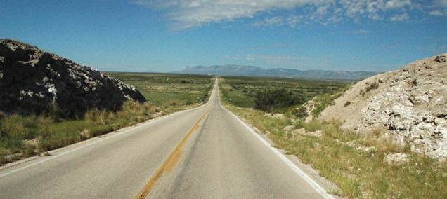
State Line outcrop, along Rt. 180/Rt. 62 at
the New Mexico-Texas border. The mountain range is the distance is the
main scenery of Guadalupe Mountains National Park (western Texas).
Looking WSW.
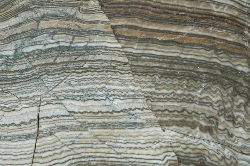
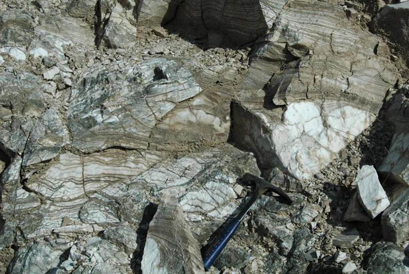
State Line outcrop - banded gypsum-calcite
rocks of the Castile Formation (uppermost Upper Permian, 251 m.y.).
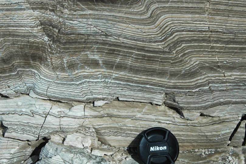
State Line outcrop - banded gypsum-calcite
rocks of the Castile Formation (uppermost Upper Permian, 251 m.y.). The
whitish layers are gypsum. The dark brown layers are calcite. Each
gypsum-calcite couplet represents one year's worth of deposition. These
layers can be called varves. The calcite-gypsum (or -anhydrite)
couplets have been successfully correlated throughout the Delaware Basin.
Note the microfolding and the many small-scale reverse faults.
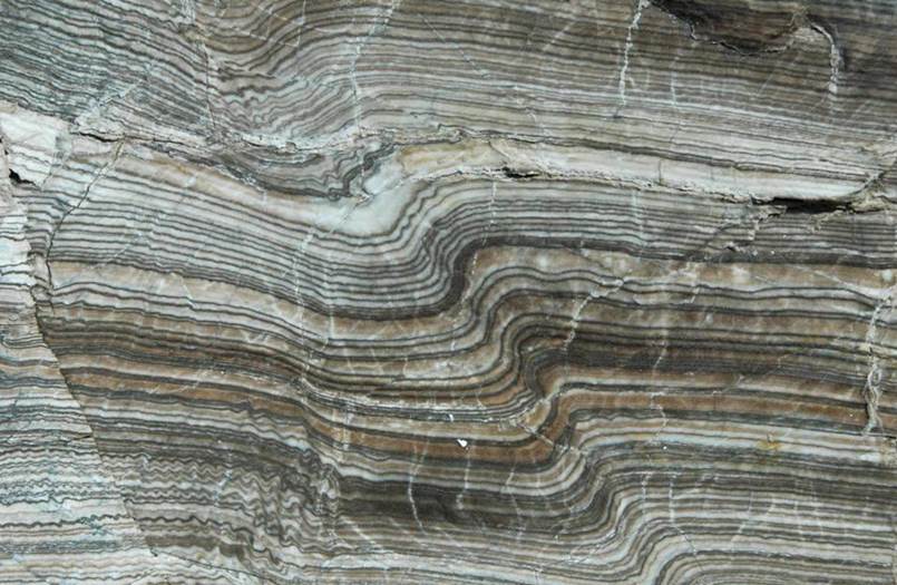
State Line outcrop - banded gypsum-calcite rock
of the Castile Formation (upper Upper Permian, 251 m.y.) showing convoluted
crumpling and microfolding, plus small-scale faults (normal & reverse).
State Line outcrop - microfolding and
small-scale normal & reverse faults in banded gypsum-calcite rocks of the
Castile Formation (upper Upper Permian, 251 m.y.).
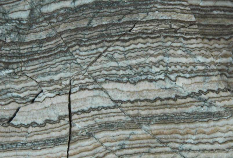
State Line outcrop - microfolding and
small-scale reverse faults in banded gypsum-calcite rocks of the Castile
Formation (upper Upper Permian, 251 m.y.).
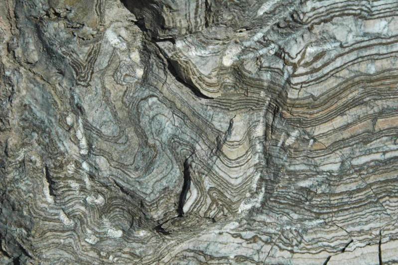
State Line outcrop - convoluted folding in
banded gypsum-calcite rock of the Castile Formation (upper Upper Permian, 251
m.y.).
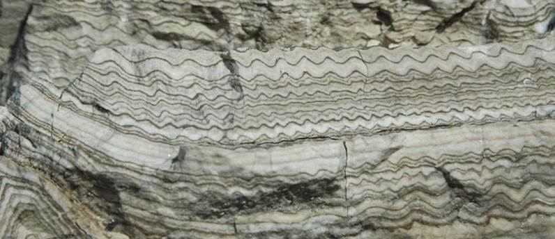
State Line outcrop - microfolding in banded
gypsum-calcite rocks of the Castile Formation (upper Upper Permian, 251
m.y.). Such patterns are thought to have inspired the decorations seen on
some southwestern American Indian pottery (see below).
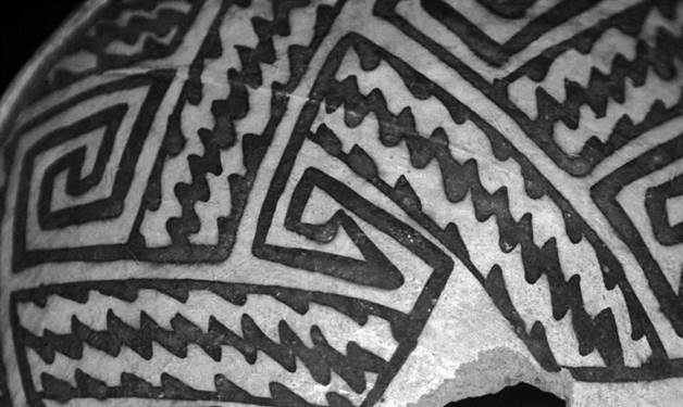
Flagstaff-style Indian
pottery
from Arizona, USA, dating to the 12th century A.D. (FMNH 707.81976, Field
Museum of Natural History, Chicago, Illinois, USA).
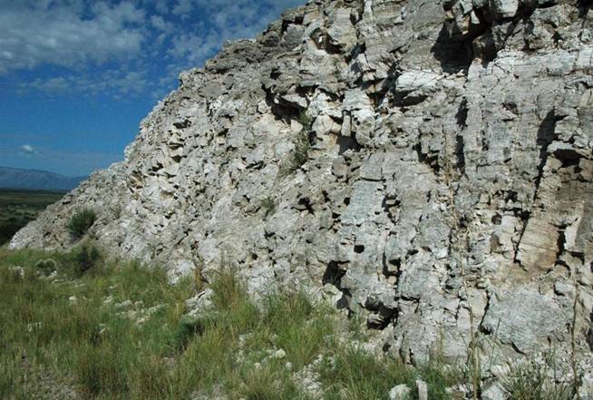
State Line outcrop - nodular gypsum (irregular
whitish masses above geology hammer) within banded gypsum-calcite rocks of the
Castile Formation (upper Upper Permian, 251 m.y.).
Info. mostly synthesized
from:
Anderson & Kirkland
(1987) - Banded Castile evaporites, Delaware Basin, New Mexico. Rocky
Mountain Section of the Geological Society of America, Centennial Field Guide
2: 455-458.