HOUCHINS NARROWS
Houchins Narrows (“Hutchins
Narrows” in some early literature, or simply “Narrows”) is a mostly
breakdown-filled giant canyon passage (vadose cave passage) between Mammoth
Cave's historic entrance and the Rotunda (= 1st cave room). It occurs at
level B, the 2nd-highest level in the Mammoth Cave system. Cave passages
at level B formed before 3.25 million years ago (during the Late Pliocene or
before). When Houchins Narrows had flowing water, the underground flow
path was to the northwest (toward the historic entrance and away from the 1st
cave room - this is toward the Green River, the local base level).
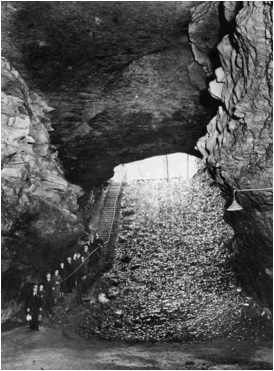
Mouth of Mammoth Cave (looking NW) (vintage
photograph) - Houchins Narrows extends from here, the historic entrance, to the
Rotunda, the first cave room (behind the photographer). The rocks are
Beaver Bend Member limestones (Girkin Ls.). The historic entrance of
Mammoth Cave was formed when a surface stream valley intersected & breached
Houchins Narrows.
The passage is named after
the fictional discoverer of Mammoth Cave. The story of Houchins' 1797
discovery of the cave while hunting a bear is fictional. Houchins Narrows
is relatively short (~0.15 miles) and extends to the southeast from the base of
the entrance stairs. A locked door near the entrance stairs prevents
access to the cave except for organized cave tours and special access by
researchers and cave employees.
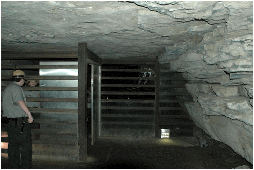
NPS locked door (looking SE, away from the
cave mouth) - the horizontal slats help to restrict air movement & simulate
what's perceived to be the original condition of this passage - rubble filled
to near the ceiling. Air moves outward from the cave mouth during the
warm summertime & inward during the cold wintertime.
The open spaces between the bars also allow bats to leave & enter the cave. Eight species of bats are known to inhabit Mammoth Cave. Bats were a common sight in Houchins Narrows in the 1800s (and in the Rotunda and Audubon Avenue and Little Bat Avenue, etc.). Bat populations used to number in the millions, but are significantly reduced nowadays.
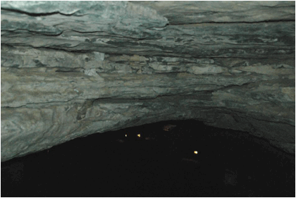
Houchins Narrows (looking SE) - the ceiling
of this passage is occasionally low enough to prevent upright walking for some
people. Here, the rocks are limestones of the Beaver Bend Member of the
Girkin Limestone, the same unit exposed along the entrance stairway at the cave
mouth.
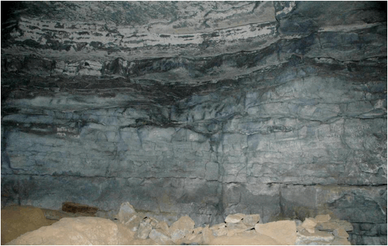
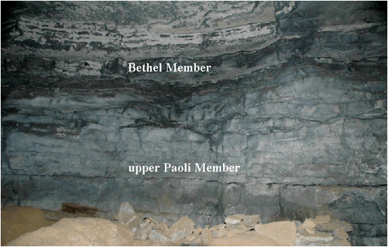
Houchins Narrows (above & below; looking
at the southwestern wall) - the passage descends gradually toward the first
cave room. So, the stratigraphic units along the walls get progressively
older. Below the Beaver Bend Member (seen at the cave mouth & near
the locked door) are the Bethel Member and the Paoli Member (both
lower Girkin Limestone). The Bethel is a thin interval of dark,
argillaceous limestone. The dark gray beds near the top of this photo are
the Bethel. The gray limestone beds below that are the upper Paoli
Member.
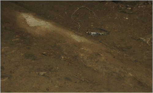
The dirt piles and rubble on
the floor at the bottom of the photo are remnants of a saltpetre mining
operation during the 1810s.

Houchins Narrows (looking at the
northeastern wall) - this feature is artificial. It was carved out from
the walls of Houchins Narrows & a vertical shaft connected this to the old
visitor center. Mammoth Cave's air is about 54° F year-round, and the
cave air cooled the old visitor center in the summertime. Natural air
conditioning! This is no longer used.
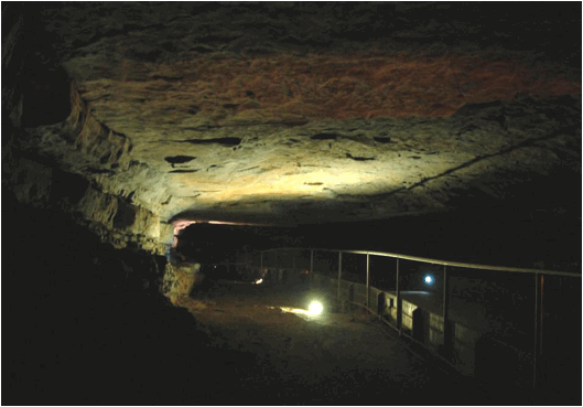
Houchins Narrows (looking NW, toward the
Historic Entrance) - this shows the passage cross-section shape of Houchins
Narrows. An undetermined thickness of sediments, rubble, and debris has
filled the passage, so it is not known how far down the original passage floor
is. Houchins Narrows is the top portion of a giant canyon passage, so it
originally formed above the water table. An underwater river flowed
through this passage. Which way did the water flow? Available
evidence indicates that water flowed to the northwest when the underground
river was here.
The area to the left of the
railing in the above photo is part of the 1810s saltpetre mining
operation. Original wooden pipes are still on the floor here. The
pipes are hollowed-out tulip poplar tree trunks (see below). These pipes
delivered water from the entrance waterfall to leaching vats in the Rotunda
& Broadway Avenue.