HWANGCHEON RIVER SECTION
Woraksan National Park is a
gorgeous forested mountainous area in central South Korea (scenery pics of park).
Most of the park's mountainous scenery (including Mt. Worak) is developed on a
weathered pluton of Bulguksa Granite, part of a Cretaceous-aged subduction zone
complex. Intrusion of the Bulguksa Granite has cooked the surrounding
country rock somewhat. "Woraksan" means "beyond-mountain
mountain".
The Hwangcheon River (also
transliterated as Gwangcheon River) is located south of Lake Chungju & runs
along portions of the northern boundary of Woraksan Park.
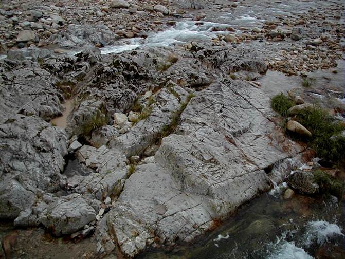
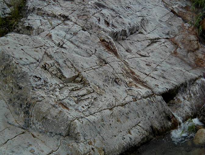
The pics below show in-place
rock exposures along the southwestern side of the Hwangcheon River. These
are silicified diamictites of the Hwanggangri Formation. The unit
ranges in thickness from 200 to 300 meters thick. Diamictites
(“pebbly mudstones”) are poorly sorted siliciclastic sedimentary rocks having a
strongly bimodal grain size distribution. Here, the rocks have
pebble-sized clasts in a muddy matrix (now silicified). The diamictite's
clasts don't show up well in these pics, though (to get closer, we needed to
wade through the bone-chillingly cold river water - none of us did). Some
diamictites approach the typical appearance of conglomerates.
Published research on
Hwanggangri Formation diamictites indicates that clasts are composed of
granite, gneiss, limestone, dolostone, shale, and quartzite. Some of the
clasts have been dated to 1.8 billion years (Paleoproterozoic). The
depositional age of this unit is unknown, however. Its
depositional environment is debated. Some interpret the Hwanggangri
diamictites as tillites (ancient glacial till), while others consider them to
be subaqueous debris flow deposits in an ancient continental slope setting.
These rocks have been
silicified & metamorphosed somewhat by contact metamorphism during
intrusion of a nearby pluton (the Cretaceous-aged Bulguksa Granite).
GPS of site: 36° 52.638' North, 128°
08.856' East.