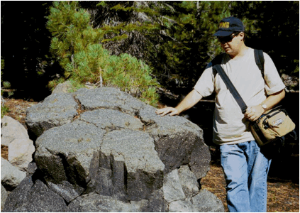
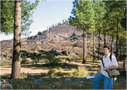
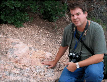
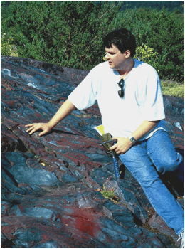
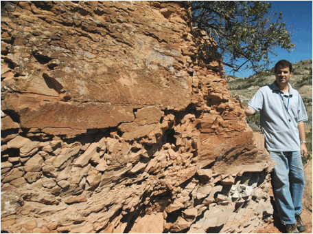
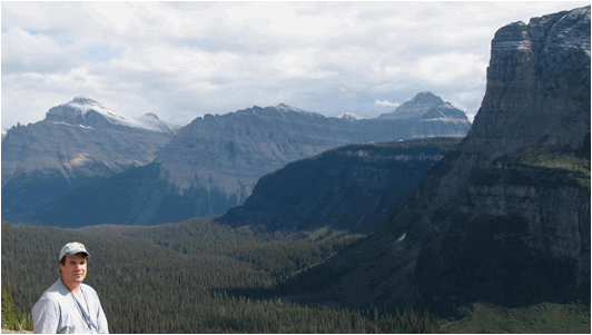
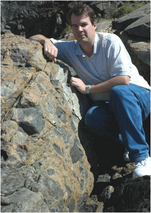
JSJ in the Field
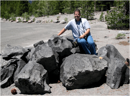
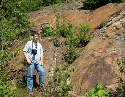
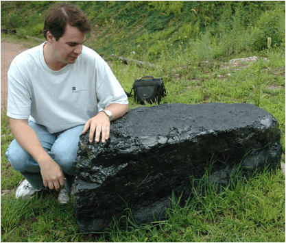
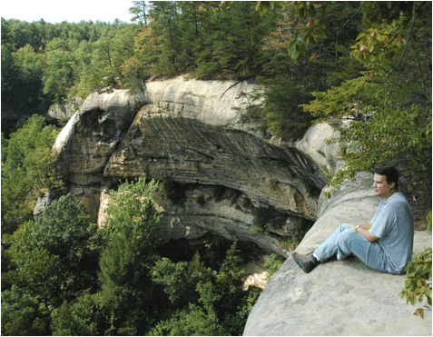
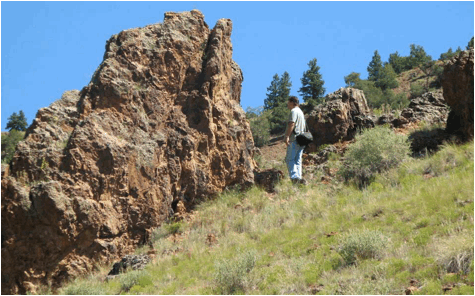
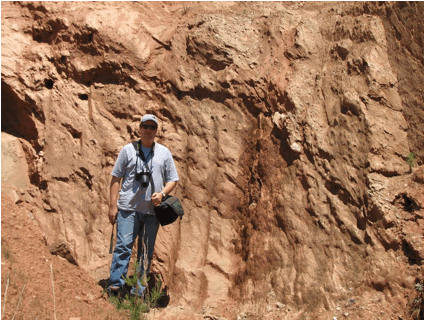
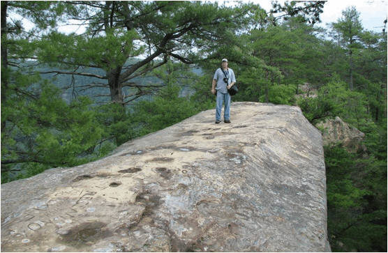
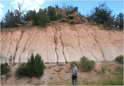
Mt. Lassen volcanic lava (Devastated Area, Lassen Volcano National Park, northeastern
California, USA) (above & below) - porphyritic black dacite from the 1915
eruption of Mt. Lassen, a large volcanic dome in the Cascade Range of America's
Pacific Northwest. The block shown below has moderately-developed
columnar jointing.
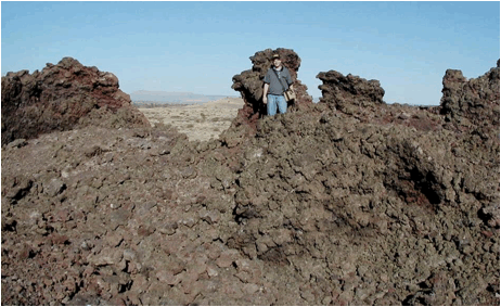
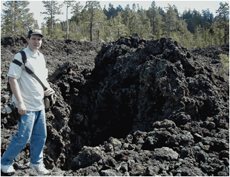
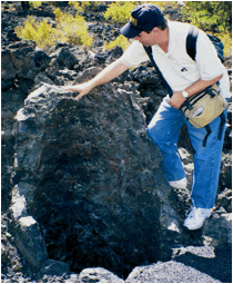
Aa lava flow of vesicular basalt, basalt, and
scoriaceous basalt (erupted about 5075 B.C.), Lava Butte Cinder Cone, Newberry
Volcano National Monument, Oregon, USA.
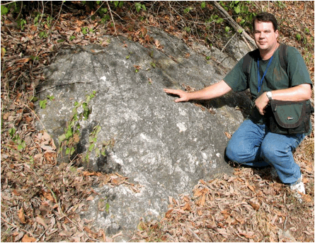
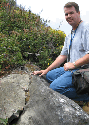
Glaciated knob of Ellsworth Schist
(Cambrian-Ordovician), Agassiz outcrop, Ellsworth Falls, southern Maine, USA.
Anakeesta Phyllite (Neoproterozoic) with iron oxide
staining from chemical weathering of pyrite in the phyllite. Newfound Gap,
Great Smoky Mountains, Appalachian Mountains, ~Tennessee-North Carolina border,
USA.
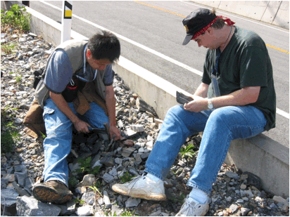
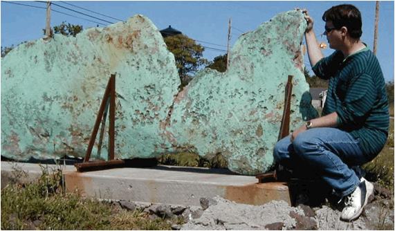
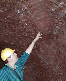
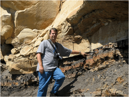
Anthracite coal (probably from the Mammoth Coal) from
the Llewellyn Formation, upper Middle Pennsylvanian at the Pioneer Valley Coal
Mine, Ashland, Pennsylvania, USA.
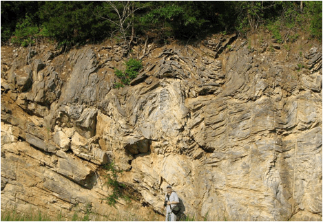
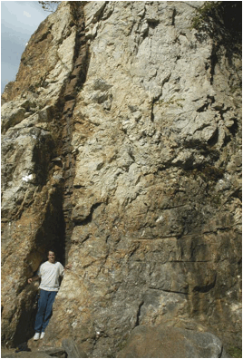
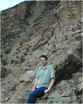
Anticline, folded Llewellyn Formation (upper Middle
Pennsylvanian), Bear Valley Coal Mine, near Shamokin, Pennsylvania, USA.
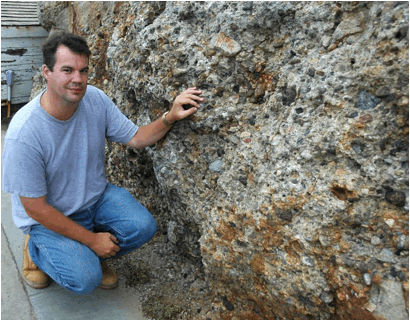
Archaeocyathan limestone, Ajax Limestone, Lower
Cambrian; Ajax Mine, South Australia.
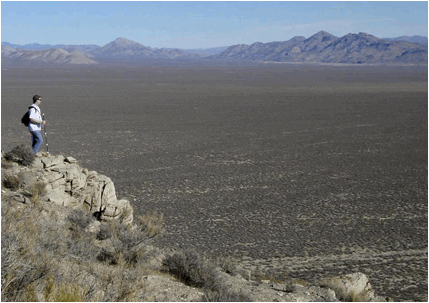
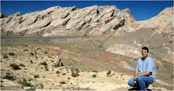
View of the Pahranagat Valley from Bactrian Mountain,
Mt. Irish Range, southern Nevada, USA. The rocks in the foreground are
limestone of the Guilmette Formation, Upper Devonian.
Scoriaceous basalt spatter agglomerate (~10,000 years
old), Bandera Crater Volcano, Cibola County, northwestern New Mexico, USA.
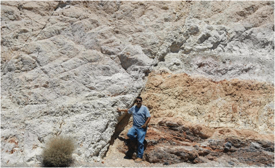
Cryogenian-Ediacaran GSSP (global stratotype section
and point), Neoproterozoic. The dark reddish rock below the boundary is a
Snowball Earth tillite - the Elatina Formation. The light brown rock
above the boundary is a supergreenhouse climate cap carbonate unit - the
Nuccaleena Formation. Enorama Creek, Brachina Gorge, Flinders Ranges,
South Australia.
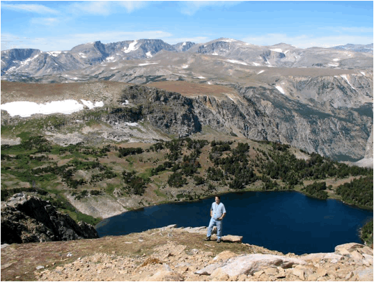
Twin Lakes area, Beartooth Mountains, ~Montana-Wyoming
border, USA. The rocks in these mountains are principally Archean-aged
metamorphics.
Long Lake Granite, Neoarchean, 2.74 billion
years. Long Lake area, Beartooth Mountains, ~Montana-Wyoming border, USA.
Rock Creek Vista Point, Beartooth Mountains,
~Montana-Wyoming border, USA. The rocks are principally Archean-aged
metamorphics.
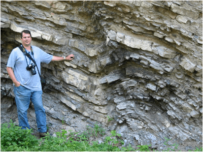
Fossiliferous limestones & shales, Bellevue
Limestone, Upper Ordovician. Maysville West roadcut, northeastern
Kentucky, USA.
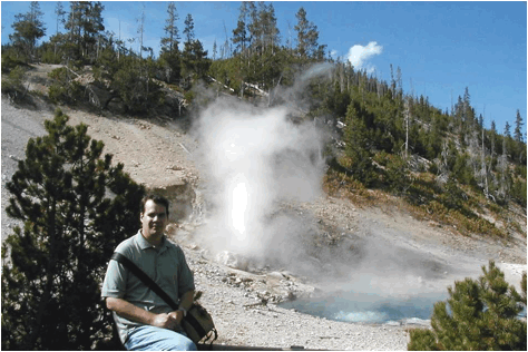
Beryl Hot Spring, Yellowstone Hotspot, northwestern
Wyoming, USA.
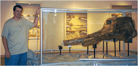
Mastodon skull (fossil elephant), Pleistocene, Big
Bone Lick, northern Kentucky, USA.
Scoriaceous basalt spatter agglomerate, 3300 years
old, Black Crater Spatter Cone, Lava Beds National Park, northern California,
USA.
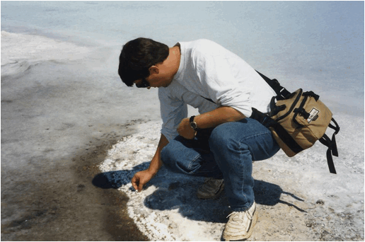
Halite from modern lacustrine evaporite deposit.
Bonneville Salt Flats, Utah, USA.
Chert nodules in limestone, Casey Member of the Boyle
Formation, Middle Devonian. Drowning Creek West roadcut, eastern
Kentucky, USA.
Bulguksa Granite, formed along a Cretaceous to early
Paleogene subduction zone. Lake Chungju, South Korea.

Planed-off/eroded stromatolites (layered structures
built up by cyanobacterial mats in a shallow marine environment) in the Hoyt
Limestone (Upper Cambrian) at Lester Park, New York State, USA.
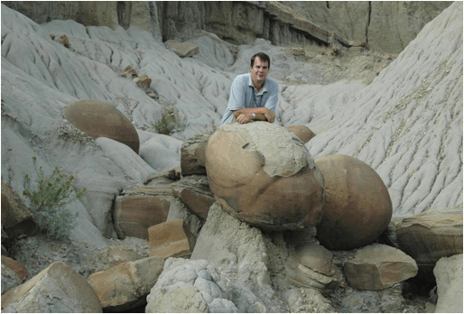
Cannonball concretions, Sentinel Butte Formation,
Upper Paleocene. Little Missouri Badlands, North Unit of Roosevelt
National Park, western North Dakota, USA.
Cross-bedded quartzose sandstones with hematite
staining & desert varnish, De Chelly Sandstone, Lower Permian. Canyon
de Chelly, northeastern Arizona, USA.
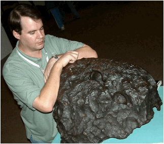
Canyon Diablo Octahedrite, an iron-nickel meteorite
principally composed of the Fe-Ni alloy minerals kamacite & taenite.
This is a core fragment from a now-disrupted differentiated asteroid in the
Asteroid Belt (between Mars & Jupiter), 4.55 billion years. Barringer
Crater area, Arizona, USA (on display at Chicago's Field Museum of Natural
History).
Carbonatite (“igneous limestone”), Magnet Cove
Complex, mid-Cretaceous, 96-102 million years. Cove Creek roadcut, Hot
Spring County, central Arkansas, USA.
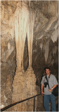
Travertine speleothem, Carlsbad Caverns, New Mexico,
USA.
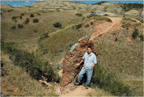
Castellate weathering, Sentinel Butte Formation, Upper
Paleocene. Little Missouri Badlands, North Unit of Roosevelt National
Park, western North Dakota, USA.
Banded gypsum-calcite rock, Castile Formation,
uppermost Upper Permian, 251 million years. State Line outcrop, Rt.
180/Rt. 62 at the New Mexico-Texas border, USA.
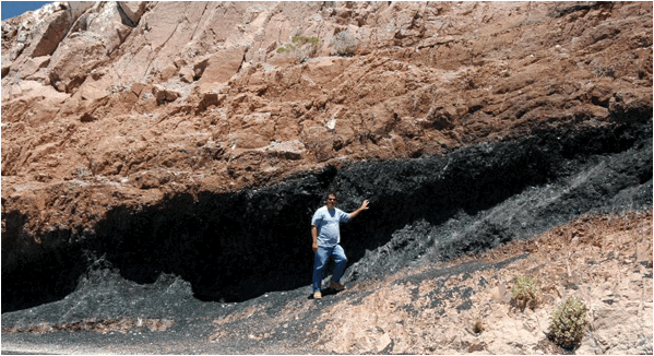
Sulfur-bearing “minerals” near vent in the
interception trench of the Centralia coal fire, Pennsylvania, USA.
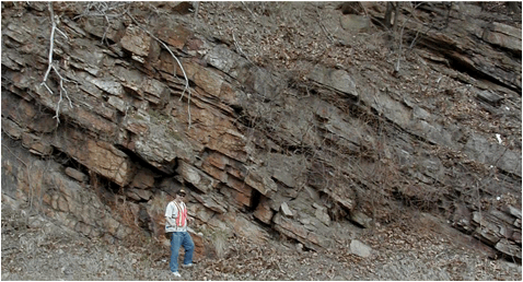
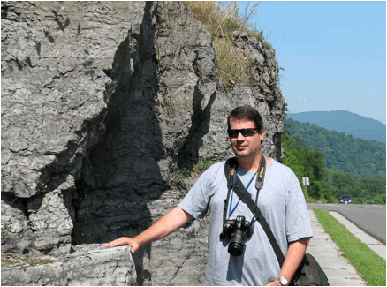
Clinch Quartzite (Lower Silurian) along Rt. 460
roadcut at the Narrows of the New River, Appalachian Mountains, Giles County,
Virginia, USA.
Clinker bed from naturally-burned lignite coal,
Sentinel Butte Formation, Upper Paleocene. Coal Vein Trail, South Unit of
Roosevelt National Park, western North Dakota, USA.
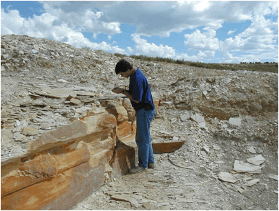
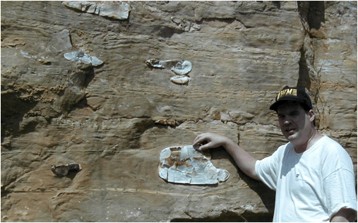
Collecting fossil fish in the Split Fish Layer, Fossil
Butte Member, Green River Formation, Lower Eocene. Commercial quarry near
Kemmerer, southwestern Wyoming, USA.
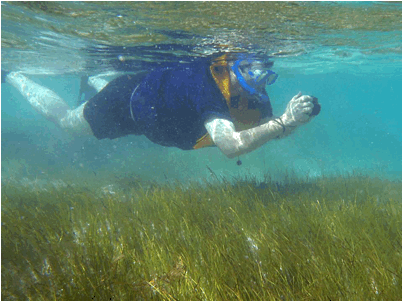
Snorkeling over a Thalassia-Syringodium
seagrass bed on the western side of North Point Peninsula, San Salvador Island,
eastern Bahamas.
Pegmatitic granite (K-feldspar, quartz, muscovite
mica) & graphic granite, Eight Mile Park Pegmatite District
(Mesoproterozoic, ~1.430-1.474 b.y.), outcrop along 3A Road, north of Royal
Gorge Bridge, west of Canon City, south-central Colorado, USA.
Collecting biotite & muscovite mica from
pegmatitic granite, Ruggles Pegmatite, Devonian. Ruggles Pegmatite Mine,
southern New Hampshire, USA.
Huge K-feldspar crystal in the Ruggles Pegmatite,
Devonian. Ruggles Pegmatite Mine, southern New Hampshire, USA.
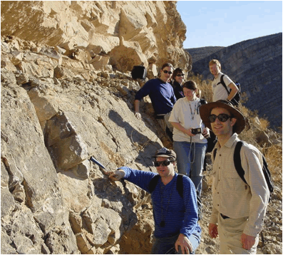
Collecting trilobites and other fossils in black
shales of the lower Jigunsan Formation (Ordovician) in the Seokgaejae section,
southern Gangwon South Province, South Korea.
Native copper with greenish malachite coating
recovered from the floor of Lake Superior, derived from the Portage Lake
Volcanic Series, Upper Peninsula of Michigan, USA. The copper
mineralization age is 1.05 to 1.06 billion years (late Mesoproterozoic).
Displayed at the Quincy Mine in Michigan, USA.
Copper Creek Thrust Fault with folded Rome Formation
limestones (Middle Cambrian) in the hanging wall (upper right) and tilted
Moccasin Formation limestones (Middle Ordovician) in the footwall (lower
left). Thorn Hill section, northeastern Tennessee, USA.
Diabase dike intruding the Ruggles Pegmatite at
Ruggles Pegmatite Mine, southern New Hampshire, USA.
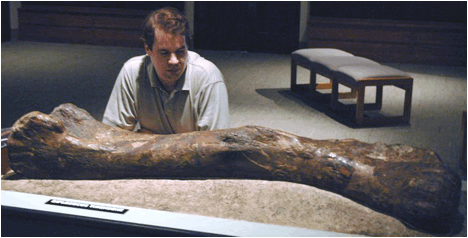
Femur from a Diplodocus sauropod dinosaur,
Upper Jurassic, western USA. On display at Carnegie Museum of Natural
History in Pittsburgh, Pennsylvania, USA.
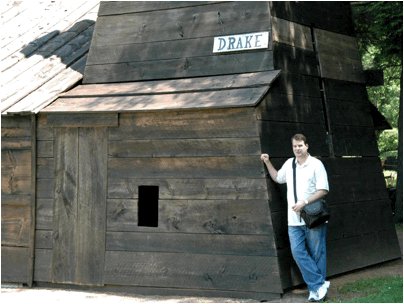
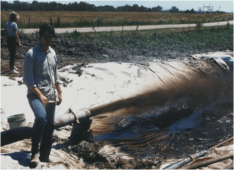
Drake Well (Earth's first deliberately-drilled oil
well, 1859) along Oil Creek near Titusville, northwestern Pennsylvania,
USA. Crude oil came from a shale-encased sandstone body in the lower
Riceville Formation, Upper Devonian.
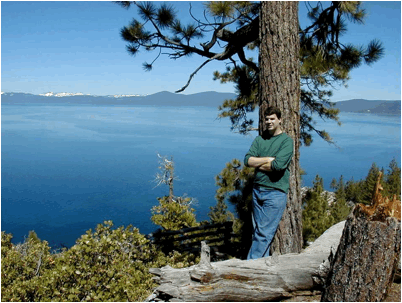
Lake Tahoe, Sierra Nevada Mountains,
~Nevada-California border, USA. The rocks all around Lake Tahoe are part
of the Sierra Nevada Batholith, a Cretaceous-aged granite formed underneath an
ancient volcanic arc along a subduction zone.
Tidalites (finely-laminated sediments deposited in a
very shallow water, tidally-influenced marine environment) in the Elatina
Formation (upper Cryogenian, middle Neoproterozoic). Pichi Richi Pass,
South Flinders Ranges, South Australia.
Emu Bay Lagerstätte (soft-bodied fossil deposit), Emu
Bay Shale, Lower Cambrian. Big Gully, Kangaroo Island, offshore South
Australia.
Fault in cupriferous felsite conglomerate, Allouez
Conglomerate, Portage Lake Volcanic Series, upper Mesoproterozoic, 1.094
billion years. 1st level, Delaware Copper Mine, Keweenaw Peninsula, Upper
Peninsula of Michigan, USA.
Fossiliferous limestone slabs derived from the upper
Richmondian Stage, Upper Ordovician. Flat Fork, Caesar Creek Lake State
Park, southwestern Ohio, USA.
Folded Middle Ordovician limestones just south of the
St. Clair Thrust Fault. Rt. 460 roadcut, Narrows of the New River,
Appalachian Mountains, Giles County, Virginia, USA.
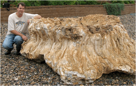
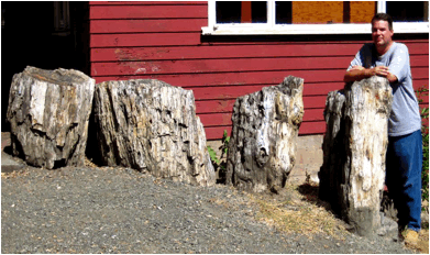
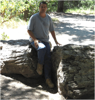
Permineralized fossil tree trunk, probably from the
Paleocene of western North Dakota, USA.
Shale-filled fossil tree stump, Kanawha Formation,
Middle Pennsylvanian. Interstate-64 roadcut at milepost 83 tollbooth,
Kanawha County, West Virginia, USA.
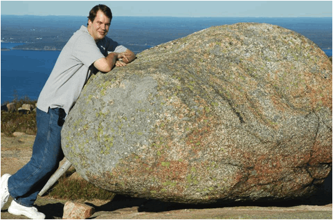
Large glacial erratic deposited by Pleistocene
glaciation, near summit of Cadillac Mountain, Acadia National Park, southern
coastal Maine, USA.
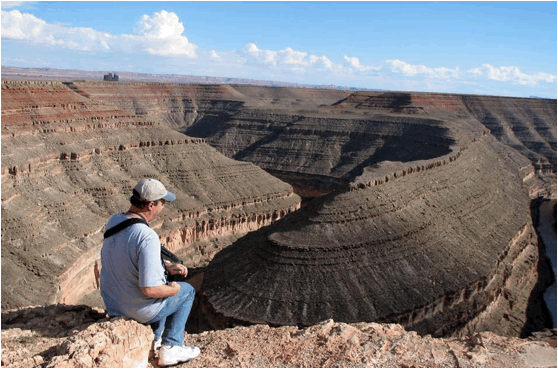
Goosenecks of the San Juan River - the classic example
of entrenched meanders, southern Utah, USA. The rocks walls are Honaker
Trail Formation and Paradox Formation (both Pennsylvanian).
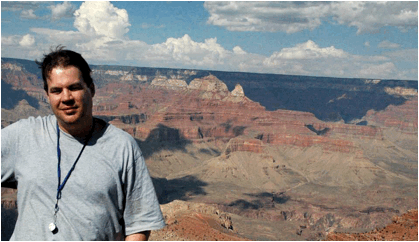
Grand Canyon, northern Arizona, USA. The lower
gray slope consists of three Cambrian-aged units - Tapeats Sandstone, Bright
Angel Shale, and the Muav Limestone. The reddish cliff above that is the
Redwall Limestone (Mississippian). The reddish cliffy-slopes above that
represent the Supai Group (Pennsylvanian). The whitish cliff above that
is the Coconino Sandstone (Permian).
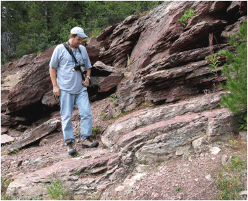
Small-scale fold in reddish argillites of the Grinnell
Formation, Mesoproterozoic, ~1.45 billion years, Glacier National Park,
Montana, USA.
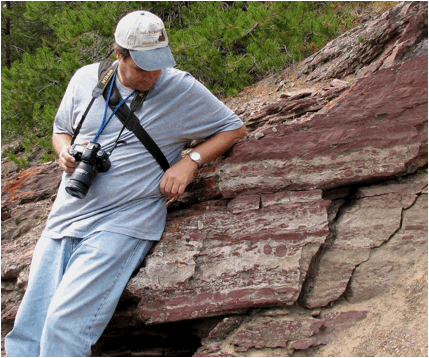
Argillite conglomerate & mud-chip breccia in the
Grinnell Formation, Mesoproterozoic, ~1.45 billion years, Glacier National
Park, Montana, USA.
Horizontal fault (at hand level) in Middle Ordovician
limestones. Rt. 100 roadcut in Pearisburg, Giles County, Virginia, USA.
Undercut cliffs of Corbin Sandstone (Middle
Pennsylvanian) near Indian Staircase, Red River Gorge, eastern Kentucky, USA.
Jaspilite (banded iron formation), Negaunee
Iron-Formation, Mesoproterozoic, 2.11 billion years (or 1.874 billion
years). Jasper Knob, Ishpeming, Upper Peninsula of Michigan, USA.
Diamondiferous lamproite rocks, Prairie Creek
Lamproite, Early Cretaceous, 106 million years. Crater of Diamonds, Pike
County, Arkansas, USA.
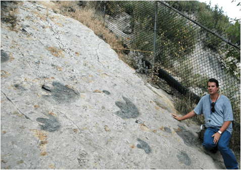
Iguanodontid dinosaur tracks on tilted sandstone
bedding plane, Dakota Sandstone, Cretaceous; Dinosaur Ridge, near Denver,
Colorado, USA.
Weathered magnesiocarbonatites, Iron Hill Carbonatite
Complex, late Neoproterozoic, ~570 million years. Iron Hill, southeast of
Powderhorn, southwestern Colorado, USA. Magnesiocarbonatites are
dolomitic intrusive igneous rocks.
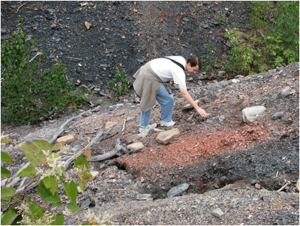
Cretaceous-Tertiary ("K-T") boundary clay
(65 million years) in a coal bed. The K-T boundary clay represents
fallout from the impact event that caused a mass extinction of dinosaurs and
many other organisms. Long Canyon Road, south of Trinidad Lake, southern
Colorado, USA.
Fossil palm fronds in sandstone, Laramie Formation,
upper Upper Cretaceous; Parfet Prehistoric Preserve, Golden, Colorado, USA.
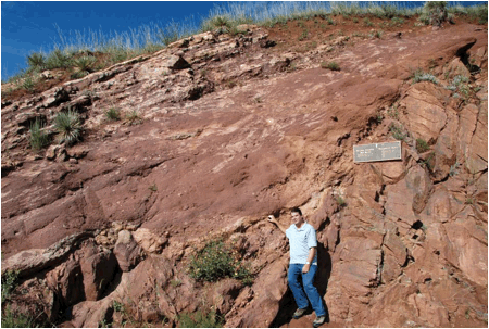
Precambrian-Pennsylvanian nonconformity at Red Rocks
Amphitheater, near Denver, Colorado, USA. Rocks below right hand are
granitic gneisses and migmatites of the Idaho Springs Formation (late
Paleoproterozoic, 1.7 billion years). Rocks above are tilted,
hematite-rich conglomerates, arkoses, and sandstones of the Fountain Formation
(Pennsylvanian). 1.4 billion years of missing time are repesented by this
unconformity.
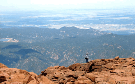
Summit of Pikes Peak, Colorado, USA. Rocks in
the foreground at bottom are granites of the Pikes Peak Batholith, late
Mesoproterozoic, 1.08 billion years.
Radioactive dinosaur bone (dark structure in the rock),
fluvial sandstone in the Westwater Member of the Morrison Formation, middle
Upper Jurassic. Dinosaur Ridge, near Denver, Colorado, USA.
Dinosaur bones are common in this sandstone unit - they have been partially
permineralized/replaced by the radioactive, uranium-bearing mineral
carnotite. Scintillometer reading on a bone here: 422 counts per minute
(cf. background reading of 140 cpm).
Sauropod dinosaur footprint bulge in sandstone, upper
Morrison Formation, Upper Jurassic. Dinosaur Ridge, near Denver,
Colorado, USA.
Uranium roll front in Dakota Sandstone, Cretaceous;
Turkey Creek Road, near Denver, Colorado, USA. Uranium compounds are
relatively mobile and move through permeable rocks while dissolved in
fluids. The black stuff is uraninite (UO2). There's
other uranium minerals here, too. The U is ultimately coming from nearby
pegmatitic granites. A reading on this roll front shows it can emit
33,000 counts per minute radiation.
Lena Pillars in Siberia. The rocks are
fossiliferous limestones of the upper Perekhod Formation, upper Lower Cambrian.
Ulakhan-Kyyry-Taas section, southern side of the Lena River, across from
At-Daban, eastern Siberia.
Pumice/pumiceous rhyolite, Big Obsidian Flow, erupted
700 A.D., Newberry Volcano National Monument, Oregon, USA.
Obsidian, Big Obsidian Flow, erupted 700 A.D.,
Newberry Volcano National Monument, Oregon, USA.
Paleocene-aged sedimentary rocks, Little Missouri
Badlands, western North Dakota, USA. The reddish-brown areas in the
valley are clinker beds (naturally burned-out lignite coal horizons).
Metanorthosite, Marcy Anorthosite, late
Mesoproterozoic, 1.155 billion years. Jay Dome, Adirondack Mountains, New
York State, USA.
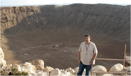
Barringer Crater (aka Meteor Crater) in
northern Arizona, USA. This hole formed ~49,000 years ago by the impact
of the Canyon
Diablo Octahedrite, a 4.55 billion year old, iron-nickel meteorite derived
from the Asteroid Belt between Mars and Jupiter.
Fossiliferous limestones of the lower Bird Spring
Formation. The geology hammer handle is pointing to the
Mississippian-Pennsylvanian boundary. This site is the GSSP (global
stratotype section and point) for the Miss.-Penn. boundary. Arrow Canyon,
southern Nevada, USA.
Ordovician fossiliferous limestones nonconformably
resting atop Proterozoic-aged gneiss. Montmorency Promontory, north of
Montmorency Falls, Quebec City, Quebec, Canada. The fossiliferous
limestones are relatively rich in a fossil traditionally called Solenopora,
which is traditionally interpreted as a fossil rhodophyte (red alga).
This unit is the Solenopora Gravels, Trenton Group, upper Middle
Ordovician.
Large-scale mudcracks in vertical beds of the ABC
Range Quartzite (lower Ediacaran, upper Neoproterozoic). Pichi Richi Pass
railroad cut, South Flinders Ranges, South Australia.

Muir Beach (eastern coast of the North Pacific Basin),
north of San Francisco, central California, USA.
NASA Ames Base, Moffet Field, central California, USA.
This equipment runs MARSWIT, the world's only wind tunnel that can be operated
at Martian surface atmospheric conditions. It was formerly a test chamber
for the Saturn V rocket.
Vanport Flint (“Flint Ridge Flint”), upper Middle
Pennsylvanian. Nethers Flint Quarries, eastern Flint Ridge, east-central
Ohio, USA.

Niagara Falls & Niagara Escarpment, New York
State-Ontario border.
Novaculite
(variably microporous metachert), Arkansas Novaculite,
Devonian-Mississippian. Hot Springs Mountain Anticline, ZigZag Mountains,
Arkansas, USA.
Crude oil derived from Upper Cambrian porous dolostones
(sandy?) at & just below the Knox Unconformity at ~2404-2410 feet below the
surface. Oil well a little southwest of Westfall, southern Pickaway
County, central Ohio, USA.

Cadillac Mountain Granite, Devonian. Otter
Cliff, Mt. Desert Island, Acadia National Park, southern coastal Maine, USA.
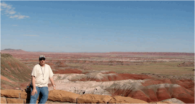
Variably colored shales of the Petrified Forest Member
of the Chinle Formation (Upper Triassic). Painted Desert, Petrified
Forest National Park, Arizona, USA.
Precambrian-Cambrian boundary, Mernmerna section,
eastern side of the Three Sisters Range, South Australia. The blackened
bedding plane represents the Precambrian-Cambrian boundary, which at this
locality is a minor disconformity (missing time). The rocks to the right
are part of the Rawnsley Quartzite (upper Ediacaran, uppermost Neoproterozoic).
The rocks to the left are part of the Parachilna Formation (lower Lower
Cambrian). The first complex trace fossils appear in the basal Parachilna
beds here.
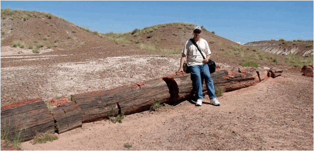
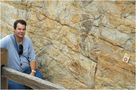
Permineralized fossil log of Araucarioxylon
arizonicum in the Chinle Formation (Upper Triassic) at Crystal Forest,
Petrified Forest National Park, Arizona, USA.
Saprolite (extremely friable, extremely weathered
Proterozoic-aged gneiss) from Pine Ridge West quarry, Appalachian Mountains,
Surry County, northwestern North Carolina, USA.
Pseudocolumnar jointing (in interval at ~hip level) in
Paleocene sedimentary rocks produced by an ancient lignite coal fire.
South Unit of Roosevelt National Park, western North Dakota, USA.
U-shaped glacial valley incised in Mesoproterozoic
Belt Supergroup rocks (1.40 to 1.47 billion years). Reynolds Creek
overlook, Glacier National Park, northwestern Montana, USA.
Shatter Zone tectonic breccia, Devonian. Sand
Beach, Mt. Desert Island, Acadia National Park, southern coastal Maine, USA.
Sky Bridge, a natural arch developed in the Corbin
Sandstone, a Middle Pennsylvanian fluvial deposit. Red River Gorge,
eastern Kentucky, USA.

Specularite (micaceous hematite schist) from the
Negaunee Iron-Formation, Paleoproterozoic, 2.11 billion years (or 1.874
billion years). Champion Mine, Upper Peninsula of Michigan, USA.
Large columnar thrombolites in bioherm at the top of
the Wirrealpa Limestone (upper Lower Cambrian), ~200 meters north of the
Blinman-Wirrealpa road near Old Wirrealpa Mine, Flinders Ranges, South
Australia. Thrombolites are similar to stromatolites, in that they are
bacterial buildups. Internally, stromatolites are thinly laminated.
Thrombolites have a clotted internal texture.
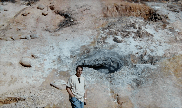
Spattering mudpot, Sulfur Works Hydrothermal Area, Mt.
Lassen National Park, Cascade Range, northern California, USA.
Swiftcurrent Falls, Many Glacier area, Glacier
National Park, Montana, USA. The rocks are sandy dolostones of the Altyn
Formation, Belt Supergroup, Mesoproterozoic, 1.40 to 1.47 billion years.
Tree molds of ponderosa pines surrounded by vesicular
basalts & scoriaceous basalts of the Lava Cast Forest Flow (erupted ~5260
B.C.). Lava Cast Forest, Newberry Volcano National Monument, Oregon, USA.
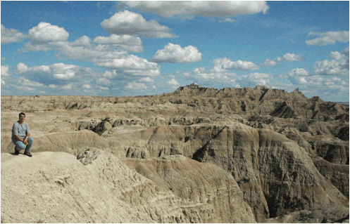
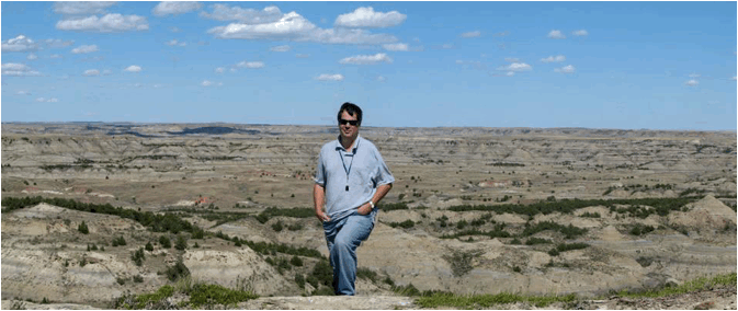
White River Badlands, western South Dakota, USA.
Rocks are differentially eroded siliciclastic sedimentary rocks of the White
River Group (Oligocene).
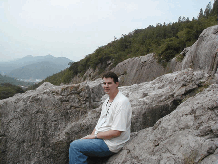
Xiaxia Limestone (Permian) at Yangshan, near Nanjing,
eastern China.
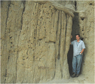
Bandelier Tuff (lower to middle Lower Pleistocene,
1.25-1.61 m.y.) exposed to the southwest of the town of White Rock, northern
New Mexico, USA. ~Neck-level & downward - ash-flow volcanic
tuffs of the Otowi Member (1.61 m.y.); thin, gray bed at head-level -
Tsankawi Pumice Bed, basal Tshirege Member (1.25 m.y.); thick, whitish
interval above head-level - ash-flow volcanic tuffs of the Tshirege Member
(1.25 m.y.).
Wall of rose quartz, derived from Colorado
pegmatitic granite, at Royal Gorge Bridge, west of Canon City, south-central
Colorado, USA.
Triceratops dinosaur footprint (Animalia, Vertebrata, Dinosauria, Ceratopsia) on
underside of sandstone bed, Laramie Formation, upper Upper Cretaceous; Parfet
Prehistoric Preserve, Golden, Colorado, USA.
Molybdenum ore - porphyritic alkalic granite (Climax Stock,
Oligocene, 24-33 m.y.) having vein of silvery-gray colored molybdenite (MoS2);
Climax Mine, Lake County, central Colorado, USA.
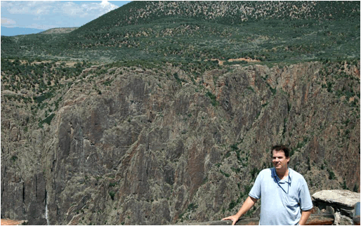
Cold Shivers Point along Columbus Canyon, Colorado
National Monument, western Colorado, USA. The ~vertical sandstone cliffs
in the foreground & background are eolian, quartzose sandstones of the Wingate
Sandstone (Lower Jurassic). The maroon shales below that (see lower
left & above my head) are part of the Chinle Formation (Upper
Triassic), representing floodplain mud deposition. Thin-bedded,
light-colored, fluvial, quartzose sandstones of the Kayenta Sandstone
(Lower Jurassic) make up the partly vegetated areas at top, above the
cliff-forming Wingate Ss. The dark gray rocks below the Chinle Fm. (see
just above my shoulder) are Precambrian basement rocks of the Black Canyon
Formation (late Paleoproterozoic, 1.7 b.y.) consisting of gneisses,
schists, migmatites, and granite dikes.
Injection gneisses of the Black Canyon Formation
(1.74 b.y., intruded by 1.36 b.y. pegmatitic granite dikes); Gunnison Point
overlook, Black Canyon of the Gunnison, western Colorado, USA.
Large talus block (left) & in-situ vertical
beds (right) of the Dakota Sandstone (Albian Stage, upper Lower Cretaceous),
Dakota Sandstone Hogback at Stonewall, southern Colorado, USA.
Injection gneisses of the Black Canyon Formation
(1.74 b.y., intruded by 1.36 b.y. pegmatitic granite dikes); Pulpit Rock
overlook, Black Canyon of the Gunnison, western Colorado, USA.
1.74 billion year old gneiss (~triangular-shaped block
of foliated material at lower left) in 1.48 billion year old Vernal
Mesa Quartz Monzonite (Mesoproterozoic). Outcrop at Chasm View
overlook, Black Canyon of the Gunnison, western Colorado, USA.
Soda Dam
(above & below - be sure to scroll to the right to see the entire photo
below) - this large, ~7 k.y., hot springs travertine mound formed along the
Jemez River, eastern side of Rt. 4, southwest of the Valles Caldera, north of
San Ysidro, northern New Mexico, USA. This travertine mound formed by
calcite precipitation (CaCO3) from waters emerging at various hot
springs. Fluids are discharging from a Jemez Fault splay. Over a
dozen individual hot springs are still active here, but the underground
plumbing at this site was wrecked by the New Mexico Highway Department while
"improving" the nearby road. As a result, Soda Dam is no longer
constructional; it is slowly eroding. (Most info. from Goff et al., 1996,
The Jemez Mountain region, New Mexico Geological Society Forty-Seventh
Annual Field Conference, September 25-28, 1996.)
Soda Dam
(just to the west of the above location) - western side of Rt. 4, southwest of
the Valles Caldera, north of San Ysidro, northern New Mexico, USA. Here,
a hot spring emerges from the rock. Dissolved Ca+2 and CO3-2
ions precipitate out as calcite (CaCO3), forming travertine (the wet
mound below knee level). Thermophilic algae are providing the green
coloration.
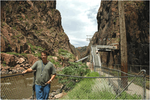
Royal Gorge along the Arkansas River, Royal Gorge Arch, west of Canon City,
south-central Colorado, USA. The rocks are Precambrian basement rocks
dating to 1.70-1.72 billion years. They are principally injection
gneisses, consisting of high-grade, foliated metamorphic rocks multiply
intruded by pegmatitic granite dikes.
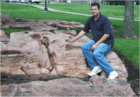
Pinkish quartzites of the Sioux Quartzite
(upper Paleoproterozoic, 1.65-1.70 Ga) along the Big Sioux River at Falls Park,
city of Sioux Falls, southeastern South Dakota, USA.
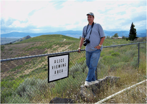
Alice Mine (Alice Pit) - this former mine in Walkerville, southwestern Montana
(just north of the town of Butte) targeted silver, manganese, and zinc minerals
in hydrothermal veins (62-66 Ma) intruding the Butte Quartz Monzonite (76 Ma,
Late Cretaceous). The pit and adjacent park (grassy area in the
background) are part of a completed Superfund cleanup site.
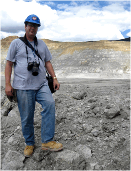
Continental Mine (Continental Pit) - this large, copper-molybdenum
mine in Butte, southwestern Montana targets the minerals chalcopyrite and molybdenite. The ore
minerals are in hydrothermal veins (62-66 Ma) intruding the Butte Quartz
Monzonite (76 Ma, Late Cretaceous), or are disseminated in the host rock.
I'm standing on an ore pile in the middle of the working floor of the
mine. The light brown-colored rocks in the upper walls of the mine in the
background represent the oxidized zone. The grayish rocks below that are
unoxidized. Minerals observed in the ore rock pile include pyrite, chalcopyrite,
molybdenite, azurite,
malachite, tenorite, and hematite.
Syndicate Pit (Butte, southwestern Montana, USA) - exposure of jointed Butte Quartz
Monzonite (76 Ma, Late Cretaceous) with an intruding aplite dike (lower
right of photo to under my knees). Aplite is a finely-crystalline
intrusive igneous rock having a granitic composition.
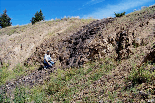
Jefferson Canyon (near Lewis & Clark Caverns, southern Montana,
USA) - outcrop of the LaHood Formation (1.47 Ga, lower Mesoproterozoic), which
here consists of arkoses
and conglomeratic arkoses. The LaHood Formation is in the lower Belt
Supergroup, a famous and extremely thick succession of sedimentary rocks in
western USA that fills a large, ancient rift valley.
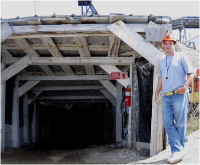
Orphan Girl Mine (World Museum of Mining, town of Butte, southwestern
Montana, USA) - this publicly-accessible adit leads down to the 65' level of
the mine. This zinc-lead-silver mine operated from the 1870s to the
1950s. Target minerals occur in hydrothermal veins (62-66 Ma) that
intrude the Butte Quartz Monzonite (76 Ma, Late Cretaceous).
Emma Vein (town of Butte, southwestern Montana, USA) - this 17'-wide
hydrothermal composite vein intrudes the Butte Quartz Monzonite (76 Ma, Late
Cretaceous). The vein includes the dark rocks immediately surrounding me,
the blackish area, and the brownish material in the right portions of the photo.
The host rock is the light brown material in the upper left portions of the
outcrop. At the surface, the Emma Vein is siliceous (quartz-dominated)
and rich in manganese oxide (blackish) & iron oxide. In the
subsurface & to the east of this outcrop, the Emma Vein had economic
concentrations of copper, manganese, and zinc minerals. These have been
mined out. The subsurface Emma Vein included a 100' wide section of rhodochrosite.
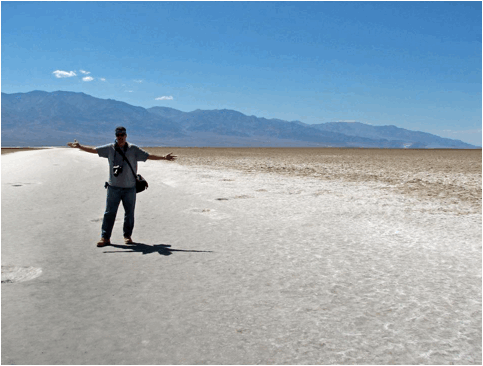
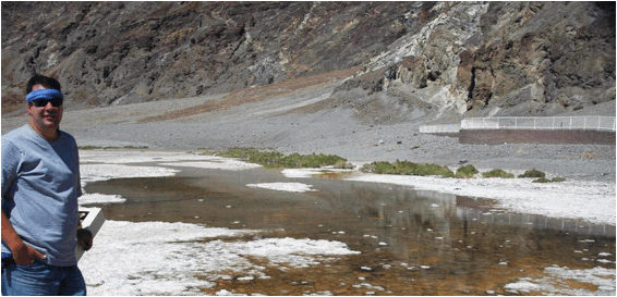
Death Valley (Badwater Spring along Badwater Road, Death Valley, California, USA) -
one of the harshest surface environments anywhere on Earth. This is the
valley floor of Death Valley at Badwater Spring (= behind the
photographer). This portion of the valley is well below sea level - the
elevation here is -279'. Air temperatures during boreal summers in Death
Valley are extremely hot. The temperature this day (July 2010) was 118°
Fahrenheit (= ~48° Celsius). A strong gust of wind swept through a few
minutes after this photo was taken - a stereotypical "blast furnace
wind". The deposits in the valley are intermontane playa evaporites
mixed with some siliciclastic material. A playa is an ephemeral lake, or
dry lake. Playas only occasionally have standing water, but it quickly
evaporates.
Death Valley & the adjacent mountain ranges are
classic examples of horsts and grabens - upthrown and downthrown fault blocks
resulting from crustal extension. The mountain ranges (upthrown fault
blocks) are horsts. The valleys (downthrown fault blocks) are grabens.
Large-scale normal faults occur at the boundaries between the mountain ranges
and the valleys in this area, and throughout the Basin & Range Province of
western America (= Nevada, western Utah, parts of southern California &
Arizona & northern Mexico, etc.).
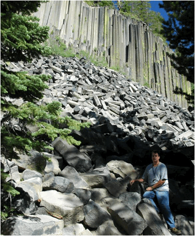
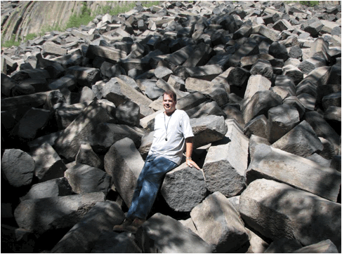
Devil's Postpile (above & below) (Devil's Postpile National
Monument, west of town of Mammoth Lakes, eastern California, USA) - the best
localities on Earth for seeing excellent columnar jointing are: Giant's
Causeway (Ireland), Devils' Tower (Wyoming, USA), and Devil's Postpile
(California, USA). Columnar jointing forms as a lava flow cools
and contracts, resulting in the development of shrinkage cracks. As shrinkage
cracks grow, they branch at ~120º angles (as seen in map view). Crack
networks merge with other networks to form columns having a polygonal
cross-section shape. Most columns are hexagonal or pentagonal in
shape. A few are 3-sided, 4-sided, or 7-sided.
Devil's Postpile is a trachybasalt (or basaltic
trachyandesite) lava flow with extremely well-developed columnar
jointing. Erosion has toppled many of the columns into a large pile at
the base of the flow. The flow represents part of the activity of the Long
Valley Volcano, which is now a large caldera in the eastern Sierra Nevada
Mountains of California. The Devil's Postpile lava flow erupted outside
the southwestern margin of the Long Valley Caldera.
Stratigraphy & age: Postpile Flow, Upper Pleistocene, 82 k.y.
Info. synthesized from Huber et al. (2001 - The
Story of Devils Postpile, a Land of Volcanic Fire, Glacial Ice and an Ancient
River, Updated from the Original Edition) and Mahood et al. (2010 - Geological
Society of America Bulletin 122: 396-407) and Bailey (2004 - United States Geological Survey Professional
Paper 1692).
Gypsum, Colorado (alongside 51 Road just north of the town of Gypsum,
western Eagle County, northwest-central Colorado, USA) - large blocks of
chickenwire rock gypsum of the Eagle Valley Evaporite, a Pennsylvanian
unit dominated by rock salt (halite, NaCl), rock gypsum (CaSO4·2H2O),
and rock anhydrite (CaSO4). These three rock types formed by
evaporation of seawater and the precipitation of dissolved minerals. With
deep burial, evaporites tend to engage in upward, solid-state flow. A
large area around Gypsum, Colorado is extensively deformed by dissolution and
upward movement of various evaporite rocks - this is the Eagle Collapse
Center, which covers about 2,500 square kilometers. Evaporite rock
movement and deformation occurred principally in the late Cenozoic. Info.
synthesized from Chronic & Williams (2002 - Roadside Geology of Colorado)
and Lidke et al. (2002 - Geological Society of America Abstracts with
Programs 34(6): 288).
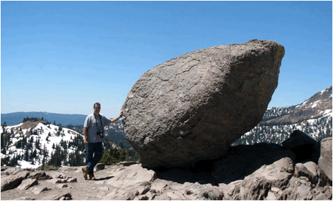
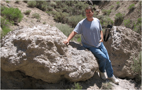
Glacial erratic (Bumpass Hell Trailhead, just south of Mt. Lassen,
Lassen Volcano National Park, northeastern California, USA) - glacial erratics
are large boulders left behind by melting glaciers. They have a somewhat
rounded shape due to glacial and post-glacial meltwater abrasion.

Hailstone deposit (motel grounds in town of Limon, Colorado, USA) - a
severe storm cell went over the town of Limon, Colorado on the evening of the
4th of July 2010, resulting in the development of a significant hailstone
deposit. The hailstones here have a ~bimodal size distribution and
individual specimens range up to 3 cm in diameter. Much larger aggregate
hailstones also fell in places during this storm event. More info. on hailstones.
Horseshoe Lake volcanic CO2 tree kill (northern shores of Horseshoe Lake, just
south-southeast of Mammoth Mountain, southwest of the town of Mammoth Lakes,
eastern Sierra Nevada Mountains, eastern California, USA) - several patches of
dead lodgepole pine trees occur in the vicinity of Horseshoe Lake,
California. They were killed during the early 1990s by lethal levels of
carbon dioxide gas in the soil. The gas appears to be derived from rising
magma in the Mammoth Mountain area. This area is just to the southwest of
the Long Valley Caldera, a still-active volcanic center.
Point Bonita pillow basalts (Point Bonita, southwestern tip of the Marin
Peninsula, Golden Gate National Recreation Area, north of San Francisco,
western coast of California, USA) - These rounded masses of volcanic rock are pillow
basalts. The pillow basalt morphology is diagnostic of an underwater
lava eruption. These basaltic lavas are part of the Franciscan Complex,
and represent the top portion of Jurassic-aged oceanic crust. This
basaltic crust originally formed at an ancient mid-ocean ridge and got
plastered onto the edge of the North American continent along a now-inactive
subduction zone. The upper portions of the subducting oceanic slab (the
Farallon Plate) got scraped off to form an accretionary wedge.
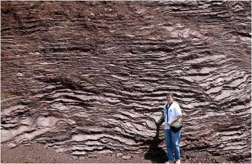
Radiolarian ribbon chert (southern Marin Peninsula, Golden Gate National
Recreation Area, north of San Francisco, western coast of California, USA) -
these spectacular rocks are tilted layers of chert. Their dark brick-red
color is due to the presence of hematite
(Fe2O3). Weathering of these chert beds results in
a ribbon-like appearance, hence the term ribbon chert. Chert is a
siliceous sedimentary rock, composed of cryptocrystalline quartz (SiO2).
These particular cherts have abundant microfossils of radiolarians,
a group of marine, unicellular, non-photosynthetic protists that make tiny
skeletons of opal (SiO2·nH2O).
Burial and diagenesis of radiolarian-rich sediments results in the formation of
radiolarian cherts. These rocks are part of the Franciscan Complex
(Jurassic) and were deposited on an ancient deep seafloor. The rocks got
scraped off from the top of a subducting slab of oceanic crust (the Farallon
Plate) along coastal California.
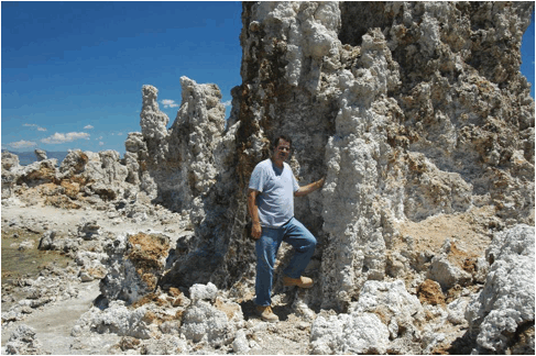
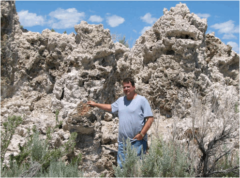
Mono Lake tufa towers (above & below) (southern shore of Mono Lake,
Mono Valley, eastern California, USA) - Mono Lake is a hyperalkaline,
hypersaline lake. It's chemistry and size have been strongly influenced
by 1940s-onward human activity (diversion of Owens River water to Los
Angeles). The rocky structures seen here (above & below) are tufa
towers. They formed underwater at a time when lake levels were much
higher than at present. Tufa is a friable precursor to travertine.
Tufa rocks are composed of calcium carbonate (CaCO3). They
formed at the sites of former lake-bottom springs, where calcium-rich
groundwater emerged and mixed with carbonate-rich lake water, resulting in the
precipitation of CaCO3. An unnamed, extremophile
γ-proteobacterium that apparently(?) incorporates arsenic (As) in its cell
structure was recently discovered at Mono Lake (more
info.).
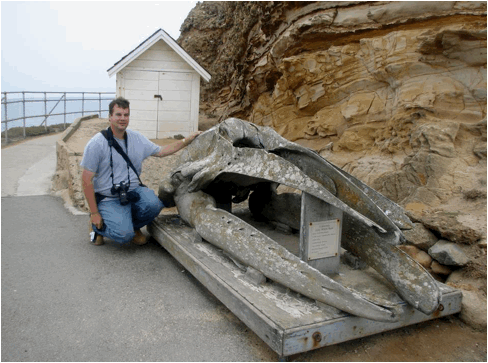
California gray whale skull (Point Reyes, westernmost Point Reyes Peninsula,
western coastal California, USA) - the California gray whale (Eschrichtius
robustus) is a very large marine mammal that attains an adult body length
of about 50 feet. The rocks in the cliff are quartzose sandstones and
polymict conglomerates of the Point Reyes Conglomerate (Paleocene-Eocene),
deposited in a continental slope environment.
San Andreas Fault Zone (Earthquake Trail, Point Reyes Peninsula, western
coastal California, USA) (above & below) - the San Andreas Fault Zone is the
classic example of a transform plate boundary, where two tectonic plates are
sliding past each other. In this case, it's the Pacific Plate and the
North American Plate. Despite the term "slide", fault movement
is rarely slow & smooth & gradual - it tends to be sudden jolts of
movement, resulting in earthquakes. The above photo shows a fence offset
along the 1906 San Francisco Earthquake fault scarp. The San Andreas
Fault Zone in the Point Reyes area is actually a broad valley (see photo below).
The Pacific Plate is to the right (west) and the North American Plate is to the
left (east).
Marble
(outcrop at parking lot for Crystal Cave, western end of Crystal Cave Road,
northwestern part of Sequoia National Park, Sierra Nevada Mountains, eastern
California, USA) - the only time I've seen marble in the field was here, in the
Crystal Cave area of California's Sequoia National Park. Marble is a
crystalline, ~monomineralic, calcitic metamorphic rock. It is composed of
calcite (CaCO3)
and forms by intermediate- to high-grade metamorphism of limestone. In
certain places in the Sierra Nevada Mountains, marble bedrock has been
partially dissolved away by slightly acidic groundwater, resulting in the
development of caves. Crystal Cave is a short hike downhill from this
outcrop.
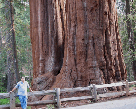
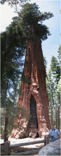
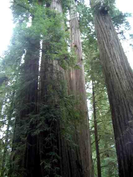
Giant sequoia trees (above & below) (Sequoia National Park, Sierra
Nevada Mountains, eastern California, USA) - California's famous giant redwoods
and giant sequoias are the largest trees in the world. Sequoia National
Park has several groves of giant sequoia trees (Sequoiadendron giganteum).
The largest tree in the world is the General Sherman tree (see photo below), as
defined by volume. It is ~52,500 cubic feet in volume (a little less than
1500 cubic meters).
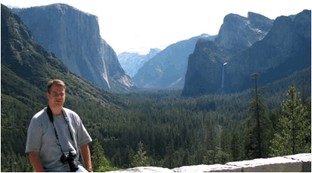
Yosemite Valley (view from the Wawona Tunnel overlook, Yosemite
National Park, Sierra Nevada Mountains, eastern California, USA) - Bridalveil
Falls is at right-center, El Capitan is the ~vertical cliff on the left, and
Half-Dome is in the far-distance at center. The broad U-shaped valley
shape is the result of glacial erosion during the Pleistocene (= the last Ice
Age). The actual bedrock valley floor is well below the present
surface. The valley has partially filled with glacial and fluvial
sediments.
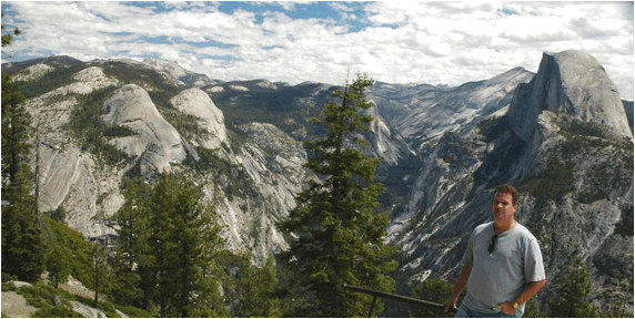
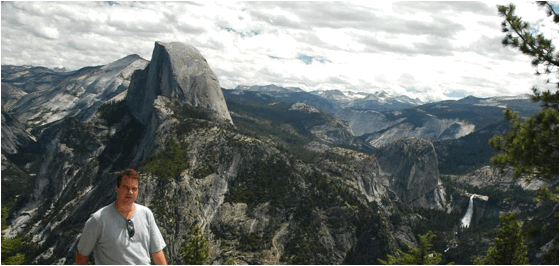
Yosemite Valley (above & below) (view from Glacier Point,
Yosemite National Park, Sierra Nevada Mountains, eastern California, USA) -
Half Dome is the distinctively-shaped mountain above my head. The rocks
in the Yosemite Valley area are principally Cretaceous-aged, felsic to
intermediate, intrusive igneous rocks. Many discrete intrusions are
present, ranging in composition from granite to granodiorite to diorite to
quartz monzonite. Most of these intrusive rocks have a strongly
porphyritic texture (= a mix of large and small crystals). The rocks in
this area are part of the Sierra Nevada Batholith, a series of old,
cooled magma chambers that were originally beneath a chain of volcanoes
developed along an ancient subduction zone.
Miner's Castle (Pictured Rocks National Lakeshore, northeast of
Munising, southern shore of Lake Superior, northern shore of Michigan's Upper
Peninsula, USA) - the rocky cliffs along Lake Superior northeast of the town of
Munising, Michigan are famous for their spectacular multicolored stains.
The projection of rock to the left in this photo is Miner's Castle, a
differentially eroded succession of quartzose sandstones. Just above lake
level is the uppermost Jacobsville Sandstone, a cross-bedded quartzose
and arkosic fluvial sandstone of Proterozoic age (~1.04-1.08 Ga).
Disconformably overlying the Jacobsville is the Munising Formation,
which makes up most of the cliff at Miner's Castle. A quartz-pebble
conglomerate occurs in the basal Munising Fm., but much of the formation
consists of planar-bedded, cross-bedded, and herringbone cross-bedded quartzose
sandstones. Body fossils are scarce in the Munising Fm., but do include
polymeroid trilobites. The trilobites indicate a late Middle Cambrian to
Late Cambrian age. Sediments of the Munising Formation were deposited in
a shallow-water, nearshore marine environment that experienced tidal
pumping. The Jacobsville-Munising contact is located approximately at the
color change near the base of the cliff (orange to very light brown).
This contact is the local Precambrian-Cambrian unconformity, and represents
about a half-billion years worth of missing time.
Eagle Harbor (northern Keweenaw Peninsula, southern shore of Lake Superior,
northern shore of Michigan's Upper Peninsula, USA) - lakeward-dipping basalts
of the Lake Shore Traps Member of the Copper Harbor Conglomerate are exposed
along the rocky shore at Eagle Harbor, Michigan. These 1.087 billion-year
old lava flows are flood basalts that filled an ancient rift valley. A
much thicker succession of rift valley-filling flood basalts is in the
underlying stratigraphic unit, the Portage Lake Volcanic Series.
Valley of Fire (near Elephant Rock, near the eastern boundary of
Valley of Fire State Park, southern Nevada, USA) - these beautiful rocks are
part of the Lower Jurassic Aztec Sandstone (equivalent to the Navajo
Sandstone of Zion National Park, Utah, USA), a quartzose sandstone succession
deposited in an ancient sand dune facies. Sandstones deposited in ancient
sand dunes are called eolianites. The red coloration is due to a
significant hematite
cement component. Detrital zircon age analysis of the Aztec Sandstone and
its equivalents elsewhere in southwestern America has shown that the principal
sediment source for these ancient sand dunes was the Appalachian Mountains
(!). The sands were delivered from the east by westward-flowing
paleorivers and paleowind currents (see Brenneman et al., 2006, Geological
Society of America Abstracts with Programs 38(5): 10).
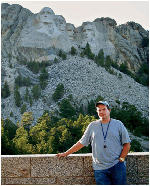
Mount Rushmore (central Black Hills, southwest of Keystone, western
South Dakota, USA) - I have mixed feelings about this locality. It's an
historic site and memorializes four of the greatest people in the history of
the planet (George Washington, Thomas Jefferson, Theodore Roosevelt, Abraham Lincoln),
but it's also just large-scale defacement of nature. I'd rather have the
natural mountainside. Destroying mountainsides in the Black Hills seems
to be fad that is spreading. American Indians are defacing another Black
Hills mountain nearby - the Crazy Horse
Memorial. I wish people would leave nature alone.
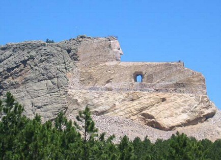
Anyway - the rocks at and around the carved faces are
part of the Harney Peak Granite (1.695 to 1.715 billion years).
The dark-colored, subhorizontal streak of rocks below Washington's chest is the
host rock for the Harney Peak Granite. The granite intruded through
metamorphic rocks, principally quartz-mica schists. Metamorphism of the
schist host rocks occurred not long before intrusion of the granite. The
schists date to 1.715 to 1.750 billion years. Both rock types (granite
and schist) can be closely examined along the walkway between the public
parking area and Mount Rushmore itself.
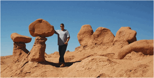
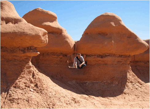
Goblin Valley (above & below) (Goblin Valley State Park, southeast-central Utah,
USA) - differential erosion of interbedded hard quartzose sandstones and
relatively soft siltstones and mudrocks has produced an abundance of
oddly-shaped features at Goblin Valley, Utah (also known as Mushroom
Valley). The reddish-brown color of the rocks is from the presence of
hematite (Fe2O3). This is the Entrada Sandstone,
an Upper Jurassic unit consisting of very shallow marine and nonmarine coastal
sand dune deposits. The same rocks make up the main scenery at Arches
National Park, Utah.
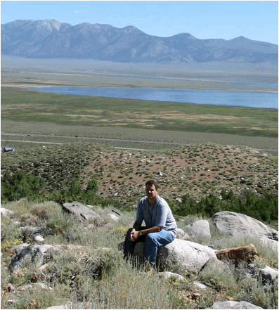
McGee Creek glacial moraine (along McGee Creek Road, eastern slopes of McGee
Mountain, eastern margin of the Sierra Nevada Mountains, eastern California,
USA) - the boulder field around me is a moraine deposit consisting of glacial
till (an unsorted, coarse-grained, non-stratified glacial deposit).
Behind the photographer is McGee Creek Canyon. During the Pleistocene (=
the last Ice Age), an alpine glacier eroded and carved that canyon. The
till here is rock debris left behind after the glacier melted away.
Published research indicates that this till is 10,000 to 20,000 years old
(Tioga Glaciation).
The lake in the distant valley is Lake Crowley, an
artificial reservoir formed by construction of the Long Valley Dam. The
mountain range in the background is the White Mountains, here consisting of
Mesozoic-aged intrusive igneous rocks and metamorphic rocks.
Info. synthesized from Milliken (1992) - Guidebook,
Mono/Owens Valleys Geology Field Trip, October 10-11, 1992.
Bakersfield, California, USA. U.S. Bureau of Land Management, Bakersfield
District Office. 35 pp.
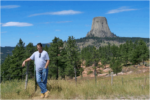
Devils Tower (northeastern Wyoming, USA) (above & below) - the principal
scenery at America's first national monument is a distinctive igneous feature
called Devils Tower. It has been variously interpreted as a volcanic neck
(probable), an eroded laccolith (unlikely), or an eroded stock
(possible). The vertical to subvertical striations along the sides of
Devils Tower (see below) represent columnar jointing, formed as the
original molten rock cooled and shrank slightly. Devils Tower is one of
three classic localities on Earth that have excellent columnar jointing (along
with Devil's Postpile in California and Giant's Causeway in Ireland). The
rocks of Devils Tower formed 49 million years ago, during the latest Early
Eocene.
Above:
view from Rt. 24, western side of Campstool Draw (Canyon), south-southeast of
Devils Tower.
Below:
view from Tower Trail, Devils Tower National Monument.
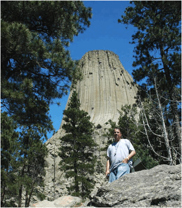
Devils Tower (Tower Trail, Devils Tower National Monument, northeastern Wyoming,
USA) - the 49 million year old rock making up Devils Tower is porphyritic phonolite,
a scarce, alkaline, intermediate igneous rock having large, whitish plagioclase
feldspar crystals in a finely-crystalline groundmass.
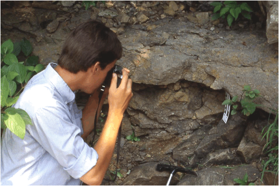
Lehigh-Hanson Harding Street Quarry (southern Indianapolis, Indiana, USA) - looking for pyrite nodules in a waste rock
pile of black shale (Blocher Member, lower New Albany Shale, upper Middle Devonian-lower
Upper Devonian). Black shale is one of two overburden units at this
quarry, which targets the Middle Devonian North Vernon Limestone for use as
aggregate, gravel, etc. The black shale unit is somewhat pyritic in
certain horizons. The pyrite occurs in disseminated form, as well as in
discrete small-to-large nodules, pyrite-rich laminations, and pyrite-rich thin
beds.
Calistoga Petrified Forest (above & below) (northern side of Petrified
Forest Road, WSW of Calistoga, eastern Sonoma County, Coast Ranges of
northwest-central California, USA) - permineralized coast redwood tree trunks, Sequoia
sempervirens. The Calistoga Petrified Forest has been called the
best-anywhere petrified forest of Pliocene age. The fossil wood here is
preserved with the most common permineralization mineral - quartz. The
preservation of these trees was the result of burial by a rhyolitic volcanic
ash-flow tuff (Sonoma Volcanics, 3.2-3.4 m.y., Upper Pliocene). The
volcanic tuff was erupted from a vent near modern-day Mt. St. Helena (north of
this locality).
Point Reyes Lighthouse (westernmost Point Reyes Peninsula, western coastal
California, USA) - these polymict conglomerates are part of the Point Reyes
Conglomerate (Paleocene-Eocene), a continental slope deposit. The
sands and large clasts were deposited in a underwater debris fan at the base of
an ancient submarine canyon incised into the seaward margin of the continental
shelf.
Resting Spring Range (Rt. 178 roadcut along western slopes of the southern
Resting Spring Range, east of Shoshone, Inyo County, southeastern California,
USA) - beautifully-exposed fault cutting through the Resting Spring Pass Tuff
(lower Upper Miocene, 9.6 Ma).
Resting Spring Range (Rt. 178 roadcut along western slopes of the southern
Resting Spring Range, east of Shoshone, Inyo County, southeastern California,
USA) - an often-visited outcrop of obsidian and volcanic tuffs, part of the
Resting Spring Pass Tuff (lower Upper Miocene, 9.6 Ma). The black
obsidian unit is actually the result of remelting of an extremely hot
volcanic tuff unit.
San Rafael Monocline (along Interstate 70, west of the town of Green
River, west-central Grand County, east-central Utah, USA) - monoclines are
kinks, or bends, in rock layers. Utah's San Rafael Monocline (a.k.a.
“San Rafael Reef”, meaning a barrier to travel) is a well-exposed,
world-class example of this type of structure. The rocks are
Jurassic-aged sedimentary units. The light pinkish-brown rocks making up
most of the “reef” is the Navajo Sandstone, a widespread Upper Triassic to
Lower Jurassic sand dune deposit in southwestern America. It's the same
Navajo Sandstone that makes the principal scenery in Utah’s Zion National Park.
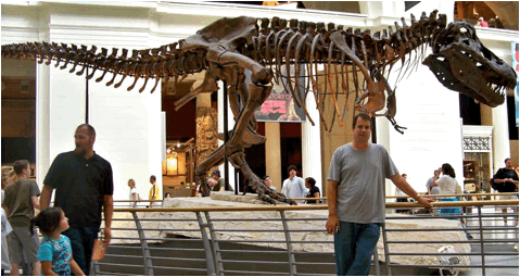
Tyrannosaurus rex (FMNH PR 2081, Field Museum of Natural History,
Chicago, Illinois, USA) - this large, complete Tyrannosaurus rex
skeleton (Hell Creek Formation, upper Upper Cretaceous; northwestern South
Dakota, USA) is the “Sue” specimen, an old adult of 28 years. Several
deformities are present on the skeleton, representing bone lesions or healed
breaks.
Firehole Falls (Firehole Canyon, Yellowstone Hotspot, northwestern
Wyoming, USA) (looking ~SSW) - Yellowstone is a gigantic hotspot volcano.
So, naturally, most of the rocks at Yellowstone National Park are young
volcanics. Here in Firehole Canyon, the Firehole River flows between the
margins of two rhyolite lava flows. The rocks to the left of the river
and the waterfall (to the east of the river) are rhyolites, rhyolite breccias,
and some mahogany obsidian of the Nez Perce Creek Flow (Central Plateau
Member, Plateau Rhyolite, Pleistocene, 160 k.y.). The rocks on the other
side of the river (to the west) are rhyolites of the West Yellowstone Flow
(Central Plateau Member, Plateau Rhyolite, Pleistocene, 111 k.y.).
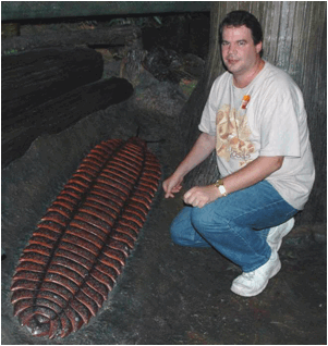
Arthropleura model, approximately life-sized (public display, Field Museum of
Natural History, Chicago, Illinois, USA). Arthropleura is the
largest known terrestrial arthropod in Earth history (the modern coconut
crab is also a giant). The arthropleurids were giant, centipede-like
organisms having a nonmineralized exoskeleton. Fossil remains allow an
estimation of a six-foot long body length. Arthropleura fossils
are only found in nonmarine, coal-bearing successions of Pennsylvanian age,
indicating a coal swamp forest habitat.
The Pennsylvanian was a time of gigantism in other
terrestrial invertebrates as well, including dragonflies and cockroaches.
Arthropod gigantism during the Pennsylvanian is usually explained as an
evolutionary result of long-term atmospheric hyperoxia (high levels of oxygen
gas compared with today).
Classification: Animalia, Arthropoda, Myriapoda, Arthropleurida
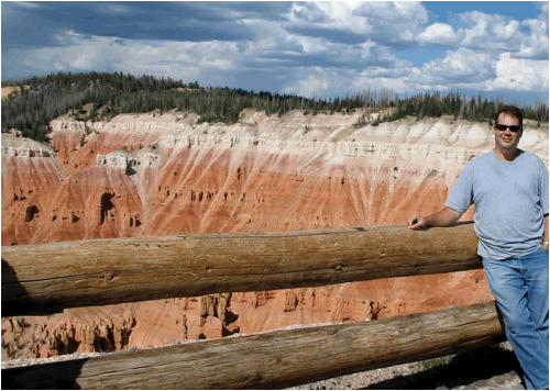
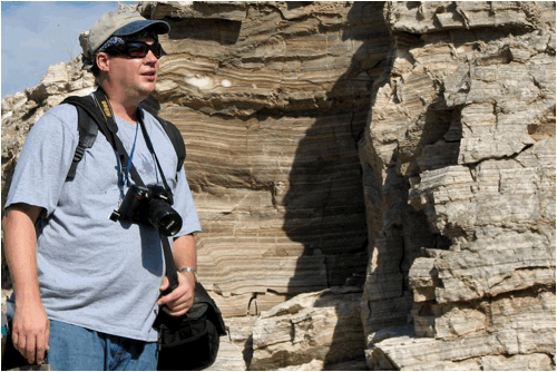
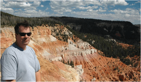
Cedar Breaks (above & below; above: Point Supreme overlook, Cedar Breaks
National Monument, southwestern Utah, USA; below: North View overlook,
Cedar Breaks National Monument, southwestern Utah, USA) - the spectacular
scenery at this park is the result of weathering and erosion of the Claron
Formation (Paleocene-Eocene), a succession of lacustrine siliciclastics and
carbonates. These colorful sedimentary rocks were originally deposited in
Lake Claron, an ancient intermontane basin. This landscape of
steep, soil-free and largely vegetation-free slopes at Cedar Breaks (& at
nearby Bryce Canyon) is called badlands topography. Note the two
faults at the far-left and left-center in the above photo (the best way to find
the faults is to look at how the whitish, cliffy-weathering unit is offset).
Eclogite
(outcrop above the eastern side of Rt. 1, just north of Jenner, coastal
California, USA) - eclogite
is a rare, very high-grade metamorphic rock, formed when basaltic-gabbroic
rocks are subducted down to mantle depths. Primary eclogite consists
principally of greenish omphacite pyroxene and reddish pyrope garnet.
With uplift to the surface, many eclogites are retrograde metamorphosed,
resulting in the appearance of other minerals. In the Jenner area, the
rocks include retrograde eclogite, some of which have distinctively bluish-gray
patches of glaucophane while still having greenish pyroxene and reddish garnet.
Badwater Spring (Death Valley, California, USA) - water does emerge
at the surface in the Death Valley area. A famous example is the
interestingly-named "Badwater Spring", in reference to its very salty
taste. Water constantly reaches the surface along a major normal fault
plane (= at the base of the Amargosa Range mountains in the background) - the
Black Mountains Frontal Fault Zone. Due to the hot, arid climate of Death
Valley, water quickly evaporates, leaving behind salt crusts rich in halite (NaCl). Life
exists in the pool, including the Badwater snail (Assiminea infima), insect
larvae, and halophilic algae.

San Salvador Island (eastern Bahamas) - the Bahamas are a world-class
place for studying subtropical marine communities and carbonate platform
geology & paleontology. Significant insights can result after
comparing modern reefs in the water and fossil reefs on the adjacent
island. Many of the species alive now are the same species seen in the
Late Pleistocene fossil record here.
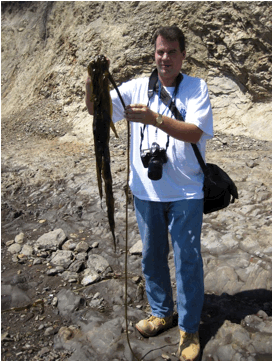
Kelp
(Plantae, Phaeophyta, Laminariales) at Agate Beach, southern Pt. Reyes
Peninsula, western coastal California, USA.
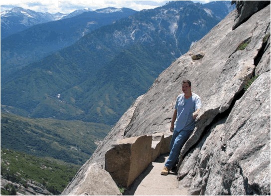
Moro Rock exfoliation dome (western Sequoia National Park, Sierra Nevada
Mountains, eastern California, USA) - the rocks are part of the Giant Forest
Granodiorite (Sequoia Intrusive Suite, 97-102 million years,
mid-Cretaceous).