LAVA BEDS
Lava Beds National Park is located in eastern Siskiyou
County, far-northern California, USA. It is a world-class place for
observing Pleistocene-Holocene mafic volcanic features. The main volcanic
features and lava flows at Lava Beds range in age from ~2 million years to
~1100 years (Late Pliocene to late Holocene).
The Lava Beds area is dominated by somewhat weathered
mafic aa and pahoehoe lava flows. Eruptive centers are usually obvious
and form prominent hills or mounds.
There's also an abundance of lava tube caves in the
area that can be entered and explored, although only one has had lights
installed by the park service.
GILLEMS BLUFF FLOW
A prominent bluff is present near the northern
entrance to Lava Beds National Park. This is a fault-uplifted block of lava
belonging to the Gillems Bluff Flow. At ~2 million years (Upper Pliocene),
the Gillems Bluff Flow is the oldest lava at the surface in the Lava Beds area.
Looking ~NNW.
Looking ~SSW. The Gillems Bluff Flow is the
cliff at the right.
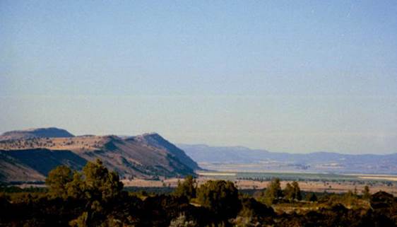
Looking ~N.
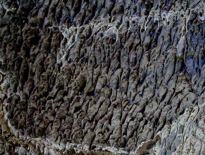
MUSHPOT CAVE
Mushpot Cave is an easily accessible lava tube cave
near the visitor's center at Lava Beds, California that has a paved trail &
electric lights. Lava tube caves represent former shallow-underground conduits
for hot, flowing lava. Lava tubes can be seen forming today at the Hawaii
Hotspot, in association with Mt. Kilauea's ongoing lava eruptions.
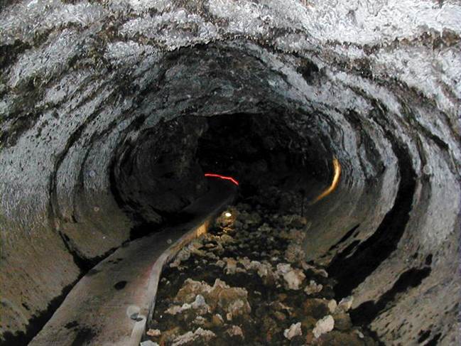
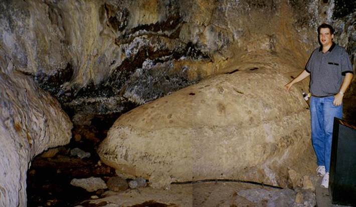
In general, the accessible portions of Mushpot Cave
have a slightly flattened circular cross-section. At one time, this cave
had >2000° F basaltic lava flowing through.
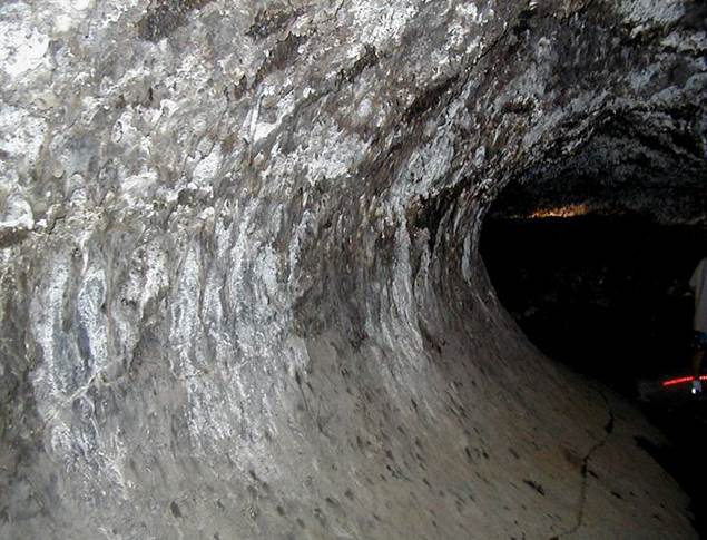
The level at which lava flowed did vary. The
former lava levels are generally represented by lines along the cave wells,
analogous to bathtub rings.
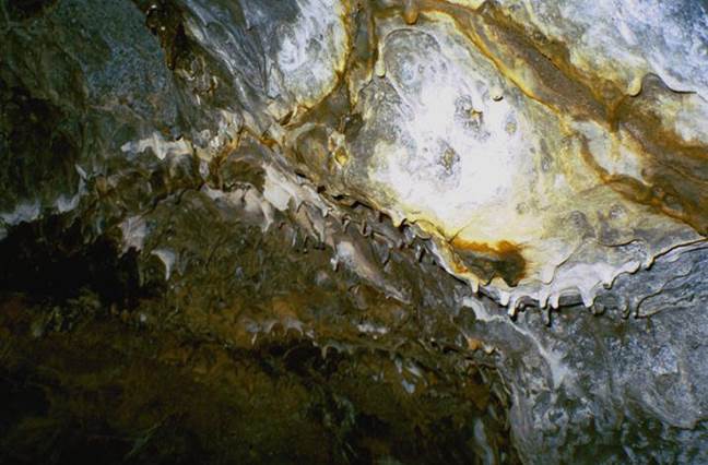
The ceiling of Mushpot Cave, and most other lava tube
caves, has distinctive “stalactite” structures. These are lavacicles.
They formed when the tube was only partially filled with flowing lava.
The ceiling rocks began to melt and dripped downward from the heat of lava
flowing underneath.
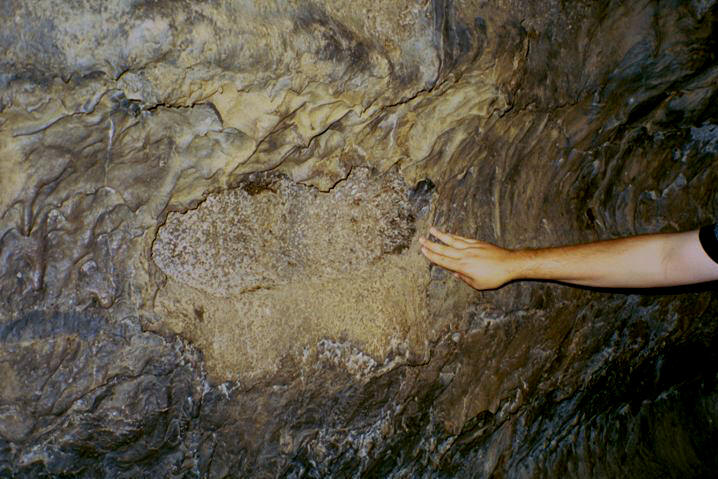
The heat of flowing lava also affected the walls of
lava tubes. Below is a photo showing a pullout structure, or
lining rupture. The heat of flowing lava weakened the lining of the tube
walls, resulting in a section of lining peeling away, or pulling out, from the
wall.
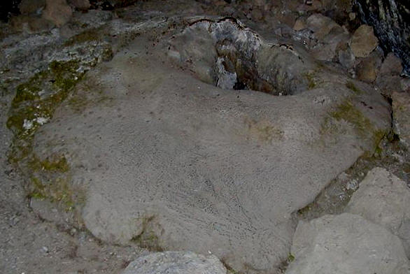
Mushpot Cave is so named after the structure depicted
in the photo above. This is a mushpot structure. It is
claimed to be the only example of this volcanic feature anywhere in the
world. It is located immediately adjacent to stairsteps at Mushpot Cave's
entrance.
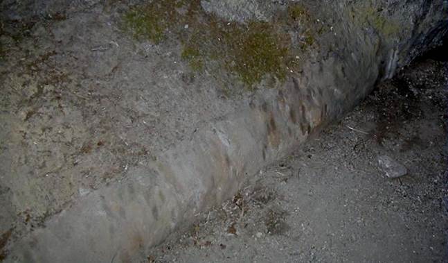
Lava tubes can be seen to have tributary and
distributary channels, just like rivers & streams with flowing water.
The pic above shows a distributary lava tube within the Mushpot Cave
lava tube.
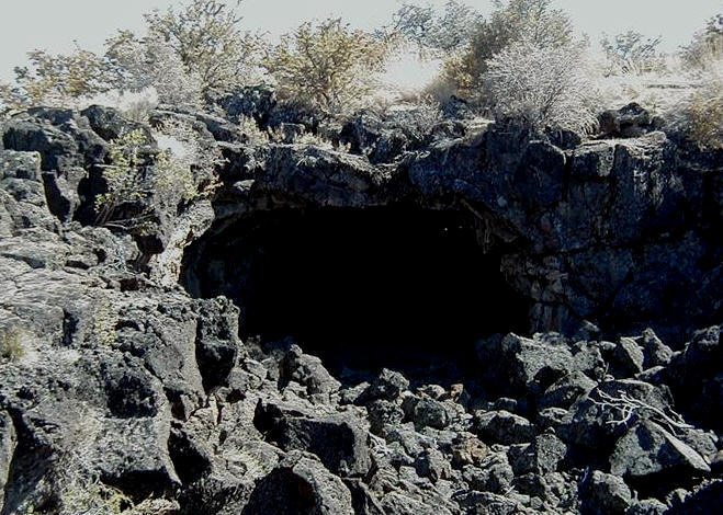
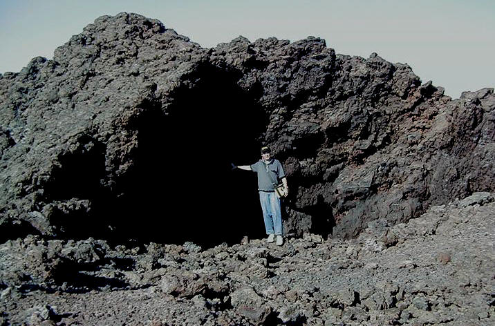
CHOCOLATE CAVE
Chocolate Cave is another of a series of lava tube
caves at Lava Beds, California. The entrance area consists of a natural arch
formed between two sections of collapsed lava tube.
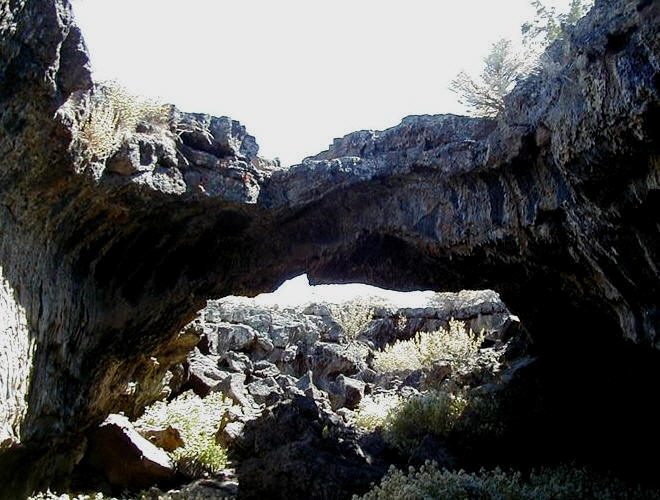
Chocolate Cave is named in reference to the rich brown
coloration of the smooth-surfaced lavacicles abundant on the walls &
ceiling.
MEDICINE LAKE VOLCANO
Medicine Lake Volcano (see pic) is a shield volcano in
far-northern California, USA. It is associated with the Cascade Range of
stratovolcanoes. The Cascade Range formed by subduction of the Juan de
Fuca Plate underneath the North American Plate in northern California, Oregon,
Washington State, and southwestern British Columbia. Quite a variety of
material has been erupted from the Medicine Lake Volcano, including basalts,
andesites, rhyolites, dacites, obsidian, and pumice.
The rocks shown below are airfall pumice pieces from a
~1065 A.D. eruption at the Glass Mountain eruptive center, on the eastern side
of Medicine Lake Volcano.
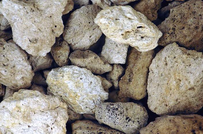
Above:
airfall pumice pieces from ~1065 A.D. eruption of Medicine Lake Volcano.
Pale-colored pumice at upper right is 2.7 cm long.
Mammoth Crater
Mammoth Crater is located at the southern boundary of
Lava Beds Park. It erupted at about 35 ky, in the Late Pleistocene. Lava
flows from the Mammoth Crater Cinder Cone cover most of the Lava Beds
area. Most of the lava tube caves in the area are developed in the
Mammoth Crater Flow.
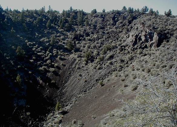
Above:
Mammoth Crater Cinder Cone's vent area. Looking ~N.
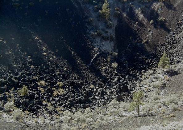
Above:
Looking down into Mammoth Crater's vent. The loose igneous debris is
vesicular & scoriaceous basalt.
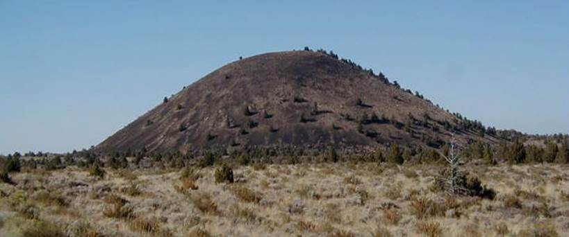
Schonchin Butte
Cinder Cone
The most conspicuous eruptive center at Lava Beds is a
tall cinder cone called Schonchin Butte. It is a classic cinder cone - a
relatively small (for a volcano), steep-sided cone of mafic igneous
debris. During the Late Pleistocene (65 ky), the Schonchin Butte Cinder
Cone erupted lava toward the north-northeast. This particular lava flow
is called the Schonchin Flow.
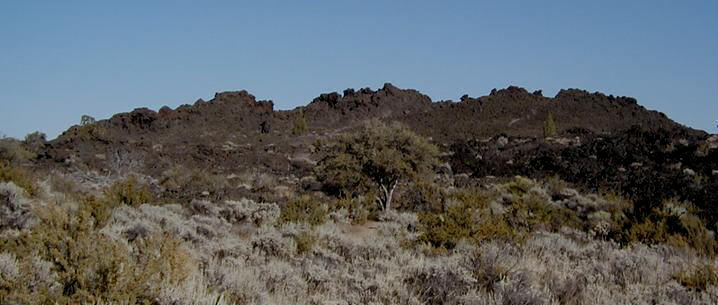
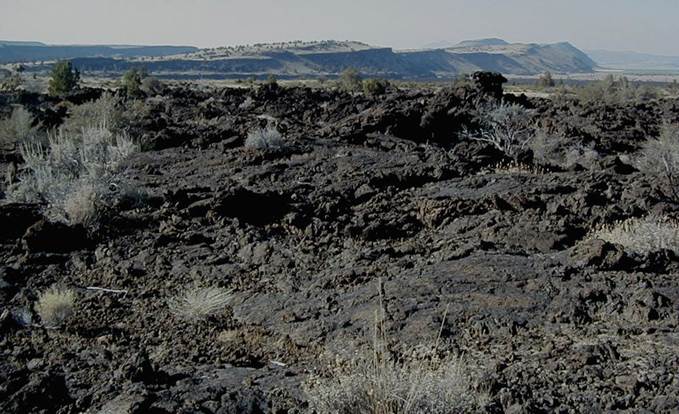
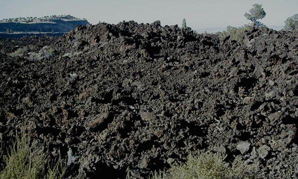
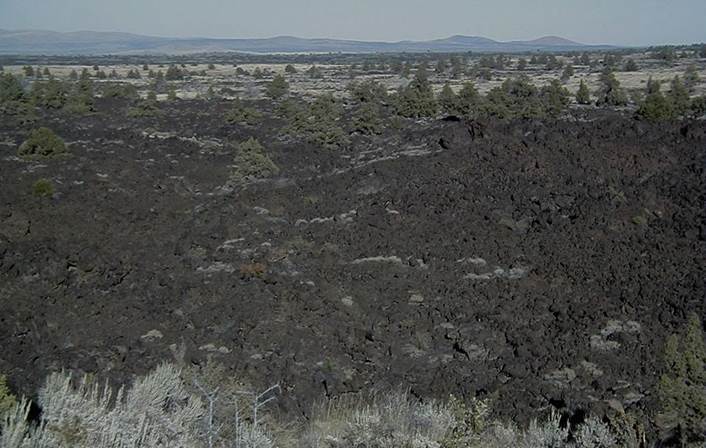
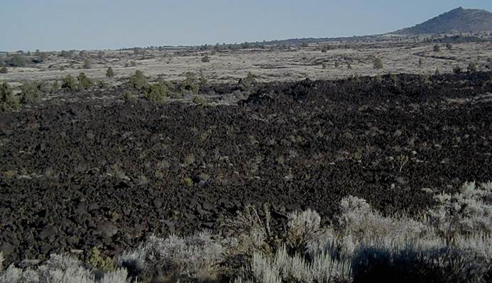
Black Crater Spatter Cone
The Black Crater Spatter Cone is a small eruptive
center at Lava Beds. It erupted relatively recently, at about 1300 B.C. (3300
years ago; 3.3 ky). The Black Crater Flow extends principally to the
north-northeast of the spatter cone.
Above:
Black Crater Spatter Cone (3.3 ky). Looking ~E.
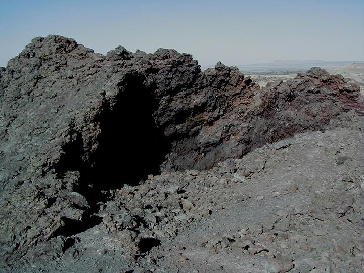
Above:
Vent area of Black Crater Spatter Cone.
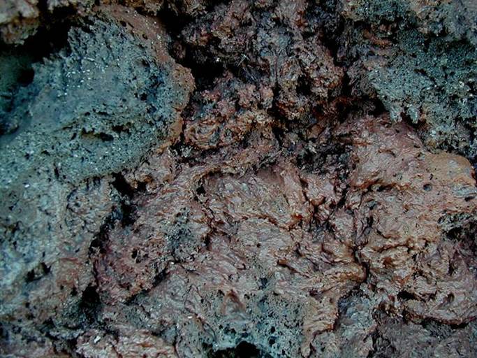
Above:
Vesicular & scoriaceous basalt spatter (3.3 ky) along the walls of Black
Crater Spatter Cone's vent.
Above:
Black Crater Spatter Cone's vent. Looking ~ENE.
Above:
Northern end of Black Crater Spatter Cone's vent. Looking ~NNE.
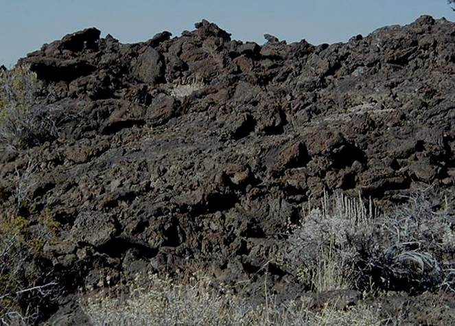
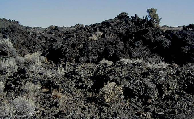
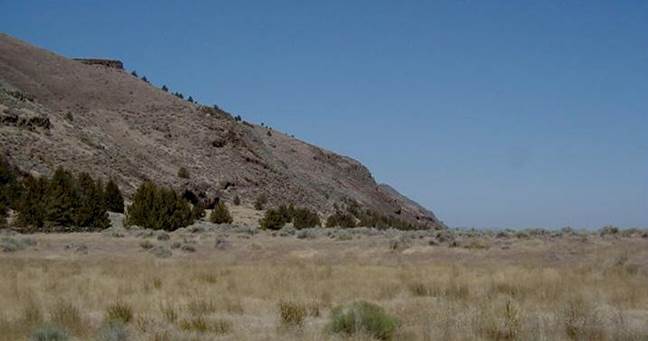
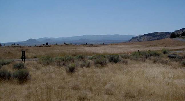
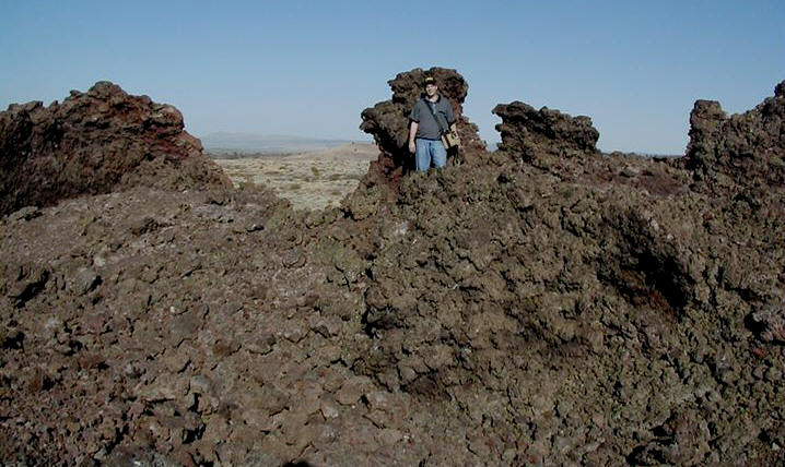
The four pics above & below show basaltic aa lava
in the 3.3 ky Black Crater Flow. The cliff-like ridge in the distant
background in the two photos below is Gillems Bluff, which exposes the ~2 my
Gillems Bluff Lava Flow.
Devil's Homestead
Flow
The Devil's Homstead Lava Flow is located along the
western boundary of Lava Beds Park. It erupted at 12.8 ky (near-latest
Pleistocene) from the Fleener Chimneys eruptive center. It consists of
vesicular & scoriaceous basaltic aa lavas.
Looking ~NE.
Looking ~SE. The hill in the distance at right
is Schonchin Butte.