SHIP ROCK
The Navajo Volcanic Field in
the Four Corners area of the American southwest has about 80 old, eroded
volcanic centers (volcanic necks/diatremes) of Oligocene to Miocene age.
The most famous and visually distinctive volcanic neck in this area is Ship
Rock.
Ship Rock is a
brownish-colored, craggy, vertical-sided mountain in far northwestern New
Mexico, USA. It represents rocks that filled up the subsurface vent
complex of an ancient volcano. The original volcano and its surrounding
landscape were approximately 1 to 2.5 kilometers above the present surface,
according to published estimates.
Radiating from the central
volcanic neck are three, miles-long, sublinear, vertical dikes. One
extends to the northeast, one extends to the west, and one extends to the
south. Several shorter radiating dikes extending in other directions occur near
Ship Rock itself. The southern major dike is the most easily
accessible, as Red Rock Highway was constructed through it.
Ship Rock and the dikes
radiating from it are principally composed of the scarce igneous rock minette
(= potassic mica lamprophyre, the intrusive equivalent of trachybasalt lava)
and volcanic breccias. Typical Ship Rock minettes are dense,
non-vesicular, finely crystalline, and are composed of alkali feldspar (K-Na
feldspar), phlogopite mica (which glitters nicely in the light), diopside
pyroxene, some olivine, plus other minor minerals.
Published studies of the
eruptive centers in the Navajo Volcanic Field indicate that the original volcanoes
erupted violently. This typically happens if the magmas are rich in
dissolved gases (water, carbon dioxide, sulfur dioxide, etc.). Minette
magmas were not rich in dissolved gases. So why the violent
eruptions? The magmas came in contact with groundwater, and the water
boiled to steam while confined underground. The steam pressure increased
until it overcame the strength of the overlying rocks, resulting in an
explosion and the creation of a surface crater (maar).
Volcanologists call these phreatomagmatic eruptions (a.k.a.
hydrovolcanic eruptions).
Age of Ship Rock: Oligocene, 27-32 million
years.
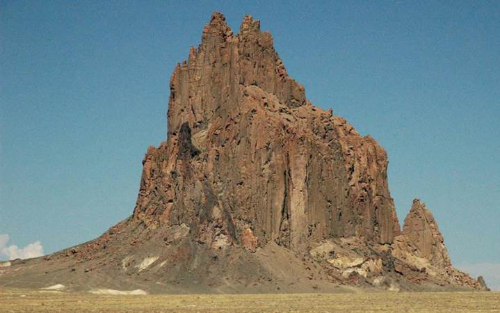
Ship Rock Volcanic Neck (diatreme), Navajo Volcanic
Field, northwestern New Mexico, USA (looking NW). The mountain consists
of minettes and volcanic breccias.

Ship Rock Volcanic Neck (diatreme) (looking NW) -
the long linear feature on the left is the southern dike, composed of finely
crystalline minette rocks. The surrounding plains are fine-grained
siliciclastic sedimentary rocks of the Mancos Shale (Upper Cretaceous).
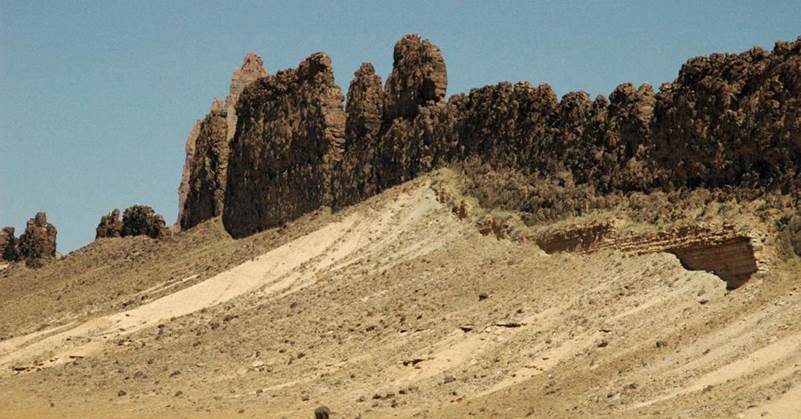
Ship Rock (looking ~NNE) - this
eroded wall is the southern dike, composed of finely crystalline, dark-colored
minette. Host rocks to the dike are fine-grained siliciclastics of the
Upper Cretaceous Mancos Shale.
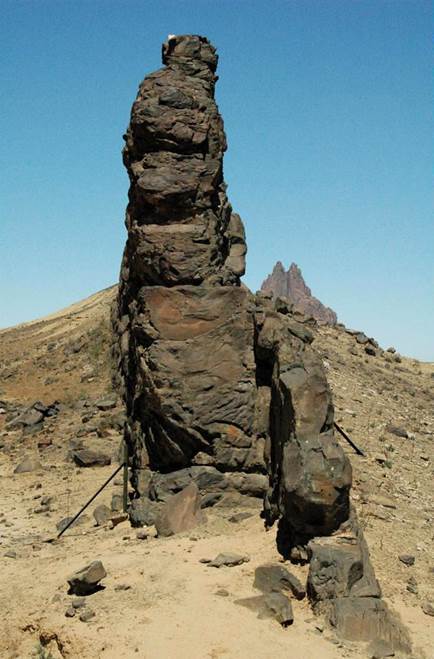
Ship Rock & eroded wall of the
southern dike (looking ~N), composed of dark-colored, finely-crystalline
minette.
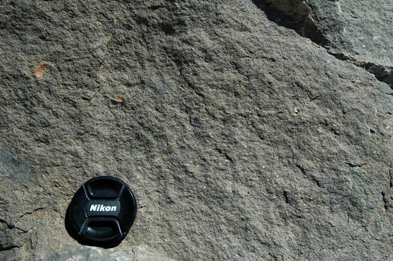
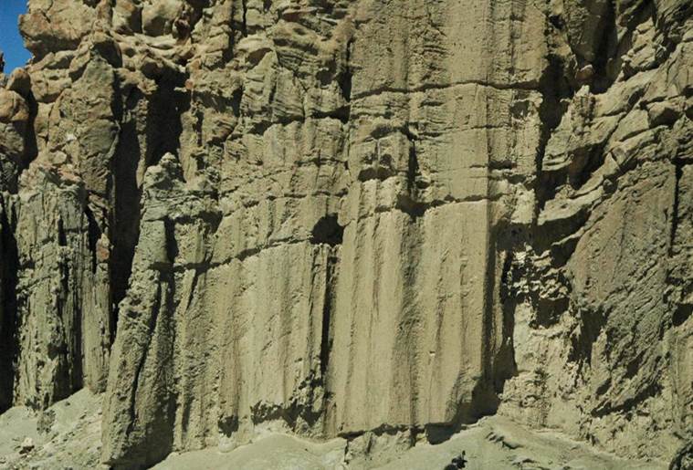
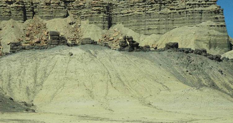
Minette - this is the rock making
up much of Ship Rock and the surrounding dikes. This exposure is from the
southern dike, along the northern side of Red Rock Highway. The dominant
minerals are alkali feldspar, phlogopite mica, and diopside pyroxene.
NAVAJO VOLCANIC
FIELD
(other volcanic
necks/diatremes)
Bennett Peak volcanic neck, western side of Rt.
491/Rt. 666, near Tocito, San Juan County, northwestern New Mexico, USA.
Ford Butte volcanic neck, eastern side of Rt.
491/Rt. 666, near Tocito, San Juan County, northwestern New Mexico, USA.
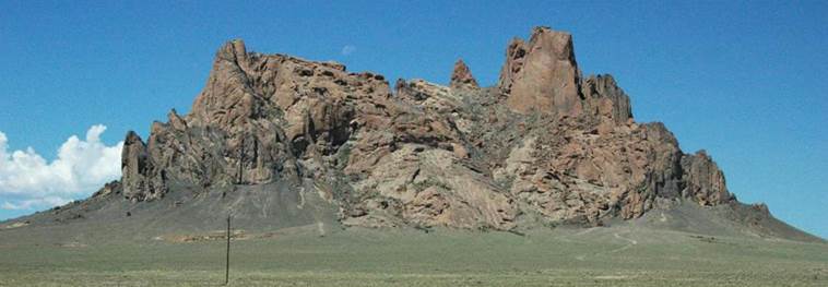
Cathedral Cliff volcanic
neck
(a.k.a. Table Mesa Plug), western side of Rt. 491/Rt. 666, adjacent to Table
Mesa, between Newcomb and Shiprock, San Juan County, northwestern New Mexico,
USA.
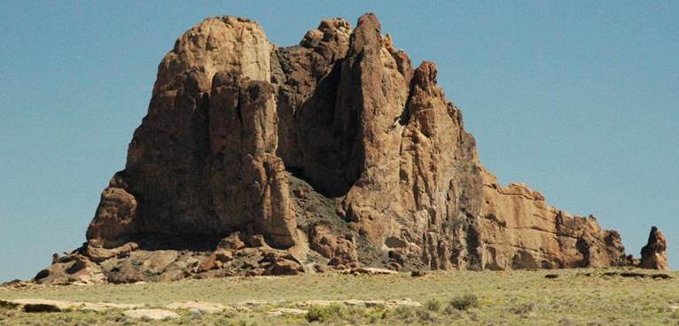
Cathedral Cliff volcanic
neck
(a.k.a. Table Mesa Plug), western side of Rt. 491/Rt. 666, adjacent to Table
Mesa, between Newcomb and Shiprock, San Juan County, northwestern New Mexico,
USA.
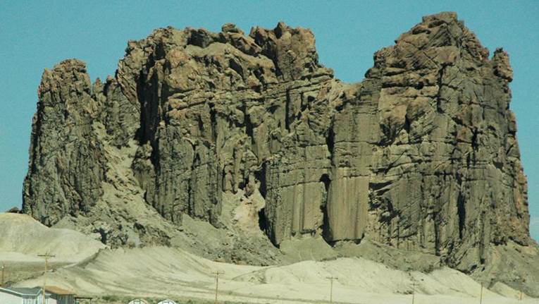
Cathedral Cliff volcanic
neck
(a.k.a. Table Mesa Plug), western side of Rt. 491/Rt. 666, adjacent to Table
Mesa, between Newcomb and Shiprock, San Juan County, northwestern New Mexico,
USA. The structure shown above is a dike,
called the Chinese Wall, that extends south from the Cathedral Cliff eroded
volcanic neck.
Barber Peak volcanic neck, eastern side of Rt.
491/Rt. 666, between Newcomb and Shiprock, San Juan County, northwestern New
Mexico, USA.

Mitten Rock volcanic neck (diatreme), northern side
of Red Rock Highway, southwest of Ship Rock, San Juan County, northwestern New
Mexico, USA.
The Thumb volcanic neck, southern side of Red Rock
Highway, near Red Rock, San Juan County, northwestern New Mexico, USA.
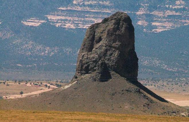
Black Rock volcanic neck, Redrock Valley, Apache
County, northeastern Arizona, USA. The
surrounding rocks are Triassic- to Jurassic-aged redbeds (= hematite-rich
siliciclastic sedimentary rocks).
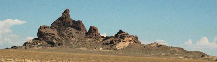
Alhambra Rock volcanic neck, northern side of Rt. 163,
west of Mexican Hat, San Juan County, southeastern Utah, USA.
Alhambra Rock volcanic neck, northern side of Rt. 163,
west of Mexican Hat, San Juan County, southeastern Utah, USA.

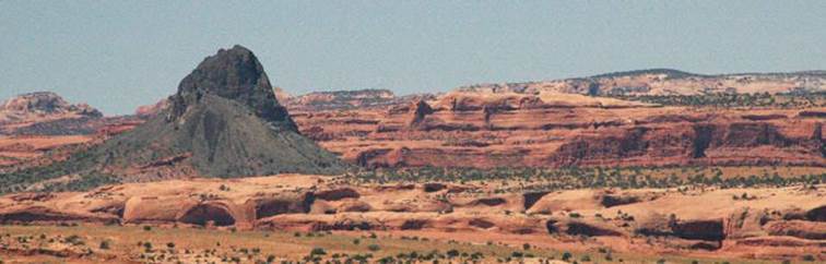
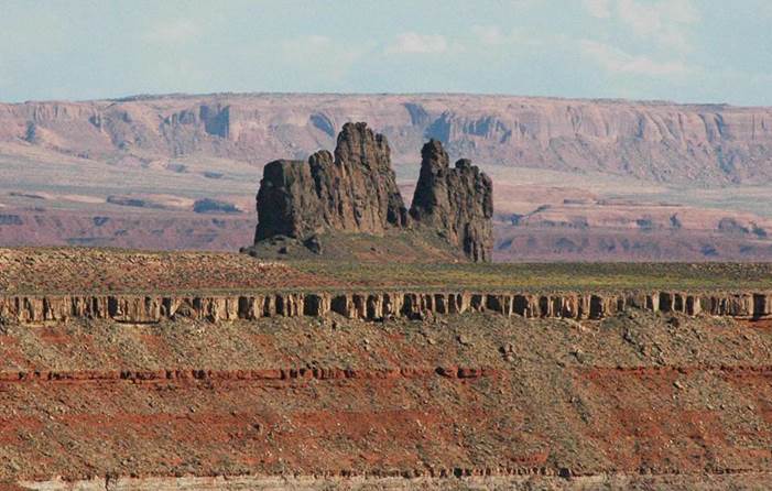
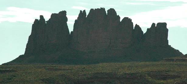
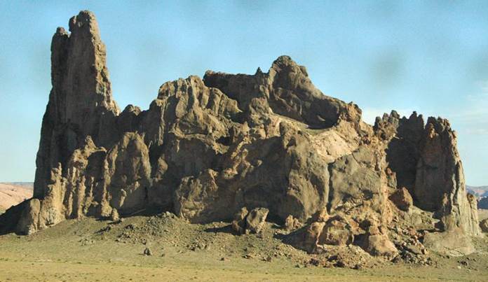
Agathla Peak volcanic neck (diatreme), eastern side of
Rt. 163, north-northeast of Kayenta, Navajo County, northeastern Arizona, USA. Agathla Peak has volcanic breccia and minette
dikes.

Chaistla Butte volcanic neck, eastern side of Rt. 163,
northeast of Kayenta, Navajo County, northeastern Arizona, USA.
Church Rock volcanic neck (diatreme), northern side
of Rt. 160, east of Kayenta, Navajo County, northeastern Arizona, USA.
Info. principally
synthesized from:
Delaney (1987) - Ship Rock,
New Mexico: the vent of a violent volcanic eruption. Rocky Mountain
Section of the Geological Society of America, Centennial Field Guide 2:
411-415.
Semken (2003) - Black rocks
protruding up: the Navajo Volcanic Field. in Geology of the
Zuni Plateau. New Mexico Geological Society Guidebook, 54th Field
Conference, September 24-27, 2003: 133-138.