THE NARROWS
WATER GAP
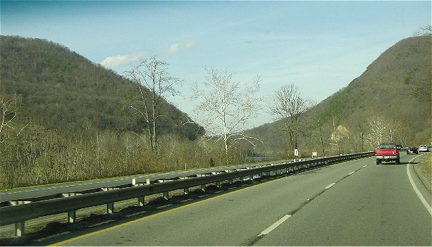
The Narrows in western
Virginia is a classic example of a water gap (see photo). A water
gap is a "deep, narrow, low-level pass penetrating to the base of and
across a mountain ridge, and through which a stream flows, especially a narrow
gorge or ravine cut through resistant rocks by an antecedent stream" (Glossary
of Geology). The Appalachian Mountains of eastern North America have
quite a few long, tall, linear ridges. Travel-wise, rivers are
traditionally the best way to get across the Appalachian's ridges. At the
Narrows, the New River has punched through one of these ridges (called Peters
Mt. on the eastern side & called East River Mt. on the western side).
This particular ridge's bedrock has an interval of very hard quartzite.
The rock is so hard that even this old, large river has rapids developed here.
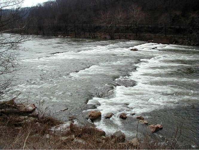
The Narrows Water Gap (see
map) - rapids in the north-flowing New River, running over hard,
resistant beds of the Silurian-aged Clinch Quartzite. Looking ~SW.
How did the Narrows Water
Gap form? The two traditional explanations are:
1) the New River is an
antecedent stream
2) the New River is a
superimposed stream
Antecedent streams refer to rivers that
existed before the mountains formed. Well, the Appalachian Mountains
formed principally in the Pennsylvanian (Late Paleozoic), during the assembly
of the supercontinent Pangaea. The New River existed before the
Pennsylvanian, and the erosive power of the river was strong enough to maintain
a channel as the mountains were uplifted.
This means that this very
water gap is >300 million years old! Is this believable?
Some orogenic deformation
has defeated some river channels in the Appalachians - there are examples of
abandoned channels in this part of the world.
If the New River is a superimposed
stream, then the following must have happened:
The rocks of the
Appalachians were deformed (folded & faulted & uplifted), and that
landscape got buried in flat-lying sediments. Regional drainage atop
these flat-lying sediments resulted in dendritic stream patterns. The
flat-lying sediments were eventually eroded away, re-exposing the underlying
deformed rocks, and the stream pattern got superimposed on that landscape.
Which is correct? Well, there isn't any
preserved evidence for any cover of flat-lying sedimentary rocks. The
antecedent stream idea seems to apply here.
The rapids in the New River
at the Narrows Water Gap run over the Silurian Clinch Quartzite, a very
hard quartzose sandstone. "Quartzite" is traditionally supposed
to refer to crystalline-textured, quartzose metamorphic rocks, the result of
metamorphism of sandstones. Many non-metamorphosed sandstones have the
outcrop characteristics of true quartzites, and so are also called
quartzites. This is a bit of a problem. The same term shouldn't
refer to some sedimentary rocks and some metamorphic rocks. Many
geologists now use the term metaquartzite to refer to metamorphosed
sandstones, to avoid confusion with the sedimentary use of
"quartzite".
The Clinch Quartzite (aka
Tuscarora Quartzite, Clinch/Tuscarora Sandstone; Clinch/Tuscarora Formation)
generally consists of hard, well-cemented, quartzose sandstones and some
quartz-pebble conglomerates. Commonly seen sedimentary features include
cross-bedding and burrows. The quartz grains in the Clinch appear to have
been recycled, probably several times during the Precambrian and Early
Paleozoic. These sediments were deposited near the end of the Taconic
Orogeny.
Stratigraphy & Age: Clinch Quartzite,
Llandoverian Series, lower Lower Silurian.
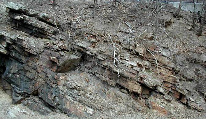
Clinch Quartzite - Rt. 460 roadcut at the
Narrows Water Gap. Looking E.