BACK
BASIN,
NORRIS
GEYSER BASIN (YELLOWSTONE
HOTSPOT) HYDROTHERMAL FEATURES
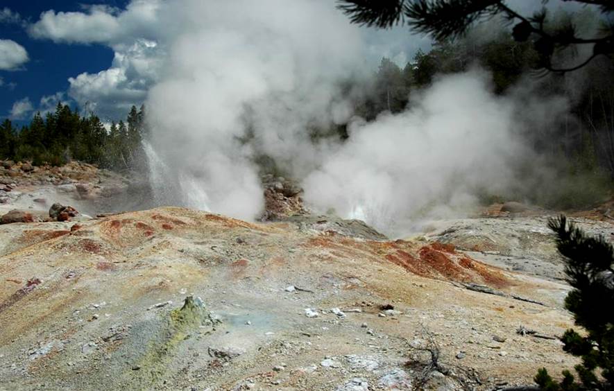
Norris Geyser Basin is the hottest of
Yellowstone’s hydrothermal areas. Much
of the water discharged from Norris hot springs and geysers is slightly to
strongly acidic. The acid involved is H2SO4
- sulfuric acid. Sulfuric acid forms as
rising volcanic H2S gas (hydrogen sulfide - that’s responsible for
the scent of rotten eggs) gets oxidized (H2S + 2O2 à H2SO4). Sulfolobus
microbes (Archaea, Mendosicutes, Crenarchaeota) are common at Norris Geyser
Basin. These microbes are
thermoacidophiles - they love hot, acidic water - and they also oxidize
hydrogen sulfide gas into sulfuric acid.
The high water temperatures at Norris
Geyser Basin is a consequence of high subsurface heat flow. This occurs because Norris Basin is above the
intersection of multiple structures: the Hebgen Lake Fault Zone, the 640 ka
Yellowstone Caldera rim fault, and the Norris-Mammoth Corridor Fault Zone. A research well that was drilled in Norris Basin
recorded a temperature of 459° F (= 237° C) at 1,087 feet depth. Temperatures are even higher at greater
depths. Deep hot water reservoirs below
Norris are estimated to be 640° F (= 340° C).
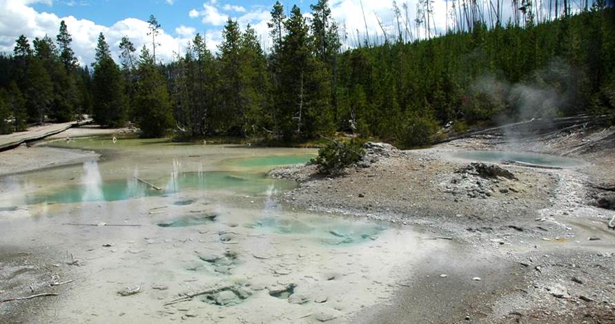
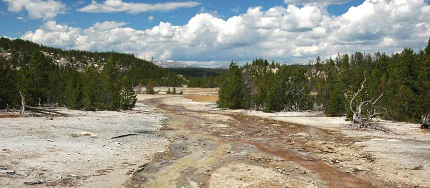
Norris Geyser Basin has three large
concentrations of hydrothermal features located in somewhat broad, mostly
siliceous sinter-floored, stream valleys.
These three hydrothermal areas are called the Back Basin, the Porcelain
Basin, and the One Hundred Springs Plain. Tantalus Creek and the South Fork of Tantalus
Creek are the main drainage channels running through Back Basin - they capture
geyser and hot spring runoff water. The
East Fork of Tantalus Creek drains Porcelain Basin. Because of Norris Geyser Basin chemistry,
Tantalus Creek water is acidic, chloride-rich, and sulfate-rich. This water ultimately drains into the Gibbon
River.
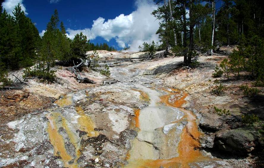
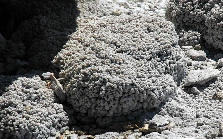
Norris Basin geyser and hot spring waters
precipitate geyserite, also called siliceous sinter. Geyserite is a chemical sedimentary rock
composed of opaline silica (SiO2·nH2O - hydrous
silica). Most of Yellowstone’s
hydrothermal areas have geyserite (a major exception is Mammoth Hot Springs,
where travertine is commonly deposited, which is composed of calcite). At Norris Geyer Basin, geyserite’s silica
ultimately comes from rhyolitic ash-flow tuffs of the Lava Creek Tuff, which is
the dominant bedrock unit in the area.
The Lava Creek Tuff is a 640,000 year old, lithified volcanic ash
deposit. It was emplaced immediately
prior to the most recent Yellowstone Caldera collapse event. Outcrops of Lava Creek Tuff in the Norris
Geyser Basin area are frequently whitish-colored and acid-leached.
In most years, usually during late summer
to early fall, Norris Geyser Basin undergoes basin-wide disturbances, during
which the geysers, hot springs, fumaroles, and pools have unusual and/or
energetic behavior. The disturbances
occur during times of lower water tables.
Less groundwater means lower pressures in the hot, deep reservoirs
beneath Norris Basin. Lower pressures
result in more conversion of water to steam (boiling). The excess rising steam plus boiling-induced
mixing of different subsurface reservoir waters results in more energetic
surface activity. Disturbance activity
is occasionally violent. Hydrothermal
explosions have occurred at Norris Basin during the park’s history - see the
stories of Steamboat Geyser and Porkchop Geyser below.
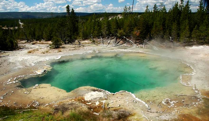
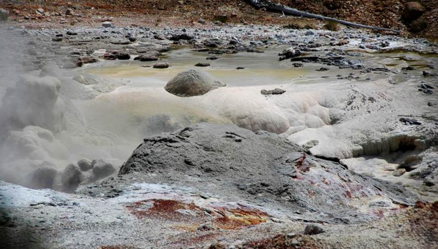
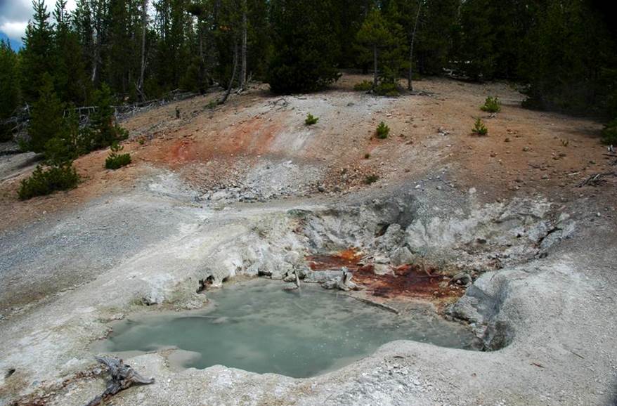
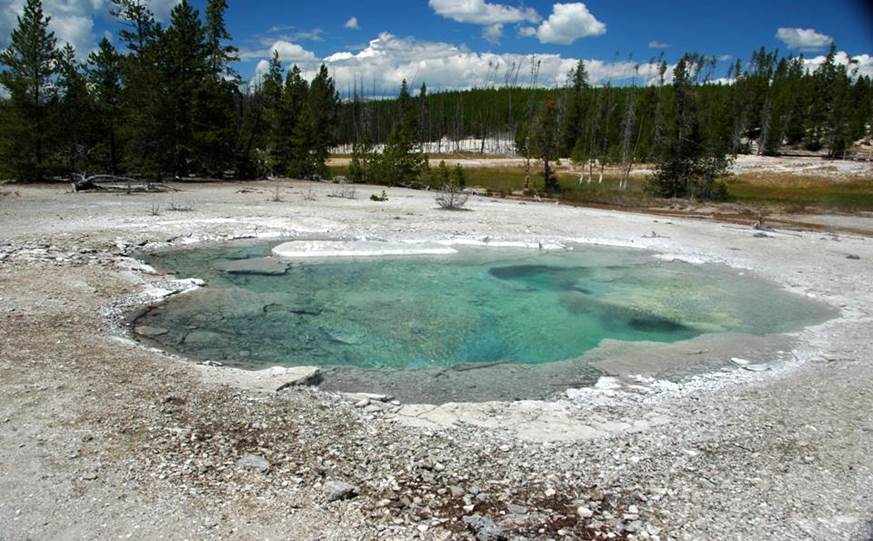
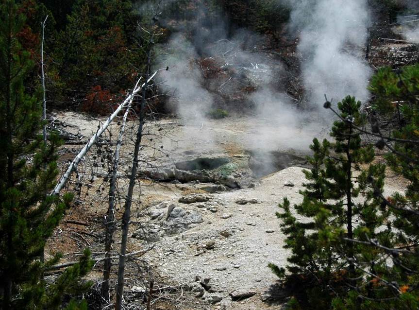
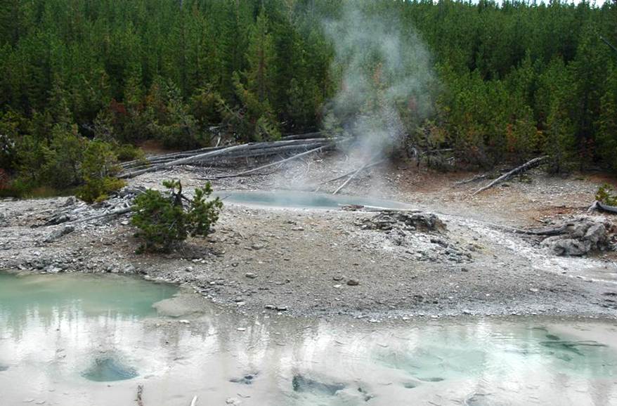
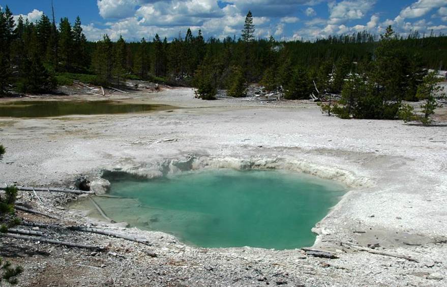
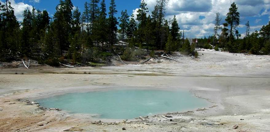
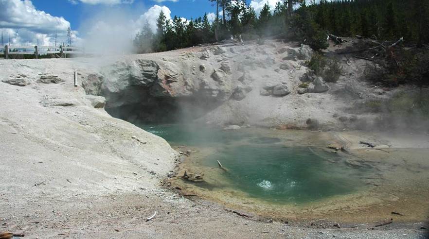
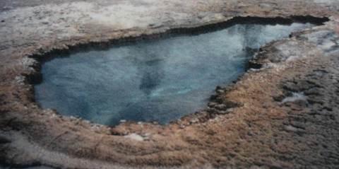
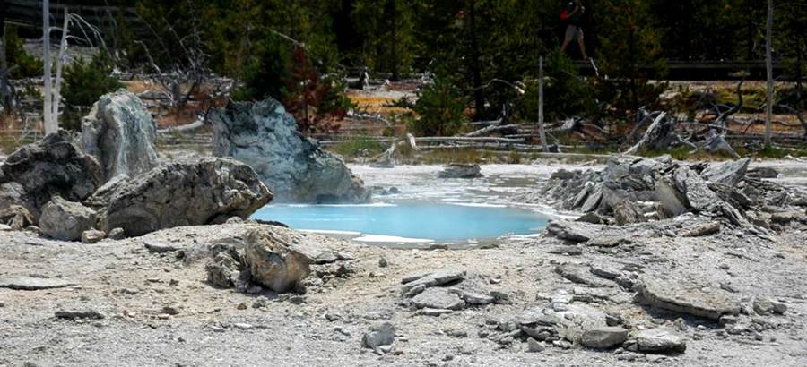
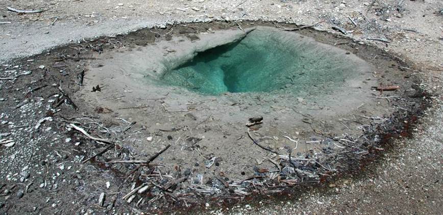
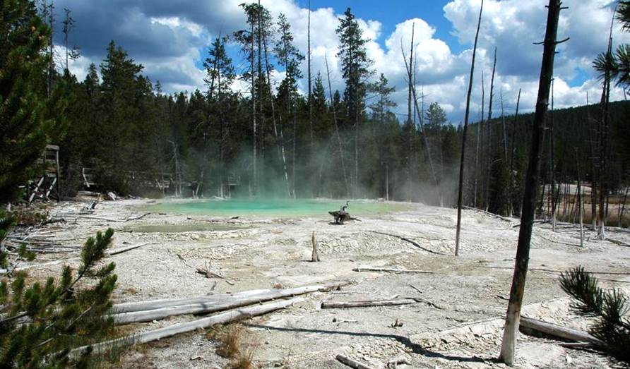
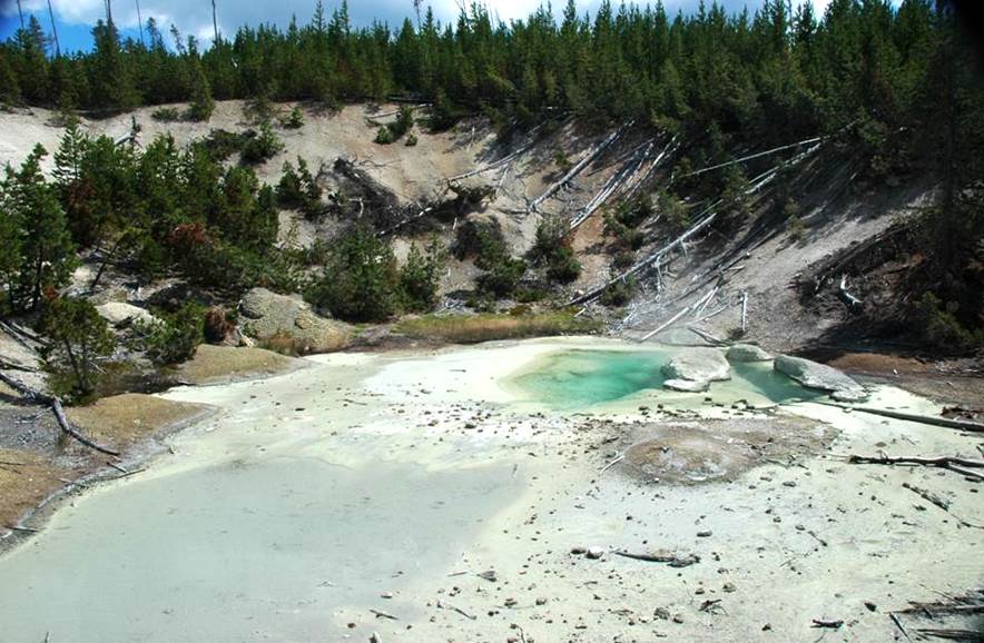
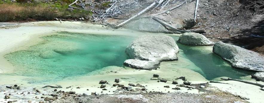
Emerald Spring, northern Back Basin, central Norris
Geyser Basin, Yellowstone Hotspot, northwestern Wyoming, USA on 9 August 2011
(looking ~WSW).
This 25 to 30 feet deep pool has
occasional geyser eruptions, but is usually a gently overflowing hot
spring. The water is acidic and near-boiling
to superheated. The intense green color
is a combination of blue, colloidal silica-rich water (seen in many, very hot
pools throughout Yellowstone) and yellow-colored elemental sulfur (S) lining
the floor and walls of the pool. A thin
border of whitish-colored siliceous sinter, composed of opal (SiO2·nH2O
- hydrous silica), encircles the pool.
A rising stream of bubbles near the center
of Emerald Spring consists of water vapor (H2O), carbon dioxide (CO2),
plus other gases. A whitish- to
grayish-colored, siliceous sinter-lined runoff channel heads southwest from
Emerald Spring (see upper left of photo), merges with Monarch Geyser’s runoff
channel, and eventually drains into Tantalus Creek.
In the early 1930s, Emerald Spring had
significant and frequent geyser eruptions up to about 80 feet high.
During the annual Norris Geyser Basin
disturbances, Emerald Spring becomes muddy (= suspended fine-grained sediments)
and has relatively small geyser eruptions about 6 feet high or less.
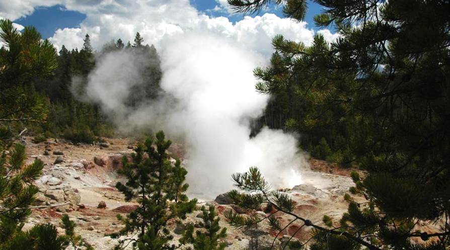
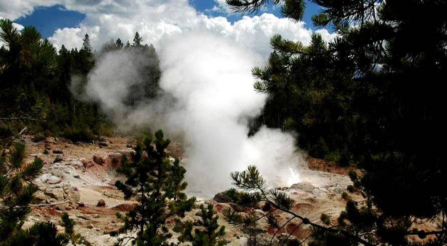
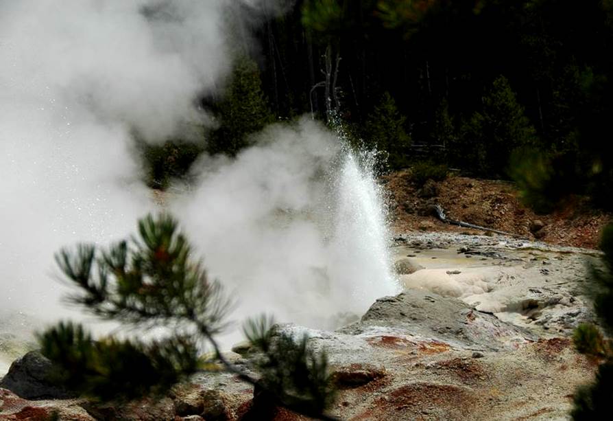
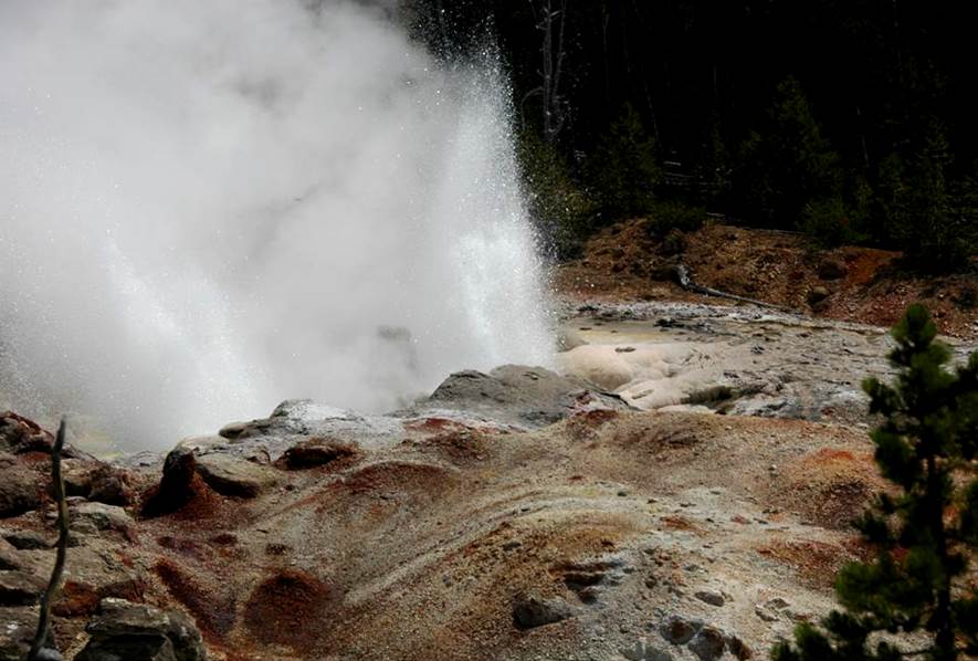
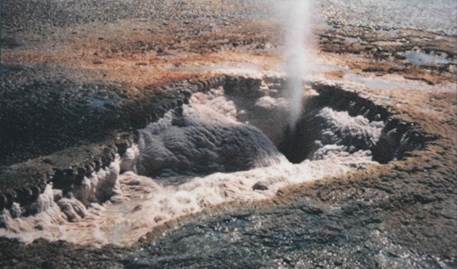
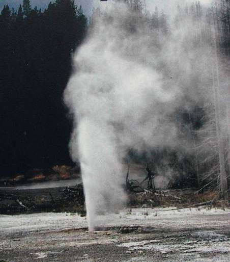
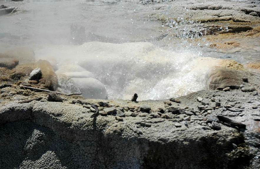
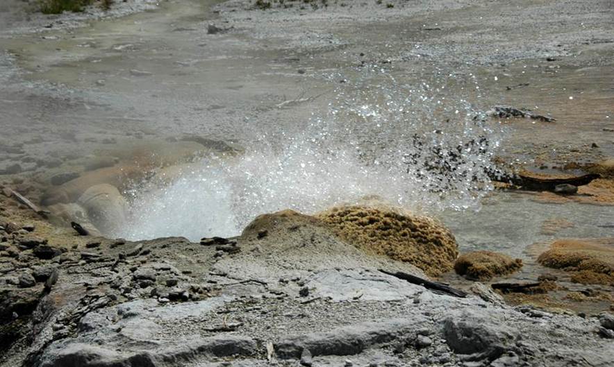
Steamboat Geyser (above & below), northeastern Back
Basin, southeastern Norris Geyser Basin, Yellowstone Hotspot, northwestern
Wyoming, USA on 9 August 2011.
Major eruptions at Steamboat Geyser are
the tallest in the world. This feature
first appeared on 11 August 1878 after a hydrothermal explosion. This was similar to, but larger than, the 5
September 1989 Porkchop Geyser hydrothermal explosion event (see below). Steamboat Geyser consists of two vents in a
gentle hillside of rhyolitic ash-flow tuff (Lava Creek Tuff, lower Middle
Pleistocene, 640 ka). Initially, the
vents were powerful fumaroles that emitted steam and some mud. By 1879, moderately high to high geyser
eruptions occurred. Small to large
eruptions occurred at Steamboat Geyser from the late 1870s to the early
1910s. This was followed by 50 years of
dormancy. Geyser eruptions resumed in
the 1960s. Dormancy occurred during the
early and mid-1970s. More major
eruptions occurred in the early 1980s, followed by sporadic to rare events from
the mid-1980s to the 2000s.
Major eruptions of Steamboat Geyser have
fountains of water reaching over 100 feet high.
The highest have reached close to 400 feet high - the highest on
Earth. Major eruptions do not occur at
regular intervals and thus are not predictable (decades ago, one woman waited
52 continuous days, hoping to witness a major eruption). Steamboat’s major eruptions are about 3 to 40
minutes long, followed by hours of roaring fumarole activity.
Normal activity at Steamboat Geyser
consists of frequent splashing spouts (see above & below photos) that
reaching about 10 to even 60 feet high.
Emitted water at Steamboat Geyser is somewhat acidic and quite hot.
Steamboat Geyser (above & below), northeastern Back
Basin, southeastern Norris Geyser Basin, Yellowstone Hotspot, northwestern
Wyoming, USA on 9 August 2011.
Steamboat Geyser (above & below), northeastern Back
Basin, southeastern Norris Geyser Basin, Yellowstone Hotspot, northwestern
Wyoming, USA on 9 August 2011.
Steamboat Geyser (above & below), northeastern Back
Basin, southeastern Norris Geyser Basin, Yellowstone Hotspot, northwestern
Wyoming, USA on 9 August 2011.
Steamboat Geyser (above & below), northeastern Back
Basin, southeastern Norris Geyser Basin, Yellowstone Hotspot, northwestern
Wyoming, USA on 9 August 2011.
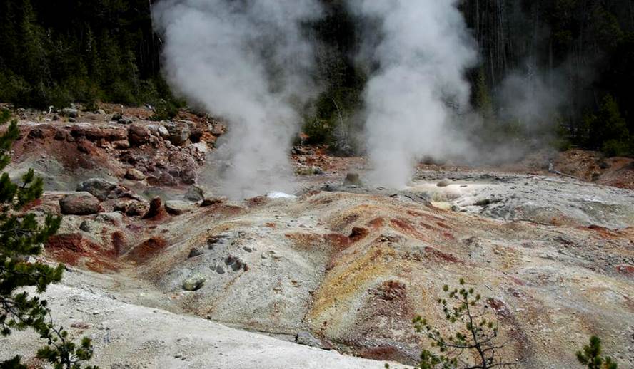
Above (looking N): The runoff channel for
Steamboat Geyser eruptions heads south and joins Tantalus Creek upstream from
Tantalus Geyser).
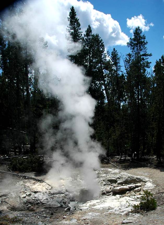
Below (looking ~SSE): Steam plume from
Steamboat Geyser, as seen from near Dr. Allen’s Paint Pots.
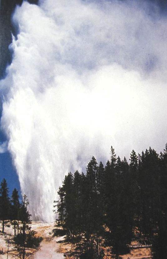
Steamboat Geyser in major eruption (looking N) during the
1960s (from frontispiece in White et al., 1988).
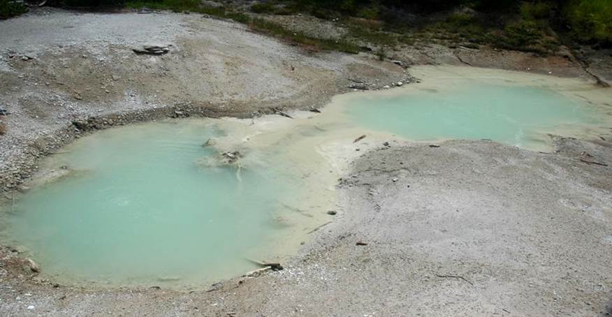
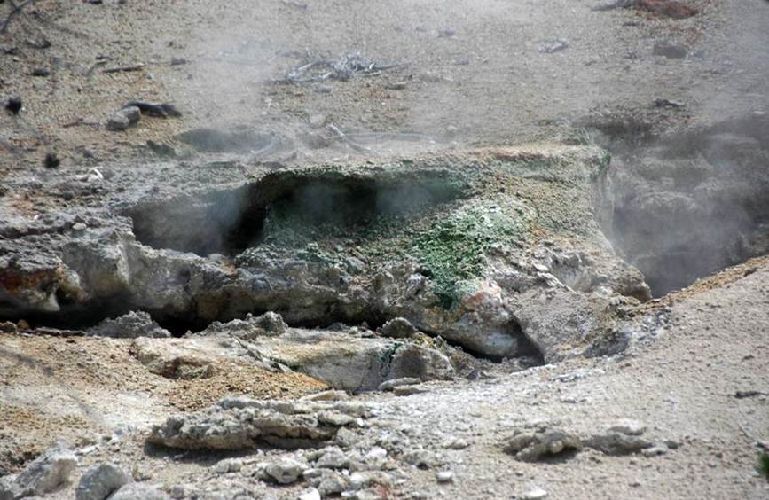
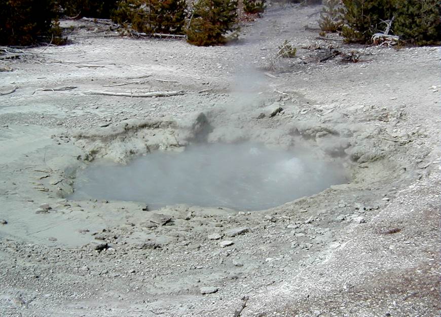
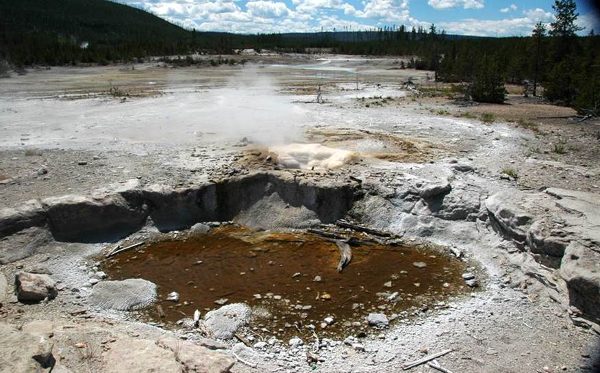
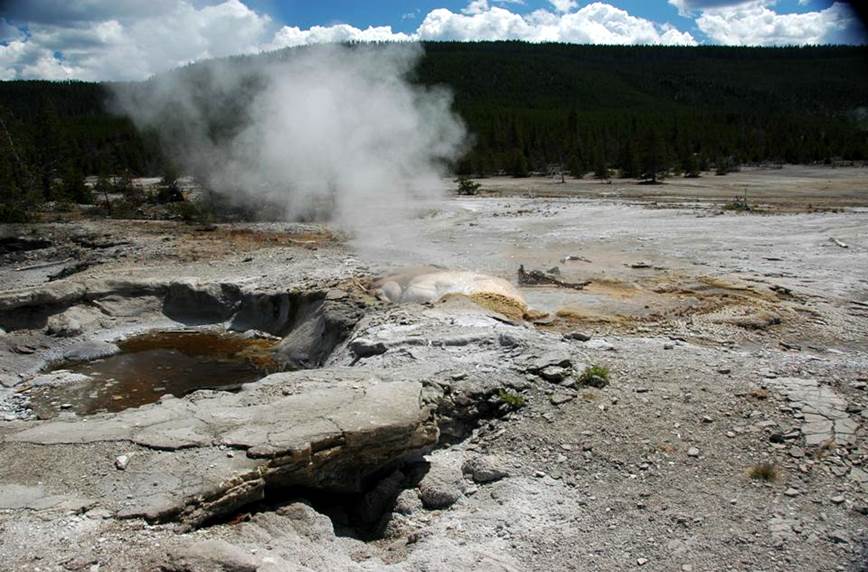
Sulphur Pot, eastern Back Basin, southeastern Norris
Geyser Basin, Yellowstone Hotspot, northwestern Wyoming, USA on 9 August 2011.
This small pool is located a little
north-northwest of Echinus Geyser. It
has warm, nearly opaque, pale yellow-colored water that is quite acidic.
More than one feature labeled “Sulphur
Pot” is shown on various Norris Back Basin maps. One occurs a little east of Echinus Geyser
and another (= the one shown above) occurs a little north-northwest of Echinus
Geyser.
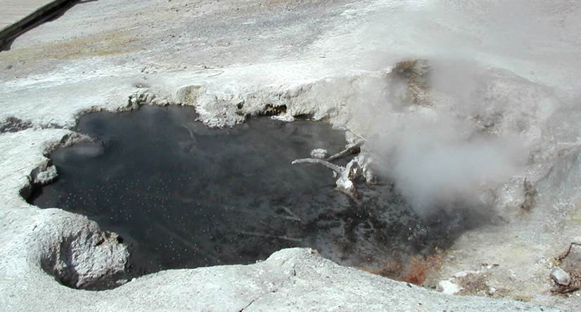
Black Pit Spring (above & below), eastern Back Basin,
southeastern Norris Geyser Basin, Yellowstone Hotspot, northwestern Wyoming,
USA.
Above: 9 August 2011. Below: 8 September 2005.
Black Pit Spring ranges from having
inky-black water (see below) to greenish-gray, slightly murky water (see
above). This hillside feature was
formerly several small fumaroles. The
pool contains hot, slightly acidic water.
The hillside consists of Upper Pleistocene glacial till.
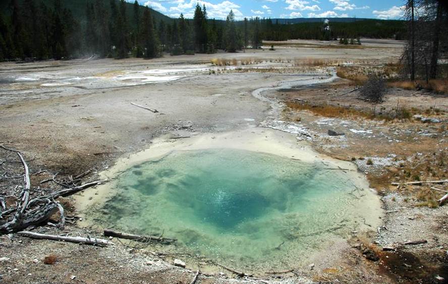
Echinus Geyser (above & below), eastern Back Basin,
southeastern Norris Geyser Basin, Yellowstone Hotspot, northwestern Wyoming,
USA on 9 August 2011.
Above: looking ~SE. Below: looking ~ESE.
Echinus Geyser is now mostly dormant but
was formerly a frequently erupting geyser with high spouts, sometimes exceeding
100 feet. The water at Echinus Geyser is
acidic, hot, chloride-rich, and sulfate-rich, as are many hydrothermal features
in Norris Geyser Basin. Variations in
water chemistry measurements indicate that this geyser erupts and discharges a
mix of deep groundwater and shallow groundwater.
Spinose geyserite (siliceous sinter) is
common at and immediately around Echinus Geyser, inspiring the name (“echinus”
means “spiny”). Chemical analyses of
geyserite from here show that opaline silica (SiO2·nH2O -
hydrous silica) is not the dominant material.
About 20% of the geyserite here is silica and about 57% is hematite (Fe2O3
- iron oxide), which is typically brick red to reddish-brown in color (note the
reddish-brown color of the geyserite at the geyser and in the runoff channels
in the above & below photos). Other
significant impurities in Echinus Geyser geyserite include arsenic, aluminum,
sulfur, and calcium. Whitish gray,
low-impurity geyserite occurs below the surface, usually as irregular-shaped
blocks. Subfossil logs occur below that,
dating to the early 1400s A.D.
At the surface, some geyserite rubble and
blocks occur at Echinus Geyser. These
fragments were formed and deposited during violent geyser eruptions. In the late 1970s, Echinus Geyser eruptions
spewed small rock fragments composed of banded pyrite-marcasite (both are FeS2
- iron sulfide). These sulfides have
been observed in thin hydrothermal veins intruding geyserite in Echinus
Geyser’s crater.
Pebbles of lithified rhyolitic ash-flow
tuff litter the Echinus Geyser area, derived from adjacent hillside outcrops of
Lava Creek Tuff (lower Middle Pleistocene, ~640 ka). The geyserite rubble blocks and volcanic tuff
pebbles have coatings of recent geyserite, often covered with spinose
projections.
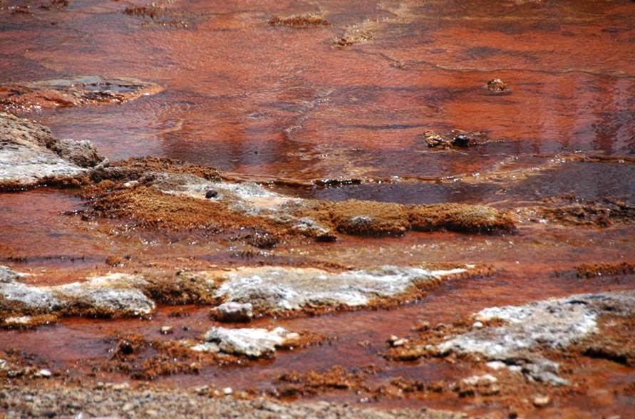
Echinus Geyser’s runoff channel (above & below), eastern Back Basin,
southeastern Norris Geyser Basin, Yellowstone Hotspot, northwestern Wyoming,
USA on 9 August 2011.
Above: hematite-rich, spiny geyserite in
Echinus Geyser’s proximal runoff channel.
Below (looking west): Echinus Geyser’s runoff
channel (center foreground) drains to the west and quickly merges with Tantalus
Creek (= left side & distant center).
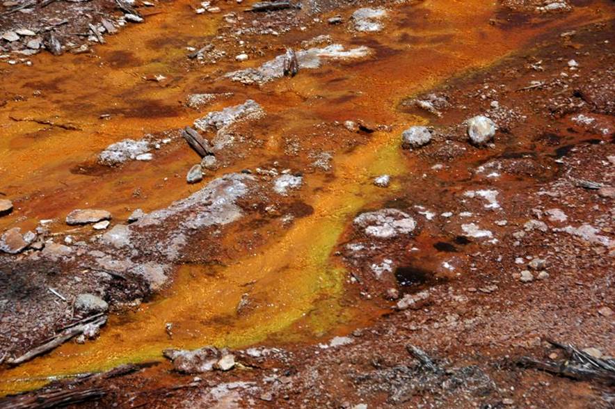
Echinus Geyser’s runoff channel, eastern Back Basin, southeastern Norris
Geyser Basin, Yellowstone Hotspot, northwestern Wyoming, USA on 9 August 2011.
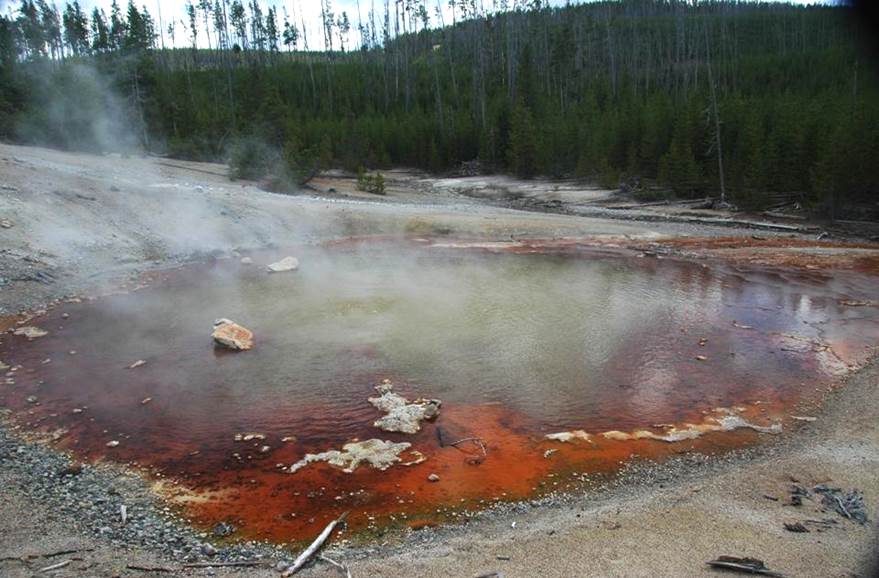
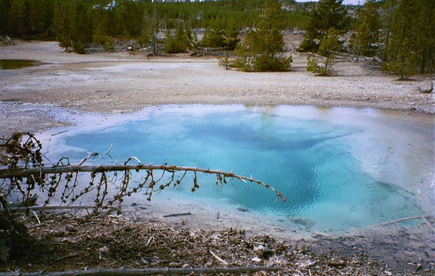
Crater Spring (above & below), eastern Back Basin,
southeastern Norris Geyser Basin, Yellowstone Hotspot, northwestern Wyoming,
USA on 9 August 2011.
This bluish-green pool is distinctive in
having significantly projecting ledges of geyserite (siliceous sinter) (see the
shadowed areas in the pool). Some of
these geyserite ledges collapsed long ago, resulting in scattered, angular
geyserite blocks (see especially the left-center parts of the pool in the below
photo). The undercut geyserite ledges
formed by erosive hydraulic action during energetic hydrothermal activity in
former times.
In general, Crater Spring has been
observed to be a small perpetual spouter.
Geyser activity occurred here in 1983 and 1984 with water spouting
northward at an angle over 20 feet high.
More recently, it has been a relatively quiet pool. The water here is very hot, acidic,
chloride-rich, and sulfate-rich, as are many hydrothermal features in Norris
Back Basin.
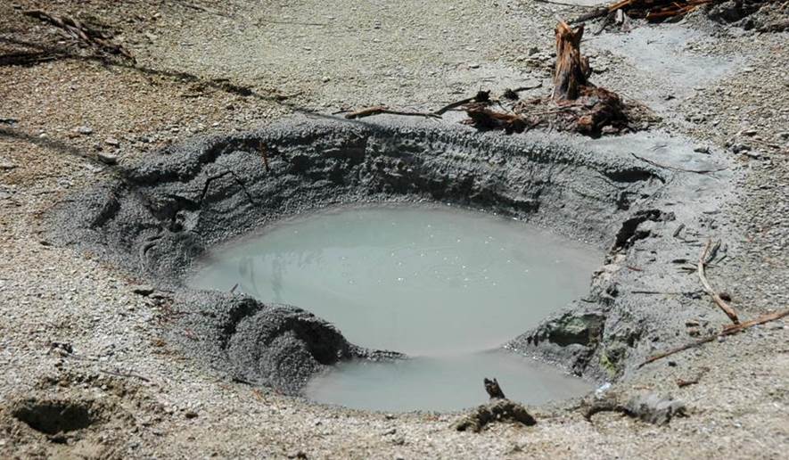
Root Pool, eastern Back Basin, southeastern Norris
Geyser Basin, Yellowstone Hotspot, northwestern Wyoming, USA on 9 August 2011.
This feature consists of two,
water-filled, circular to irregular-outlined basins connected by a relatively
narrow channel, and developed in Upper Pleistocene glacial till. The water is slightly greenish-colored,
slightly murky, acidic, and hot. Small
surface boils are present in both basins.
Root Pool has also experienced low splashing activity. Geyser eruptions occurred here in late summer
1967.
Tantalus Geyser, eastern Back Basin, southeastern Norris
Geyser Basin, Yellowstone Hotspot, northwestern Wyoming, USA on 9 August 2011
(looking ~NE).
This geyser is referred to as Decker
Geyser or Decker Island Geyser in the older literature.
Tantalus Geyer’s vent occurs in the
channel of Tantalus Creek, and so all of the stream’s drainage enters and exits
the pool. This geyser is normally quiet,
but it splashes and becomes turbid during the annual Norris Geyser Basin
disturbances.
In 1969, activity at Tantalus Geyser
included spouts of brown, turbid water up to 35 feet high.
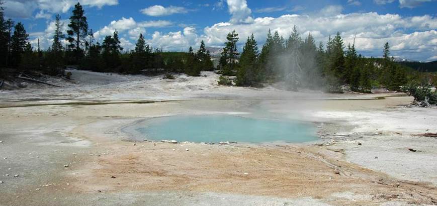
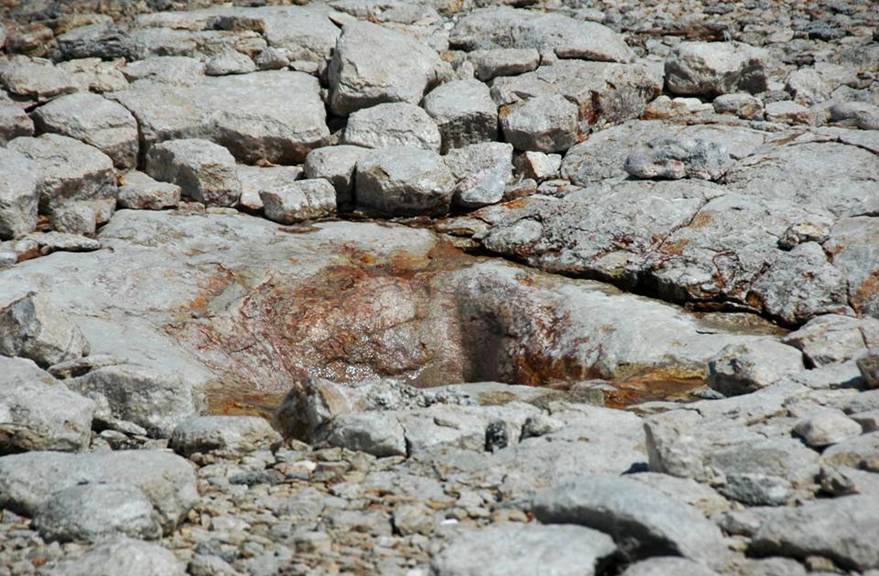
Arch Steam Vent (above & below), eastern Back Basin,
southeastern Norris Geyser Basin, Yellowstone Hotspot, northwestern Wyoming,
USA on 9 August 2011.
Arch Steam Vent is an active fumarole with
an irregularly slit-shaped vent developed on a hillside of rhyolitic ash-flow
tuff (Lava Creek Tuff, member B, lower Middle Pleistocene, ~640 ka), glacial
till (Upper Pleistocene), and geyserite (siliceous sinter).
This feature formerly had an arch of
geyserite, which has since collapsed.
Geyserite arches are very rare, but an intact example still exists at
Avoca Spring in the Sapphire Group at Biscuit Basin.
Rarely, this feature discharges acidic,
chloride-rich, and sulfate-rich water in the form of runoff and angled geyser
eruptions up to an estimated 40 feet high.
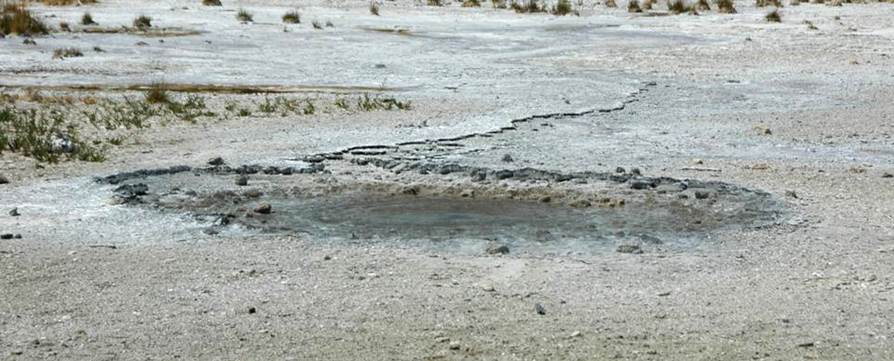
NBBNN25, (above & below), east-central Back
Basin, southeastern Norris Geyser Basin, Yellowstone Hotspot, northwestern
Wyoming, USA on 9 August 2011.
This unnamed hydrothermal feature is just
west of Arch Steam Vent. It consists of
a small, bubbling pool adjacent to two larger ponds. NBBNN25 has acidic, low-temperature water. The medium gray-colored materials lining the
walls of the pool appear to be stratified glacial deposits. The light-colored gravel surrounding the pool
is weathered geyserite (siliceous sinter).
Dishwater Spring (above & below), east-central Back
Basin, southern Norris Geyser Basin, Yellowstone Hotspot, northwestern Wyoming,
USA on 9 August 2011.
Above: looking ~SSW. Below: looking ~E.
Dishwater Spring is a subcircular,
slightly bubbling pool perched above a larger pond having an irregular
outline. The symmetrical mound
immediately surrounding the spring is composed of geyserite and weathered
geyserite. Dishwater Spring occasionally
overflows (see the whitish-yellow runoff channel on the right side of all three
photos above & below). The pool’s
water is hot, somewhat acidic, and chloride-rich & sulfate-rich.
Dishwater Spring, east-central Back Basin, southern Norris
Geyser Basin, Yellowstone Hotspot, northwestern Wyoming, USA on 9 August 2011
(looking ~E).
Mystic Spring (above & below), south-central Back
Basin, southern Norris Geyser Basin, Yellowstone Hotspot, northwestern Wyoming,
USA (looking ~NW).
Above: 9 August 2011. Below: 8 September 2005.
Mystic Spring is an irregularly circular
pool located between Dishwater Spring (see above) and Mud Pool (see
below). It is surrounded by geyserite,
weathered geyserite, and geyserite gravel.
The subaqeous portions of the pool’s geyserite have a pale
yellowish-colored coating of elemental sulfur.
The behavior of this feature varies. It ranges from being fairly quiet to gentle
boiling to overflowing to perpetual splashing.
During some annual basin-wide disturbance events, Mystic Spring has
geyser eruptions. During the mid-2000s,
eruptions reached 4 feet high.
Water here is moderately hot and quite
acidic.
Mud Pool (Mud Spring), southern Back Basin,
southern Norris Geyser Basin, Yellowstone Hotspot, northwestern Wyoming, USA
(looking ~NW).
Above: 9 August 2011. Below: 8 September 2005.
Mud Pool can have clear, blue water or
slightly turbid, greenish water or very muddy water. Water turbidity (= high abundance of
suspended, fine-grained sediments) usually occurs here during the annual
basin-wide disturbances. The water is
quite hot and acidic, as are many Norris Back Basin features.
During occasional years, Mud Pool has
geyser eruptions. Many are low surging eruptions
while others reach up to 30 feet high.
NBBNN04 (above & below), southern Back Basin,
southern Norris Geyser Basin, Yellowstone Hotspot, northwestern Wyoming, USA on
9 August 2011.
Above: looking ~WNW. Below: looking ~W.
This unnamed hot spring pool contains hot,
acidic water.
Yellow Mud Pool, southern Back Basin, southern Norris
Geyser Basin, Yellowstone Hotspot, northwestern Wyoming, USA on 9 August 2011
(looking ~WSW).
The small, dark greenish gray to black
pool in the right-center foreground appears to be the feature that has been
called Yellow Mud Pool. Its water is
cool and very acidic.
Puff 'n Stuff Geyser (above & below), southern Back Basin,
southern Norris Geyser Basin, Yellowstone Hotspot, northwestern Wyoming, USA on
9 August 2011 (looking ~SE).
Puff 'n Stuff Geyser frequently acts as a
fumarole or sprayer. Rare geyser
eruptions also occur that reach about ten feet high. Puff 'n Stuff’s water is very hot and fairly
acidic.
Black Hermit Cauldron, southern Back Basin, southern Norris
Geyser Basin, Yellowstone Hotspot, northwestern Wyoming, USA on 9 August 2011
(looking ~SSW).
This acid hot spring consists of two
overlapping craters, usually filled or nearly filled with hot to very hot
water. Observed behaviors include light
bubbling-boiling action, heavy boiling, overflowing, surging, and small,
splashy bursting. The water is usually
opaque and ranges from pale blue to grayish to gray-brown to dark gray to
black.
A steep hillside composed of Upper
Pleistocene glacial till occurs on the southern side of Black Hermit
Cauldron. The flats on the northern and
northeastern sides of the spring consist of the same till, plus Upper
Pleistocene disrupted kame deposits.
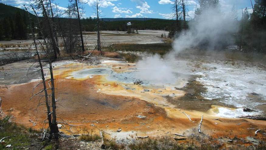
Green Dragon Spring, southern Back Basin, southern Norris
Geyser Basin, Yellowstone Hotspot, northwestern Wyoming, USA on 9 August 2011
(looking ~ESE).
At Green Dragon Spring, water emerges from
three water-filled basins that form one larger pool having an irregularly
elongated outline. The easternmost of
these three basins occurs in a “cave”, under an overhang of lithified Upper
Pleistocene disrupted kame deposits. The
walls and ceiling of the “cave” are yellowish, greenish, and orangish in
places, which can be difficult to see in the shadows and rising steam. The colored areas represent coatings of
elemental sulfur and iron sulfates.
The hot to boiling-hot, acidic water
emerging at Green Dragon Spring appears to be derived via subsurface conduits
or subsurface diffuse flow from Gray Lakes, immediately west of here (see
below). Green Dragon Spring’s water
drains westward, back to Gray Lakes.
Water at Green Dragon Spring is often deep
green and slightly murky. During the
annual Norris Geyser Basin disturbances, water here becomes muddy brown (= high
abundance of suspended, fine-grained sediments).
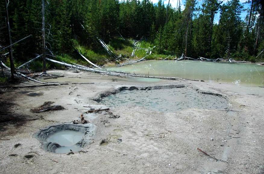
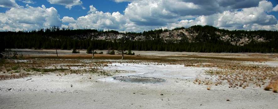
Gray Lakes, southwestern Back Basin, southwestern
Norris Geyser Basin, Yellowstone Hotspot, northwestern Wyoming, USA on 9 August
2011 (looking ~SW).
The Gray Lakes consist of two moderately
large ponds in the headwaters area of the South Fork of Tantalus Creek. The water is usually turbid (muddy),
bluish-gray to grayish-green in color, hot, acidic, chloride-rich, and
sulfate-rich. Many springs occur along
the borders of the Gray Lakes; these springs discharge much water into the
lakes, which is then discharged into the north-flowing South Fork of Tantalus
Creek. Some of these bordering springs
have occasional geyser eruptions.
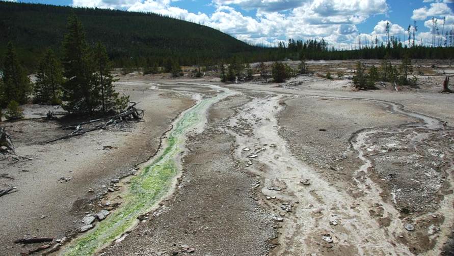
South Fork of Tantalus Creek, southwestern Back Basin, southern Norris
Geyser Basin, Yellowstone Hotspot, northwestern Wyoming, USA on on 9 August
2011 (looking ~S).
The South Fork of Tantalus Creek flows
north and drains the Gray Lakes area of Norris Back Basin. The water is warm to hot, acidic,
chloride-rich, and sulfate-rich. The
green coloration in the channel on the left is from colonies of unicellular,
photosynthetic, extremophile organisms - Cyanidium
caldarium in this case. Confusingly,
despite its green color, Cyanidium
caldarium is a red alga (Rhodophyta, Rhodophyceae, Cyanidiales,
Cyanidiaceae). This genus of red algae
is known to prefer hot, acidic water environments.
The hill in the distance is composed of
rhyolitic ash-flow tuff of the Lava Creek Tuff (lower Middle Pleistocene, 640
ka) and covered by Upper Pleistocene glacial till.
Blue Mud Spring (above & below), southwestern Back
Basin, southern Norris Geyser Basin, Yellowstone Hotspot, northwestern Wyoming,
USA on 9 August 2011 (looking ~W).
Blue Mud Spring is one of my favorite
features in Norris Geyser Basin. It can
be a fumarole or a muddy, splashing perpetual spouter or an overflowing hot
spring. It’s also had muddy mist
eruptions up to 10 feet high. Blue Mud
Spring water is very hot and somewhat acidic.
Blue Mud Spring (above & below), southwestern Back
Basin, southern Norris Geyser Basin, Yellowstone Hotspot, northwestern Wyoming,
USA on 9 August 2011.
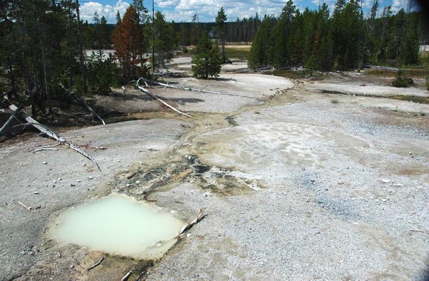
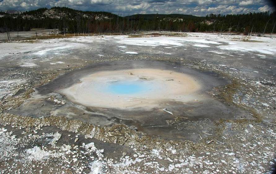
Yellow Funnel Spring, southwestern Back Basin, southern Norris
Geyser Basin, Yellowstone Hotspot, northwestern Wyoming, USA on 9 August 2011
(looking ~NE).
Yellow Funnel Spring has a subcircular,
fairly symmetrical, funnel-shaped basin.
This feature has varied significantly in its appearance over the
decades. It was formerly was an
attractive, multicolored, relatively quiet, water-filled pool. It had pale bluish-green water at the center
and was surrounded by yellow, sulfur-coated geyserite. The yellow sulfur areas were surrounded by
geyserite coated with/stained by pale orangish-brown iron sulfate and
purplish-gray iron sulfate.
In recent decades, Yellow Funnel Spring’s
turbidity (= muddiness) was frequently high.
Many times, the spring’s basin has been dry, or barely filled with
water. Geyser eruptions have occurred
here, involving spouts between 1 and 6 feet high. During the 2000s, geyser eruptions at Yellow
Funnel Spring eroded its own basin (see the jagged-shaped walls in the lower
parts of the pit in the above photo).
The sloping walls of Yellow Funnel
Spring’s basin are Upper Pleistocene glacial deposits, interpreted by some as
glacial till, but identified by others as disrupted kame deposits. A thin crust of geyserite caps the glacial
material (see the back right-hand side of the basin in the above photo).
Water at Yellow Funnel Spring is hot to
near-boiling and acidic.

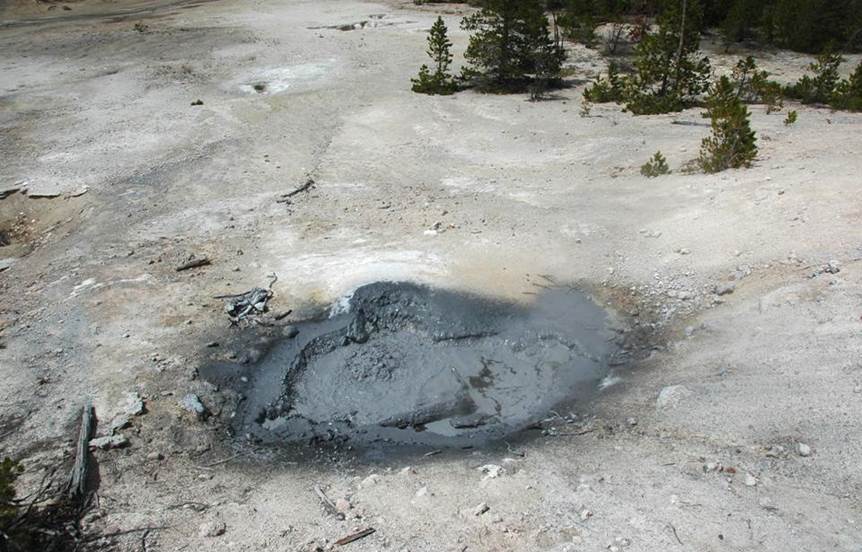
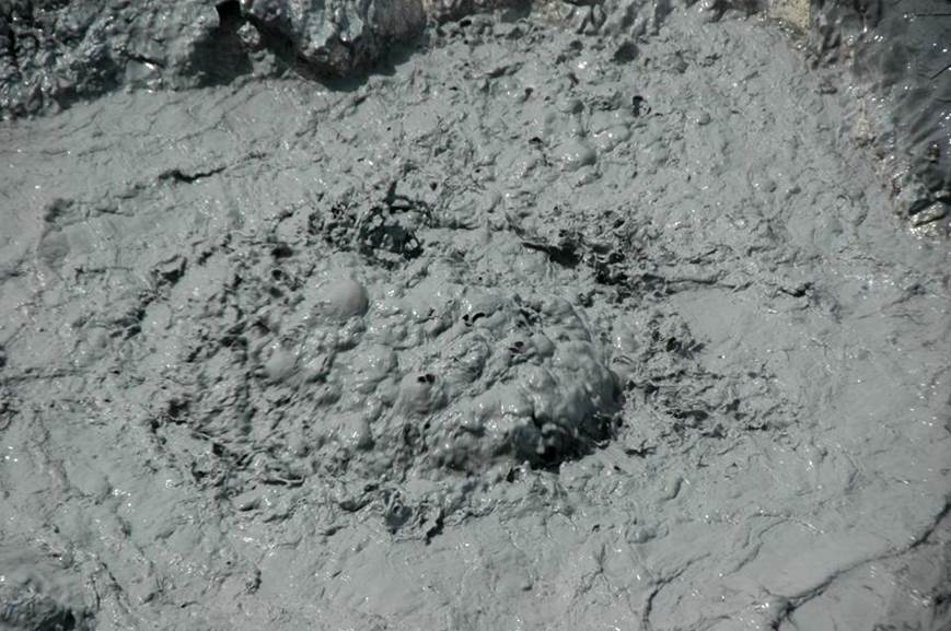
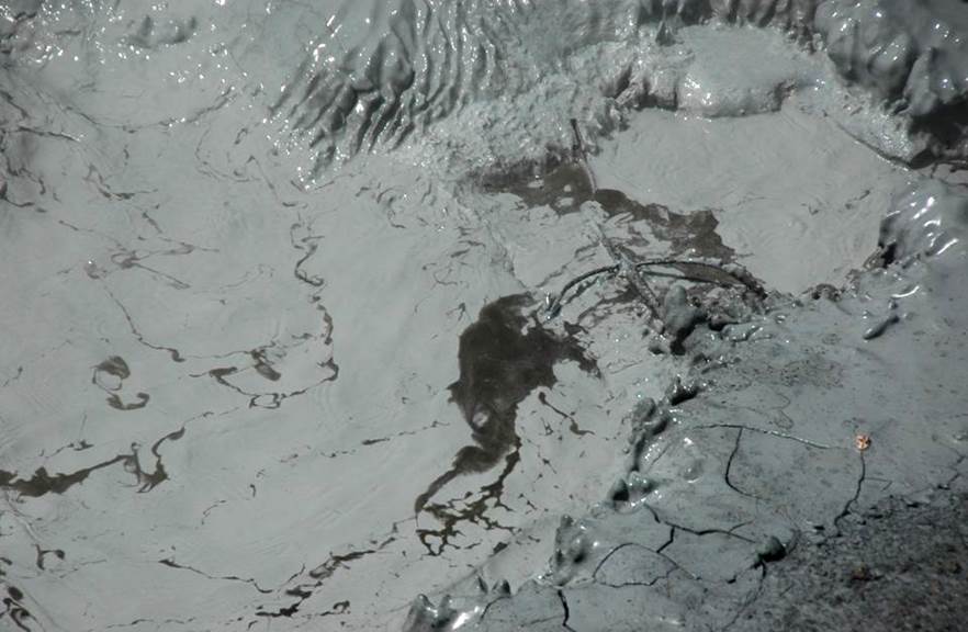
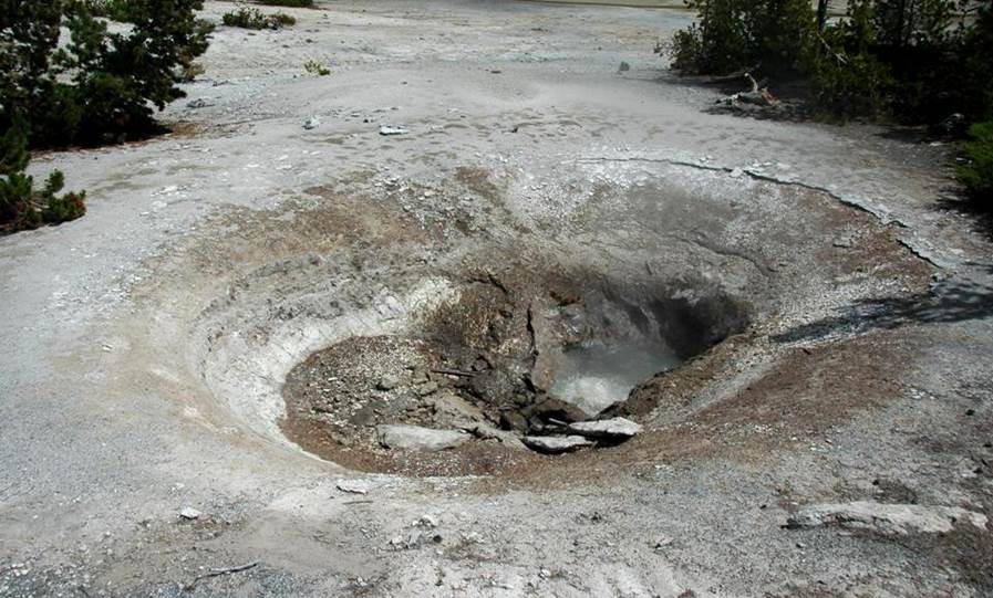
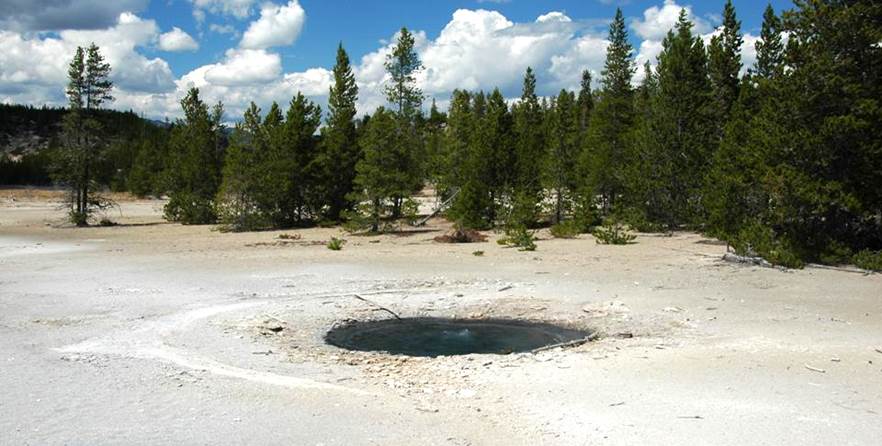
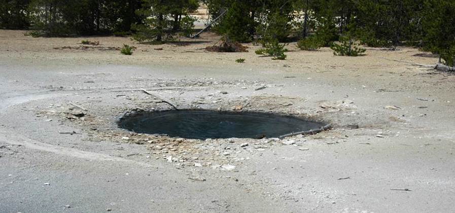
Porkchop Geyser (above & below), western Back Basin,
southern Norris Geyser Basin, Yellowstone Hotspot, northwestern Wyoming, USA.
Above: pre-1989 appearance of Porkchop Geyser’s
vent area (from National Park Service trailside signage).
Porkchop Geyser was formerly known as
Porkchop Spring. It’s basin was shallow,
had a porkchop-shaped outline, a pustulose geyserite border, and a very small
vent (see above and below). Occasional
to regular geyser eruptions occurred here during the 1970s and 1980s; spouts
reached up to about 20 feet high. From
1985 to mid-1989, Porkchop exhibited perpetual spouter behavior, with a roaring
column of water reaching over 30 feet high.
On 5 September 1989, during the annual
basin-wide disturbance, a hydrothermal explosion event occurred at Porkchop
Geyser, the first one in Norris Back Basin since the large 1878 event that
created Steamboat Geyser (see above).
The explosion was immediately preceded by partial collapse of Porkchop
Geyser’s very small vent, resulting in a brief, high geyser eruption, reaching
to about 100 feet. This abnormal
discharge of water lowered pressure in Porkchop Geyser’s subsurface
reservoir. The lowered pressure caused a
large volume of superheated reservoir water to instantly boil and convert to
steam. The steam pressure was
sufficiently high to explosively shatter geyserite around the vent and send
large to small rock fragments up to 220 feet away (one rock was roughly 6 by 4
by 2.5 feet in size). Angular geyserite
boulders and smaller rubble still surround the vent to this day. Geologists who examined the site a few hours
after the explosion found some geyserite (= hydrothermal opal - hydrous silica)
that was soft and gelatinous; this material was derived from the pre-explosion
subsurface conduit walls.
Since the explosion, the feature has been
a hot spring with milky blue-colored water and having gentle surface
disruptions by rising gases. Occasional
geyser eruptions have occurred here since 1989.
Water at Porkchop Geyser ranges from slightly
hot to very hot. Unlike many Norris Back
Basin features, Porkchop Geyser water is not acidic - it’s usually close to
neutral or slightly alkaline.
Below: pre-1989 appearance of Porkchop Geyser’s
vent area (from National Park Service trailside signage). The photo on the left shows perpetual spouter
activity in 1986. The photo on the right
shows the very small vent (shadowed) - it was about 1 to 2 inches in size.
Porkchop Geyser (above & below), western Back Basin,
southern Norris Geyser Basin, Yellowstone Hotspot, northwestern Wyoming, USA.
Above: pre-1989 eruption of Porkchop Geyser
(from National Park Service trailside signage).
Below: post-explosion appearance of Porkchop
Geyser with abundant bedded geyserite boulders and finer-grained rubble formed
and deposited during the 1989 hydrothermal explosion event (from National Park
Service trailside signage).
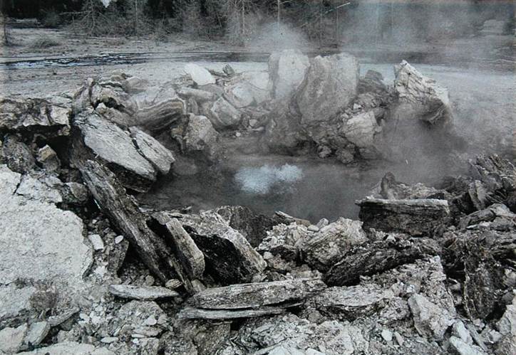
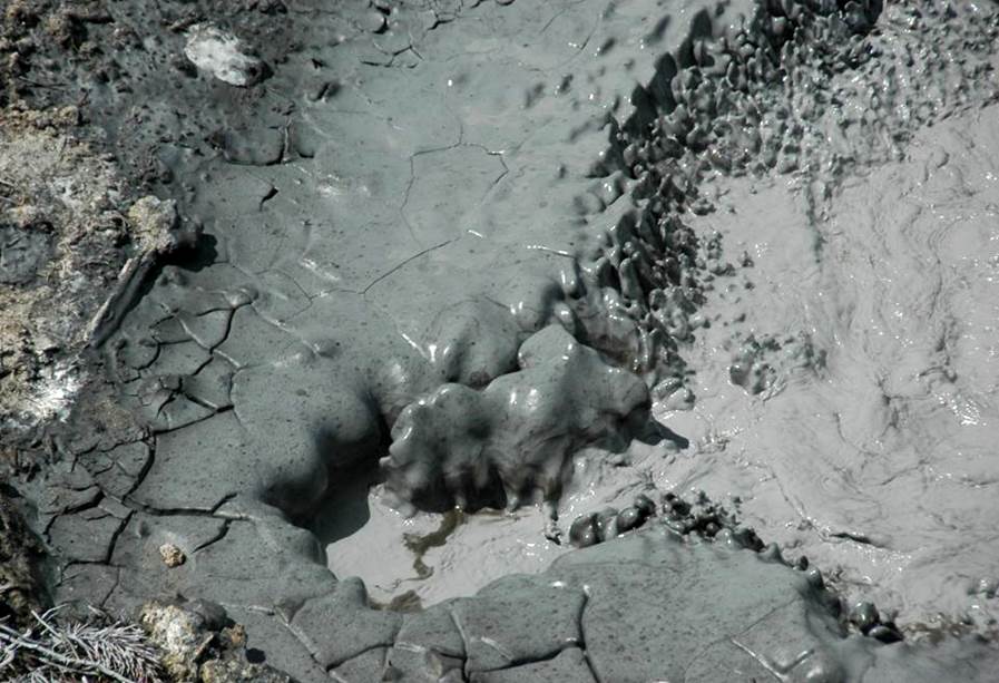
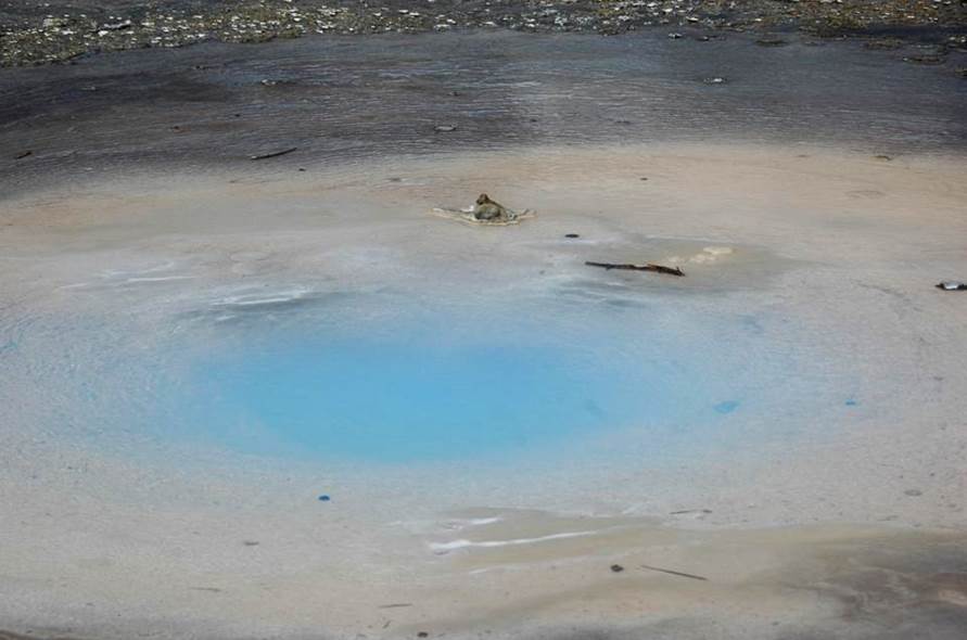
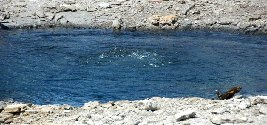
Porkchop Geyser (above & below), western Back Basin,
southern Norris Geyser Basin, Yellowstone Hotspot, northwestern Wyoming, USA on
9 August 2011.
Hydrothermal explosion-generated geyserite
rubble surrounds a milky blue-colored pool.
The coloration is caused by an abundance of suspended, submicron-sized
colloidal silica plus larger particles of suspended solid silica. Without the latter, the water would be clear
blue (see, for example, Sapphire Pool in Biscuit Basin and Gem Pool in the
Cascade Group). With the addition of
suspended solid silica, hot spring water becomes milky blue.
Pearl Geyser (above & below), western Back Basin,
southern Norris Geyser Basin, Yellowstone Hotspot, northwestern Wyoming, USA on
9 August 2011 (looking ~WNW).
Pearl Geyser is an attractive,
subcircular-shaped feature located east-northeast of Porkchop Geyser. Over the decades, Pearl Geyser has variously
been an empty fumarole, partially water-filled, and completely
water-filled. It can be an overflowing
hot spring, it can have frequent small splashing activity, and it can have
geyser eruptions.
In the past, Pearl Geyser had clear blue
water. The photos above & below show
milky blue water, the result of suspended, submicron-sized colloidal silica
particles plus larger particles of suspended solid silica. The hot spring water has deposited cream- to
tan-colored geyserite in most of the crater, surrounded by a ring of gray to
dark gray geyserite
Water at Pearl Geyser is hot to
near-boiling and ranges from being slightly acidic to neutral to slightly
alkaline.
Vixen Geyser (above & below), northwest-central
Back Basin, southern Norris Geyser Basin, Yellowstone Hotspot, northwestern
Wyoming, USA on 9 August 2011 (looking ~NE).
Vixen Geyser is located to the
north-northeast of Pearl Geyser. The
relatively small vent is surrounded by light gray, blocky-weathering geyserite
(siliceous sinter). The vent has
reddish-brown staining from deposition the iron oxides hematite and limonite.
Geyser eruption durations here range from
seconds to almost an hour long. Eruption
fountain heights vary, but reach up to 40 feet high. Water at Vixen Geyser is quite acidic and hot
to boiling hot.
Vixen Geyser may originally have had a
prominent, multivent, spinose geyserite cone.
A Yellowstone geyserite cone having that description is on display at
America’s National Museum of Natural History (= Smithsonian Institute; = United
States National Museum) in Washington D.C.
The museum’s specimen was collected and shipped by an early park
superintendent. Unfortunately, available
historical evidence is ambiguous and contradictory. Some written records indicate that the
Smithsonian specimen is definitely not from Vixen Geyser. Other reports suggest that it might indeed be
from Vixen Geyser in Norris Back Basin.
I strongly suspect that the Smithsonian specimen is not from Vixen, but
Vixen’s present vent area “looks” slightly unnatural, as if something is
missing. It’s possible that more than
one geyserite cone was collected by early park officials.
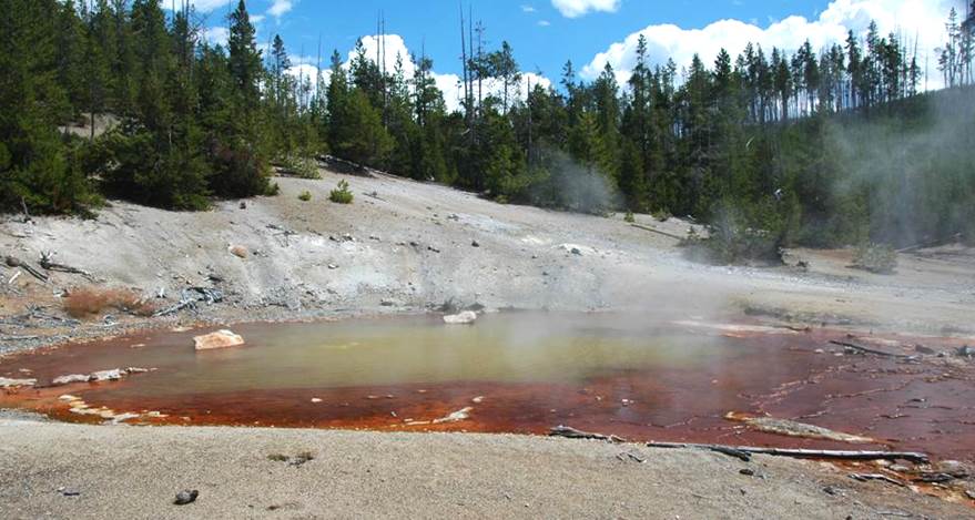
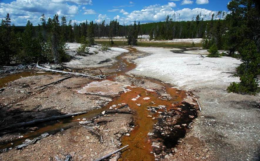
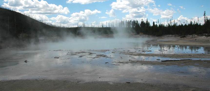
Tantalus Creek, north-central Back Basin, southern
Norris Geyser Basin, Yellowstone Hotspot, northwestern Wyoming, USA on 9 August
2011 (looking ~NW).
Tantalus Creek is the main drainage in
Norris Back Basin. Here, it is flowing
to the northwest; it joins with the South Fork of Tantalus Creek in the
distance. Much of the water in these
creeks is geyser and hot spring runoff.
Chemically, the creek water is acidic, chloride-rich, and sulfate-rich.
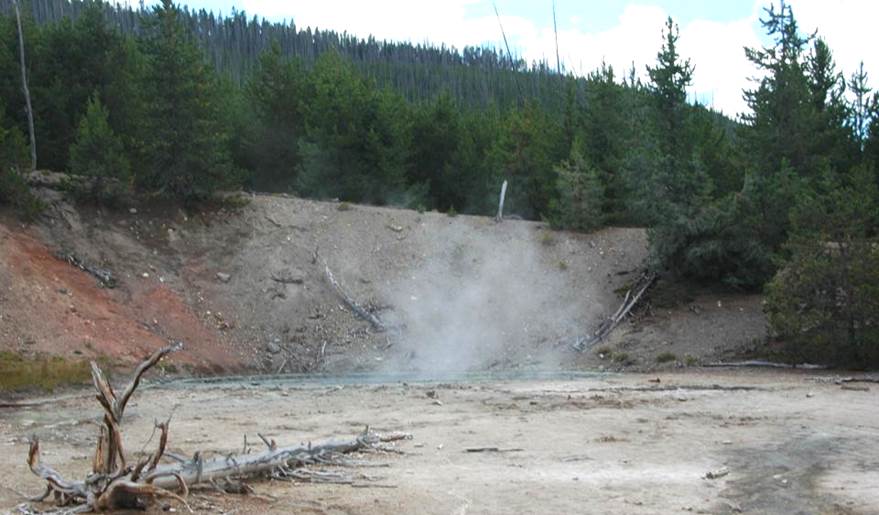
Corporal Geyser, north-central Back Basin, southern
Norris Geyser Basin, Yellowstone Hotspot, northwestern Wyoming, USA on 9 August
2011.
Corporal Geyser is a circular pool lined
and walled by geyserite (siliceous sinter).
An overhanging ledge of geyserite occurs in the northwestern portion of
the pool. The water is acidic and hot. This feature can be dormant or occasionally
overflowing or having small splashing geyser eruptions.
Dog’s Leg Spring (above & below), north-central Back
Basin, southern Norris Geyser Basin, Yellowstone Hotspot, northwestern Wyoming,
USA on 9 August 2011.
Located next to Corporal Geyser, this
small hydrothermal feature’s activity was first observed in the 1970s. The two vents are surrounded by geyserite
(siliceous sinter) and Upper Pleistocene glacial till. Geyserite pebbles and finer-grained
sediments, plus plant debris partially fill the vents. Dog’s Leg Spring water is acidic and hot to
very hot. Geyser eruptions are
moderately small, and reach about 3 feet high.
Dog’s Leg Spring (above & below), north-central Back
Basin, southern Norris Geyser Basin, Yellowstone Hotspot, northwestern Wyoming,
USA on 9 August 2011.
Above: eastern vent. Below: western vent.
Veteran Geyser (above & below), north-central Back
Basin, southern Norris Geyser Basin, Yellowstone Hotspot, northwestern Wyoming,
USA on 9 August 2011 (looking ~SSW).
This multivent geyser consists of a
moderately large central crater walled by whitish-gray geyserite (siliceous
sinter) that is overhanging in places.
Just to the south of the crater is a moderately small vent (the “main
vent”), surrounded by pale yellowish- to cream-colored geyserite. Most eruptive activity occurs there. Small splashing eruptions are nearly
perpetual. Some geyser spouts here reach
50 feet high. The central crater fills
with water during episodes of significant geyser activity.
Another vent (see first photo below)
occurs below an eroded, overhanging geyserite ledge outside the northwestern
margin of the central crater. When
active, that vent ejects water at a low angle.
Veteran Geyser water is essentially
neutral to slightly acidic and near-boiling hot.
Veteran Geyser (above & below), north-central Back
Basin, southern Norris Geyser Basin, Yellowstone Hotspot, northwestern Wyoming,
USA on 9 August 2011.
Veteran Geyser, north-central Back Basin, southern Norris Geyser Basin, Yellowstone Hotspot,
northwestern Wyoming, USA on 9 August 2011.
Veteran Geyser, north-central Back Basin, southern Norris Geyser Basin, Yellowstone Hotspot,
northwestern Wyoming, USA on 9 August 2011.
This knob of pustulose to spiny geyserite
(siliceous sinter) is adjacent to the vent under the overhang along the
northwestern outside margin of Veteran Geyser.
Veteran’s Auxiliary Vent, northern Back Basin, southern Norris
Geyser Basin, Yellowstone Hotspot, northwestern Wyoming, USA on 9 August 2011
(looking ~SE).
Activity at Veteran’s Auxiliary Vent
typically consists of rises in water level.
These occur at the same time as activity at adjacent Veteran
Geyser. Water levels here are usually
subsurface.
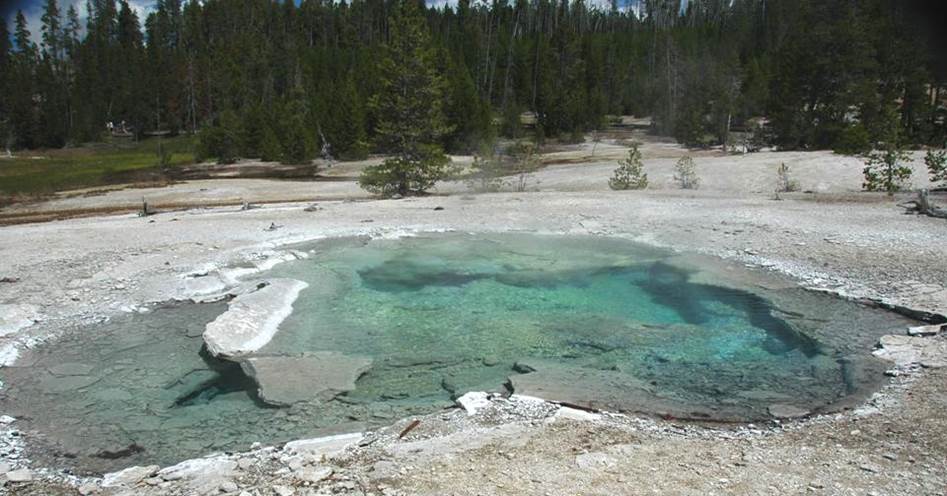
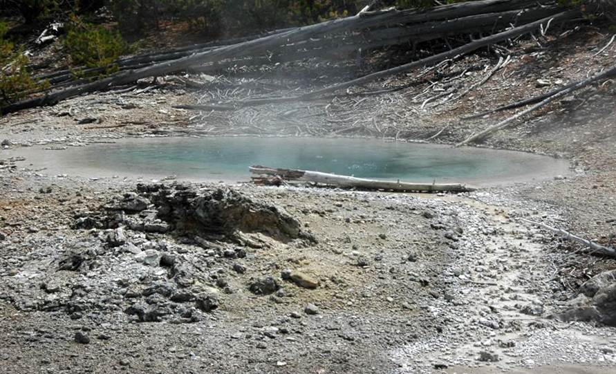
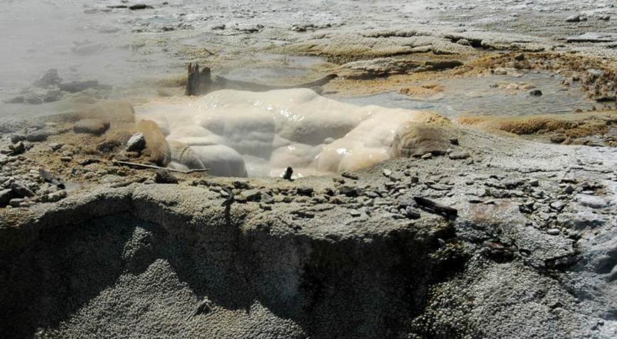
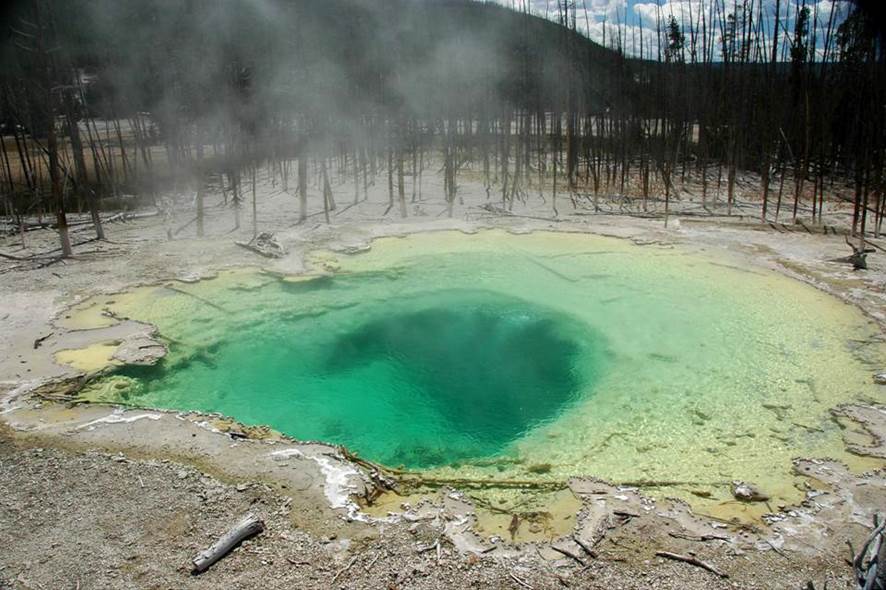
Cistern Spring (above & below), northeastern Back
Basin, southeastern Norris Geyser Basin, Yellowstone Hotspot, northwestern
Wyoming, USA on 9 August 2011.
Above: looking ~ESE. Below: looking ~SSE.
Cistern Spring’s summer 2011 appearance is
nearly identical to Emerald Spring (see above).
Before the mid-1960s, Cistern Spring was a quiet, dark-colored hot
spring. It then transformed into a
boiling, overflowing, milky blue-colored hot spring. The silica-rich runoff started rapid buildup
of geyserite around the pool. It also
started killing the evergreen trees in the surrounding forest (see above &
below photos).
The subsurface reservoir and underground
plumbing system of Cistern Spring are connected with nearby Steamboat Geyser,
the tallest erupting geyser on Earth.
Activity at Cistern Spring doesn’t precede Steamboat Geyser activity, so
it can’t be used to make predictions.
But Cistern Spring does have obvious responses to Steamboat activity,
particularly its famous major eruptions.
Steamboat major eruptions result in Cistern Spring’s pool displaying
unusual activity, such as decrease in water level, increase in turbidity
(muddiness - suspended, fine-grained sediments), and cooling of its surface
water. Sometimes, Cistern Spring has had
surging overflow or geyser eruptions about 20 feet high in response to
Steamboat activity.
In summer 2011, Cistern Spring was not a
blue-colored pool. It had a green
coloration, the result of mixing of “blue water” with the yellow-colored
coatings of elemental sulfur on the floor and walls of the pool.
Cistern Spring water varies in temperature
and acidity. It ranges from moderately
hot to very hot. It can be somewhat
acidic to neutral to very slightly alkaline.
Palpitator Spring (Palpitator Geyser) (above & below),
northern Back Basin, south-central Norris Geyser Basin, Yellowstone Hotspot,
northwestern Wyoming, USA on 9 August 2011 (looking ~W).
This moderately small, relatively shallow,
circular hot spring has small surging domes at its surface, causes by rising
gases. These surges generate radiating
ripples and cause bouncing water levels.
Slightly overflowing water occurs sometimes, which drains to the west
(see the runoff channel on the far side of the pool in the above & below
photos) and empties into Tantalus Creek.
Small splashing geyser eruptions occur at
Palpitator Spring and reach about 3 feet high.
Stronger eruptions were reported here in the late 1800s.
Water at Palpitator Spring is hot and
close to neutral (not acidic or alkaline).
The spring is surounded by light gray-brown to whitish gray geyserite
(siliceous siner).
Fearless Geyser (above & below), northern Back Basin,
south-central Norris Geyser Basin, Yellowstone Hotspot, northwestern Wyoming,
USA on 9 August 2011 (looking ~NW).
Fearless Geyser is located just northeast
of Palpitator Spring. It is a dark,
moderately small, circular pool over 20 feet deep with slightly acidic water
that is hot to superheated.
Boiling surges occur near the center of
the pool, sometimes doming to about 1 foot high. Geyser eruptions occurred here in the past,
reaching over 25 feet high.
Weathered geyserite gravel and finer
grains surround Fearless Geyser’s pool.
The vent itself is walled by spinose geyserite.
Fearless Geyser, northern Back Basin, south-central
Norris Geyser Basin, Yellowstone Hotspot, northwestern Wyoming, USA on 9 August
2011 (looking ~NW).
Monarch Geyser, northern Back Basin, southwest-central
Norris Geyser Basin, Yellowstone Hotspot, northwestern Wyoming, USA on 9 August
2011 (looking ~E).
Many decades ago, Monarch Geyser was the 2nd
most significant geyser in Norris Back Basin (Steamboat Geyser is # 1). In the late 1800s, Monarch erupted
periodically and powerfully up to 200 feet high. This activity stopped in the early 1910s. Before it ceased activity, eruption columns
from Monarch were observed to be dark-colored (muddy; sediment-rich),
indicating subsurface conduit erosion.
Such conduit erosion usually indicates that the ability to have
additional geyser eruptions is diminished.
Since 1913, Monarch has had no activity, except for sporadic activity
during a few years in the 1920s, plus geyser eruptions up to 20 feet high from
1994 to 1996.
Monarch Geyser is located in a subcircular
amphitheater with partially vegetated sloping walls. The walls expose rhyolitic ash-flow tuff of
the Lava Creek Tuff (lower Middle Pleistocene, 640 ka). The amphitheater, or alcove, was presumably
eroded through the volcanic tuff by the energetic hydrothermal activity of
Monarch Geyser. It’s possible that this
feature originated via a hydrothermal explosion event, similar to the
explosions at Steamboat Geyser in 1878 and Porkchop Geyser in 1989.
Monarch Geyser’s irregularly-shaped pool
has clear, green to pale-green water similar to Emerald Spring and Cistern
Spring (see above). The water is hot,
somewhat acidic, chloride-rich, and sulfate-rich. Its modern activity consists of overflow,
plus minor surface disturbances and boils.
Branch Spring, northern Back Basin, southwest-central
Norris Geyser Basin, Yellowstone Hotspot, northwestern Wyoming, USA on 9 August
2011 (looking ~SW).
Branch Spring is a slightly bubbling pool
of hot, acidic, nearly-clear, pale yellowish-green water. Overflowing water drains to the southwest,
merges with Monarch Geyser’s runoff channel, and then drains into Tantalus
Creek.
Minute Geyser, northern Back Basin, southwest-central
Norris Geyser Basin, Yellowstone Hotspot, northwestern Wyoming, USA on 9 August
2011 (looking ~SW).
This is no longer a “natural”
feature. Morons and boneheads over the
decades have significantly vandalized this geyser. It formerly had very frequent eruptions
(hence the name). Anti-nature jerks have
thrown innumerable rocks into Minute Geyser’s vent basin (compare this with the
thousands of coins and other trash thrown into Morning Glory Pool in
Yellowstone’s Upper Geyser Basin). Some
of these rocks were removed in the 1930s, but more rocks were later thrown
in. The vent is basically sealed up now
- geyserite has cemented the rocks together.
Minute Geyser has two vents - the larger
main vent has been wrecked. The smaller
vent’s activity includes small to medium-sized geyser eruptions. In the early 20th century, some
Minute Geyser eruptions reached about 80 feet high.
Water here is almost neutral to very
slightly alkaline and is hot to very hot.
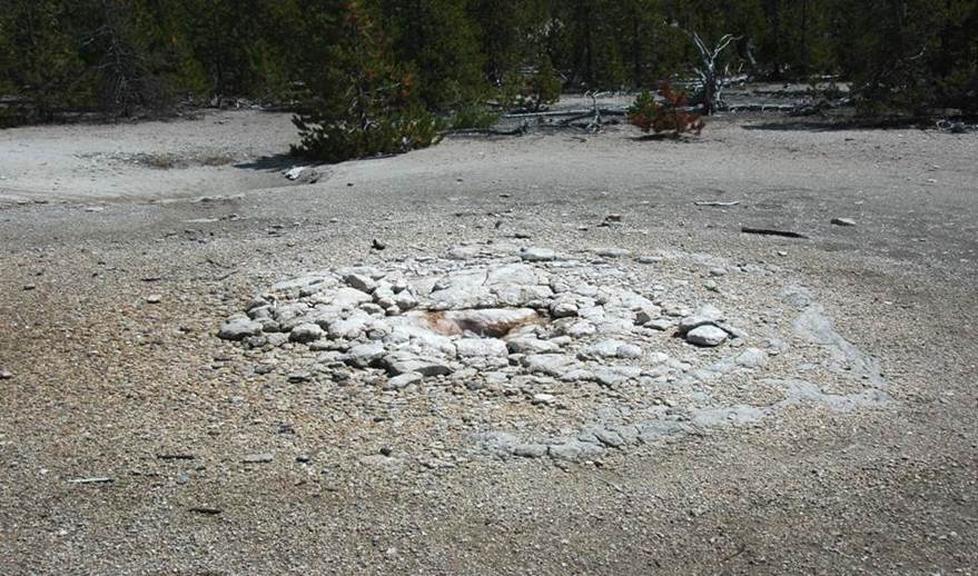
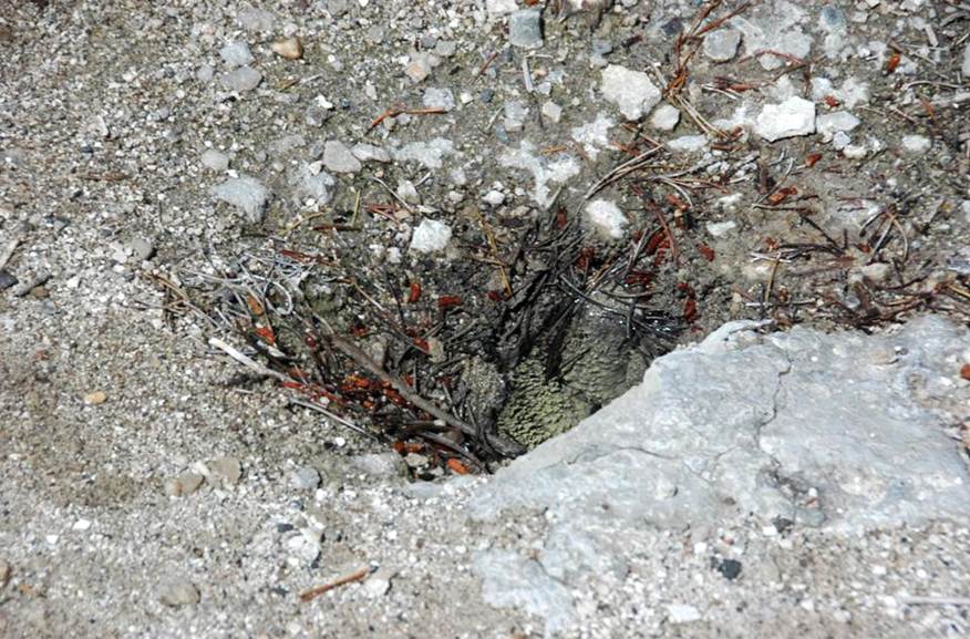
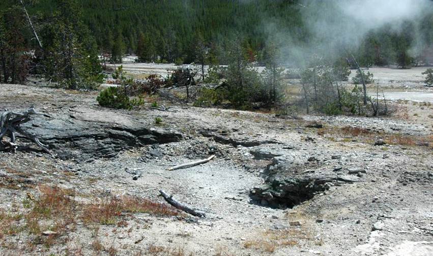
Forgotten Fumarole, northern Back Basin, central Norris
Geyser Basin, Yellowstone Hotspot, northwestern Wyoming, USA on 9 August 2011
(looking ~SW).
This feature usually acts as a fumarole
(steam vent), but geyser eruptions occurred during the 2000s, some up to 30 feet
high. The vent is surrounded by
weathered, whitish-gray, irregularly layered to blocky geyserite (apparently
including cemented geyserite rubble).
Info. mostly synthesized from:
Bryan, T.S. 2008. The Geysers of Yellowstone, Fourth Edition. Boulder, Colorado. University Press of Colorado. 462 pp.
Christiansen, R.L. & R.A.
Hutchinson. 1987. Rhyolite-basalt volcanism of the Yellowstone
Plateau and hydrothermal activity of Yellowstone National Park, Wyoming. pp. 165-172 in Geological
Society of America Centennial Field Guide Volume 2 - Rocky Mountain Section. Boulder, Colorado. Geological Society of America.
Dyer, B.D.
2003. A Field Guide to Bacteria.
Ithaca, New York. Cornell
University Press. 355 pp.
Hendrix, M.S. 2011. Geology Underfoot in Yellowstone Country. Missoula, Montana. Mountain Press Publishing Company. 302 pp.
Margulis, L. & K.V. Schwartz. 1998. Five Kingdoms, an Illustrated Guide to the
Phyla of Life on Earth. New York
City. W.H. Freeman and Company. 520 pp.
Paperiello, R. 1985. Report on the Norris Geyser Basin for 1984. 286 pp.
Schreier, C. 1987. A Field Guide to Yellowstone’s Geysers, Hot
Springs and Fumaroles. Moose,
Wyoming. Homestead Publishing. 96 pp.
United States Geological Survey - 1990s to
2000s geochemistry data set.
White, D.E., R.A. Hutchinson & T.E.C.
Keith. 1988. The geology and remarkable activity of Norris
Geyser Basin, Yellowstone National Park, Wyoming. United
States Geological Survey Professional Paper 1456. 84 pp.
1 pl.
Yellowstone Association. 2011. Norris Geyser Basin Trail Guide. [12] pp.
Yellowstone National Park’s Research
Coordination Network - 1998 geochemistry data set.