MT. PINATUBO
Mt. Pinatubo's 1991 eruption was the largest on Earth
since 1912 (see
pictures; see
more pictures). Pinatubo's big eruption is also famous for having
been successfully predicted by American volcanologists. The prediction
& subsequent evacuation saved thousands of lives.
Located near the western margin of Luzon Island in the
northern Philippines, Mt. Pinatubo is one of several subduction zone
stratovolcanoes in the Luzon Volcanic Arc. Published information
indicates that Pinatubo is >35,000 years old and is composed principally of
dacitic and andesitic rocks.
The mid-June 1991 eruptions from Pinatubo blanketed
ash, pumiceous lapilli, and pumice over the surrounding countryside, including
two American military bases (Clark & Subic Bay). The samples shown
below are dacite pumice (air fall tephra) from the 15 June 1991 eruption
collected at the U.S. Subic Bay Naval Base, ~20 miles south of Mt. Pinatubo.
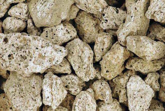
Dacite pumice (air-fall tephra) from the 15 June 1991 eruption of Mt.
Pinatubo. Collected on the grounds of the U.S. Subic Bay Naval
Base. The long axis of the pumice piece at center is 1.9 cm.
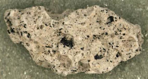
Dacite pumice (3.5 cm across) from the 15 June 1991 eruption of Mt. Pinatubo.
Collected on the grounds of the U.S. Subic Bay Naval Base.

Dacite pumice and dacite ash from the 15 June 1991 eruption of Mt.
Pinatubo. Collected on the grounds of the U.S. Subic Bay Naval Base.
For additional geologic information on the 1991
Pinatubo eruption, see:
Newhall & Punongbayan (1996) - Fire and Mud,
Eruptions and Lahars of Mount Pinatubo, Philippines. Quezon City
& Seattle & London. Philippine Institute of Volcanology and
Seismology & University of Washington Press. 1126 pp.