BEDROCK GEOLOGY OF SAN
SALVADOR ISLAND (BAHAMAS)
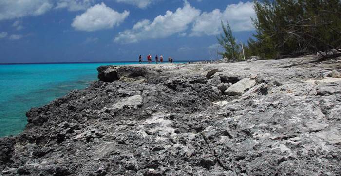
The surface bedrock geology of San Salvador consists
entirely of Pleistocene and Holocene limestones. Thick and relatively
unforgiving vegetation covers most of the island’s interior (apart from inland
lakes). Because of this, the most easily-accessible rock outcrops are
along the island’s shorelines.
The stratigraphic information presented here is
synthesized from the Bahamian geologic literature (see list).
Stratigraphic Succession in the Bahamas
Hanna
Bay Member
Rice Bay Formation
----------------------------
HOLOCENE (<10 k.y.) North
Point Member
Cockburn Town Mbr.
Grotto Beach Formation ----------------------------
lower
Upper
French Bay Member
PLEISTOCENE (119-131 k.y.)
Owl’s Hole Formation Middle PLEISTOCENE
(~215-220
k.y. & ~327-333 k.y. & ~398-410 k.y. & older)
San Salvador’s surface bedrock can be divided into two
broad lithologic categories:
1) LIMESTONES
2) PALEOSOLS
The limestones were deposited during sea level
highstands (actually, only during the highest of the highstands).
During such highstands (for example, right now), the San Salvador carbonate
platform is partly flooded by ocean water. At such times, the “carbonate
factory” is on, and abundant carbonate sediment grains are generated by
shallow-water organisms living on the platform. The abundance of
carbonate sediment means there will be abundant carbonate sedimentary rock
formed after burial and cementation (diagenesis). These sea level
highstands correspond with the climatically warm interglacials during
the Pleistocene Ice Age.
Based on geochronologic dating on various Bahamas
islands, and based on a modern understanding of the history of Pleistocene-Holocene
global sea level changes, surficial limestones in the Bahamas are known to have
been deposited at the following times (expressed in terms of marine isotope
stages, “MIS” - these are the glacial-interglacial climatic cycles
determined from δ18O analysis):
1) MIS 1 - the Holocene, <10 k.y. This
is the current sea level highstand.
2) MIS 5e - during the Sangamonian
Interglacial, in the early Late Pleistocene, from 119 to 131 k.y. (sea level
peaked at ~125 k.y.)
3) MIS 7 - ~215 to 220 k.y. - late Middle
Pleistocene
4) MIS 9 - ~327-333 k.y. - late Middle
Pleistocene
5) MIS 11 - ~398-410 k.y. - late Middle
Pleistocene
Bahamian limestones deposited during MIS 1 are called
the Rice Bay Formation. Limestones deposited during MIS 5e are
called the Grotto Beach Formation. Limestones deposited during MIS
7, 9, 11, and perhaps as old as MIS 13 and 15, are called the Owl’s Hole
Formation. These stratigraphic units were first established on San
Salvador Island (the type sections are there), but geologic work elsewhere has
shown that the same stratigraphic succession also applies to the rest of the
Bahamas.
During times of lowstands (= times of climatically
cold glacial intervals of the Pleistocene Ice Age), weathering and
pedogenesis results in the development of soils. With burial and
diagenesis, these soils become paleosols. The most common paleosol
type in the Bahamas is calcrete (a.k.a. caliche; a.k.a.
terra rosa). Calcrete horizons cap all Pleistocene-aged stratigraphic
units in the Bahamas, except where erosion has removed them. Calcretes
separate all major stratigraphic units. Sometimes, calcrete-looking
horizons are encountered in the field that are not true paleosols.
SAN SALVADOR LIMESTONES
HANNA BAY MEMBER of the RICE
BAY FORMATION
Hanna Bay Member of the upper Rice Bay Formation at Grotto
Beach. This is the youngest bedrock unit on San Salvador Island.
These well-sorted limestones consist of sand-sized
grains of aragonite (CaCO3). On the continents, many quartz
sandstones are technically called quartz arenites. Because the
sand grains making up these Bahamian rocks are calcareous (composed of calcium
carbonate), the limestones are called calcarenites. When examined
microscopically, the calcareous sand grains can be seen touching each other -
the rock is grain-supported. This results in an alternative name
for these Bahamian limestones - grainstones. “Calcarenite” seems
to be a more useful, more thoroughly descriptive term for these particular
rocks, so I use that, versus “grainstone” (although “calcarenitic grainstone”
could be used as well). The little-used petrologic term aragonitite
could also be applied to these aragonitic limestones.
Hanna Bay Member limestones are more or less
planar-bedded, and gently dip toward the modern ocean. The seaward dip,
the sorting, the occurrence of more coarse-grained, finely fragmented seashell
horizons, plus preserved sedimentary structures on some bedding planes such as bubble
porosity and swash lines (see photo below), indicate that these Hanna Bay
Member rocks represent beach deposits. At other localities, the
Hanna Bay Member includes back beach dune facies.
At the locality shown above (Grotto Beach), the lithified
beach deposits are exposed two meters above current, mean sea
level. Some geologists have taken this as evidence for a mid-Holocene
highstand, and that modern sea level is lower than it was during
portions of the mid-Holocene. A similar conclusion has been reached based
on geologic evidence from elsewhere in the New World and the Old World. Recent
work on this very Hanna Bay Member outcrop has thrown doubt on the validity of
the mid-Holocene highstand interpretation.
The aragonite sand grains in the Hanna Bay Member are
principally bioclasts (worn mollusc shell fragments & coral skeleton
fragments & calcareous algae fragments, etc.) and peloids (tiny, pellet-shaped
masses composed of micrite/very fine-grained carbonate - some are likely
microcoprolites, others are of uncertain origin).
Age:
~3200 years old, Holocene (MIS 1), although the whole-rock dates vary somewhat,
depending on specific sampling site.
Locality:
shoreline outcrop along the southwestern margin of Grotto Bay, southwestern San
Salvador Island.
Bubble porosity and subtle swash line preserved on a calcarenite
bedding plane in Hanna Bay Member limestones (upper Rice Bay Formation,
Holocene, ~3.2 ky.) at Grotto Beach, southwestern San Salvador Island.
Hanna Bay Member limestones of the upper Rice Bay Formation at a Graham’s
Harbour shoreline outcrop, between Singer Bar Point and the Bahamas Field
Station, northern margin of San Salvador Island. The bedding has a
seaward dip (the modern ocean is to the right). The rocks at this
shoreline outcrop range from representing beach facies to back-beach dune
facies (the latter is represented at this very spot).
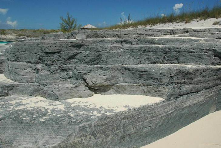
NORTH POINT MEMBER of the RICE
BAY FORMATION
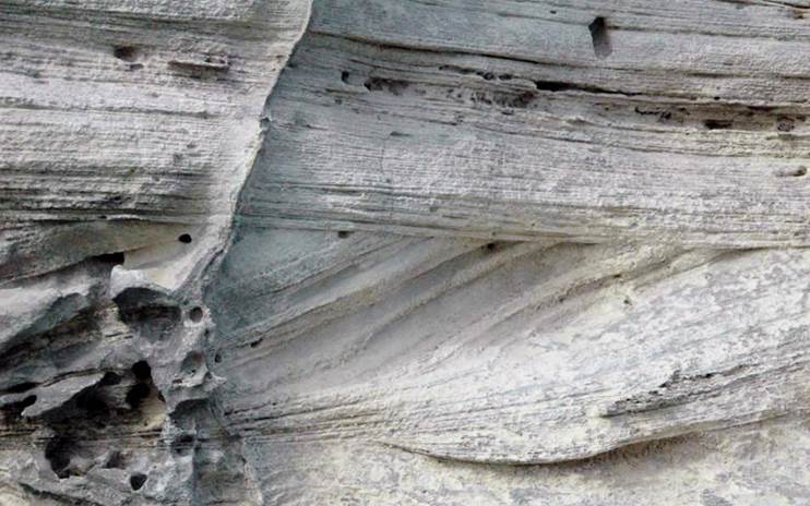
North Point Member of the lower Rice Bay Formation at Cut Cay. As are
the Hanna Bay Member rocks shown above, the North Point Member consists of
well-sorted calcarenite limestones (calcarenitic grainstones/aragonitites).
Notice that the above outcrop has horizontal bedding
(at left) and low- to high-angle cross bedding (at center and right). The
grain size and sorting and cross-bedded nature of these rocks indicates they
are ancient sand dune deposits (wind-blown). Calcarenites deposited in
ancient dune facies are called eolianites (“eolian” means “wind”).
The aragonite sand grains in the North Point Member are principally bioclasts
and peloids.
The cross-bedding extends below modern sea level at
least two meters, indicating that these sand dunes were originally deposited
when sea level was lower than now. This means that the North Point
Member limestones are older than the Hanna Bay Member limestones - this
is consistent with the more or less steady sea level rise throughout the
Holocene.
Age:
~5300 years old, middle Holocene (MIS 1).
Locality:
shoreline outcrop along the southwestern margin of Cut Cay, just north of North
Point Peninsula, northeastern corner of San Salvador Island.
North Point Member of the Rice Bay Formation (middle to upper Holocene)
- eolian, planar-bedded & cross-bedded aragonitic calcarenites along the
western side of North Point Peninsula, northeastern corner of San Salvador
Island.
North Point Member of the Rice Bay Formation (middle to upper Holocene)
- eolian, aragonitic calcarenites along the eastern side of North Point Peninsula,
northeastern corner of San Salvador Island.
North Point Member of the Rice Bay Formation (middle to upper Holocene)
- eolian, cross-bedded, aragonitic calcarenites along the western side of North
Point Peninsula, northeastern corner of San Salvador Island. The lower
portions of the crossbeds are drowned, continuing underwater for at least two
meters. They represent sand dune deposition when sea level was at least
two meters below current sea level.
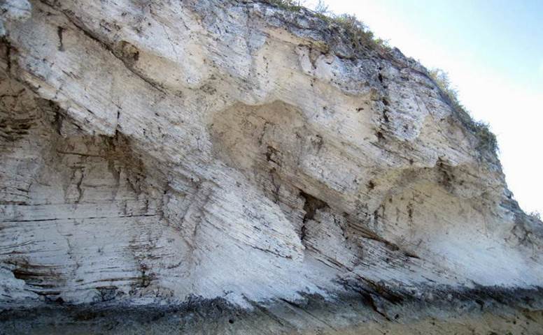
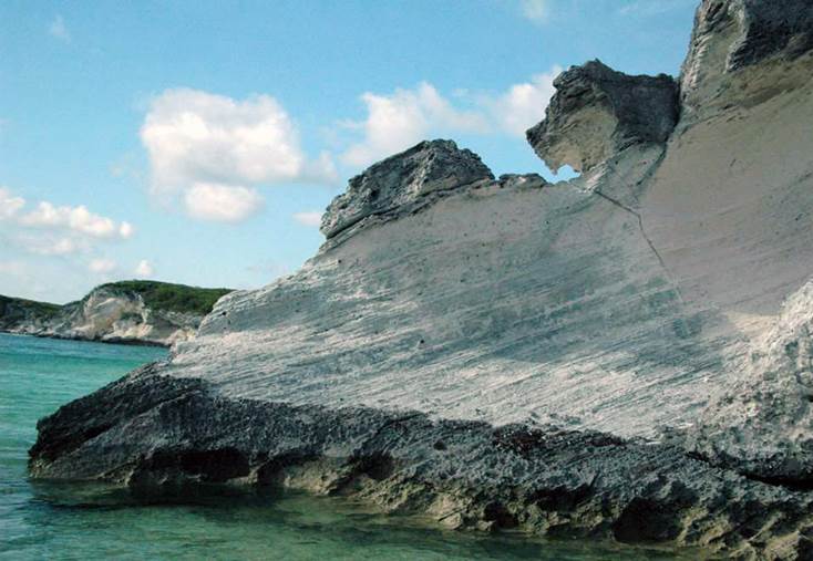
Eolianite/Dune facies of the COCKBURN TOWN
MEMBER of the GROTTO BEACH FORMATION
Cockburn Town Member (eolianite/dune facies) of the upper Grotto Beach
Formation at a roadcut in southwestern San Salvador Island.
During the stillstand and regressive phases of the MIS
5e sea level highstand event, wind-blown sand dunes were present on the
then-smaller land portion of ancient San Salvador. The outcrop shown
above consists of well-sorted, horizontally-bedded and variously cross-bedded
aragonitic calcarenites. These are MIS 5e sand dune deposits (eolianites).
Fossilized plant root traces are moderately common at this roadcut (but not at
this very spot), which is characteristic of sand dunes deposited during the
stillstand and regressive phases of Bahamian carbonate platform highstand
events.
The sand grains in Cockburn Town Member eolianites are
principally oolites, resulting in terrestrial oolitic limestones (oolitic
calcarenites). The oolites originally formed in the shallow water portion
of the flooded carbonate platform surrounding the island. Oolites are
sand-sized, well-rounded, calcareous, concentrically-layered grains formed by
rolling on the seafloor as a result of high-energy wave action in shallow
water. Fair-weather waves & storm waves deposited shallow seafloor
oolites on ancient beaches, after which winds picked them up to form oolitic
sand dunes further inland.
Age:
~119-122 k.y., Sangamonian, lower Upper Pleistocene (middle to late MIS 5e).
Locality:
roadcut adjacent to the Watling’s Blue Hole overlook platform, southwestern San
Salvador Island.
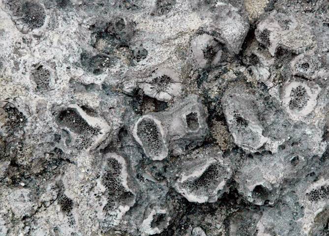
Reef facies of the COCKBURN TOWN MEMBER of
the GROTTO BEACH FORMATION
Cockburn Town Member (reef facies) of the upper Grotto Beach Formation at
the type locality, Cockburn Town Fossil Reef, western margin of San Salvador
Island.
The Cockburn Town Fossil Reef is one of the
best-preserved and well-exposed Pleistocene fossil reefs on Earth. It
consists of non-bedded to poorly-bedded, poorly-sorted, very coarse-grained,
aragonitic fossiliferous limestones (grainstones and rubblestones),
representing shallow marine deposition in reef and peri-reef facies.
Cockburn Town Member reef facies rocks date to the MIS 5e sea level highstand
event (~131-119 ky).
The outcrop shown above principally consists of
bivalve packstone, dominated by Chione elevata (fossil cross-barred
venus clam shells).
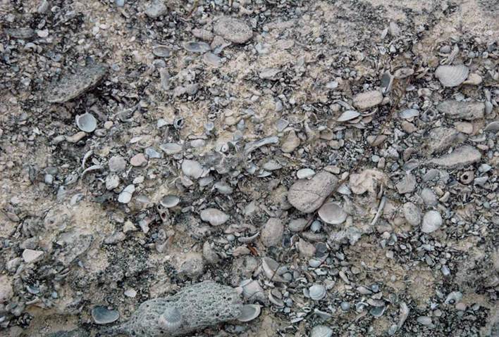
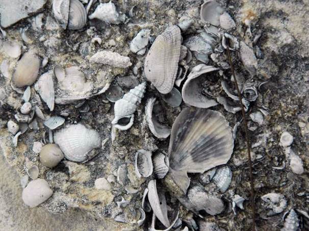
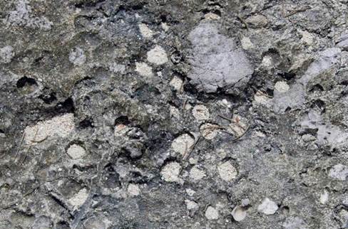
Mollusc-rich fossiliferous grainstones (above & below) from the reef facies of the
Cockburn Town Member, upper Grotto Beach Formation at the Cockburn Town Fossil
Reef, western margin of San Salvador Island.
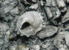
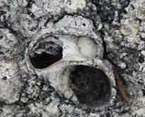
Above left: Astralium phoebium fossil star snail shell.
Above center: Conus fossil cone snail shell.
Above right: Cittarium pica fossil magpie snail shell.
Below:
fossil bivalves and gastropods, including Acar notabilis, Chione elevata,
Ceritihium, etc.
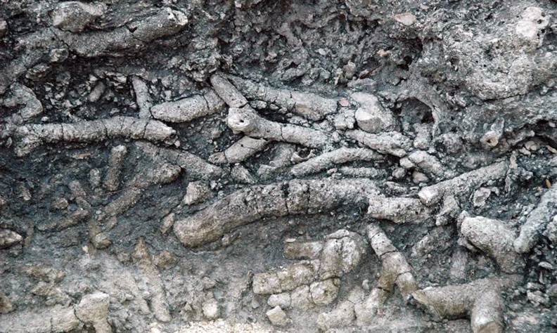
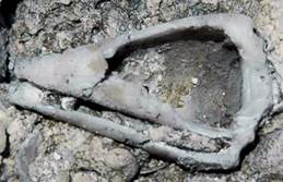
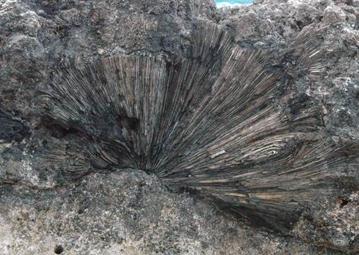
Acropora cervicornis rubblestone (above & below) in the Cockburn Town
Fossil Reef, ~125 k.y. (Sangamonian Interglacial, MIS 5e). The thick
branching structures are fossil, broken staghorn coral skeletons (Acropora
cervicornis).
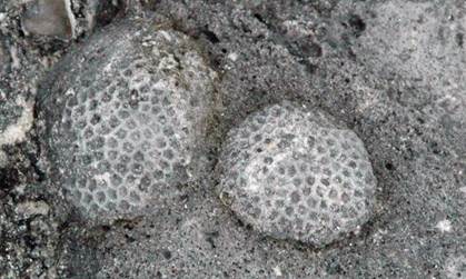
Porites porites - in-situ fossil clubbed finger coral colony
in the Cockburn Town Fossil Reef, ~125 k.y. (Sangamonian Interglacial, MIS 5e).
Pocillopora palmata - in-situ fossil cauliflower coral colony in
the Cockburn Town Fossil Reef, ~125 k.y. (Sangamonian Interglacial, MIS
5e). This is the only coral genus that went extinct in the Caribbean at
the end-Pleistocene.
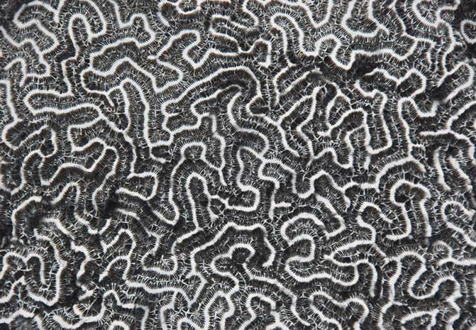
Diploria strigosa - fossil brain coral in the Cockburn Town Fossil
Reef, ~125 k.y. (Sangamonian Interglacial, MIS 5e).
Diploria
- in-situ fossil brain coral colony in the Cockburn Town Fossil
Reef. Notice that this fossil brain coral is encrusting an irregular
surface. This surface is an unconformity and is traceable throughout the
outcrop. It represents a limestone hardground surface that formed during
a short-lived, mid-5e regression at ~124 k.y., called the Devil’s Point
Event. After the event, at ~123 k.y., high sea level returned. This
coral was one of the earliest inhabitants of this locality’s shallow seafloor
after the mid-5e regression. The more deeply flooded carbonate platforms
in the Bahamas, such as Mayaguana Island, were not as significantly affected by
the mid-5e regression.
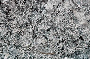
Devil’s Point Hardground (~123-124 k.y.) with encrusting scleractinian coral
colonies (above left) and unidentified “spaghetti” encrusters (above right) and
borings (below) at Cockburn Town Fossil Reef, western margin of San Salvador
Island.
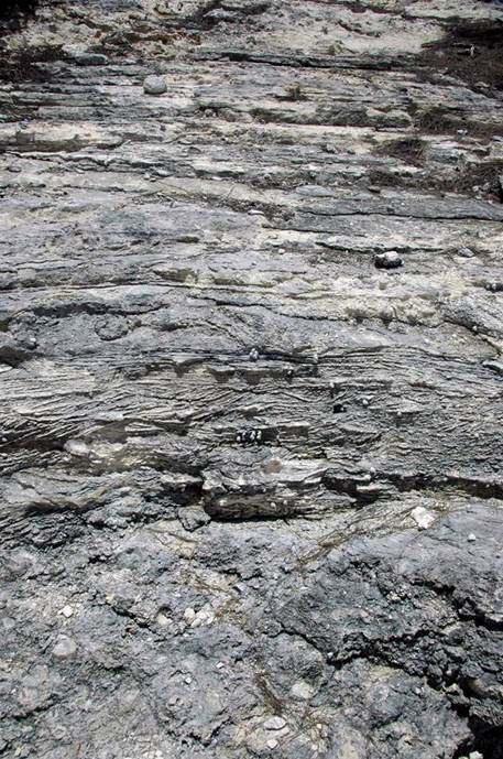
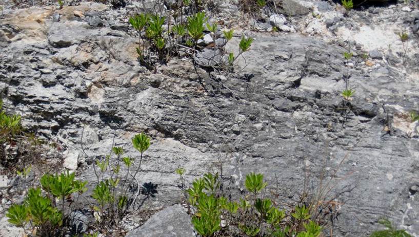
Cockburn Town Member of the upper Grotto Beach Formation at the Cockburn
Town Fossil Reef, western margin of San Salvador Island. The three
aragonitic limestone units shown here represent a shallowing-upward
(regressive) succession.
The basal unit is non-bedded, poorly-sorted,
coarse-grained, shallow subtidal, fossiliferous grainstones. The middle
unit is trough cross-bedded and herringbone cross-bedded calcarenites deposited
in a very shallow subtidal setting subjected to tidal pumping. The top
unit is ~planar-bedded calcarenites having parting lineation representing swash
zone and supratidal beach deposits. These three units are in conformable
contact, and well display a transition from subtidal to intertidal to
supratidal beach facies.
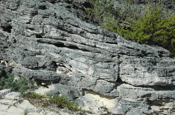
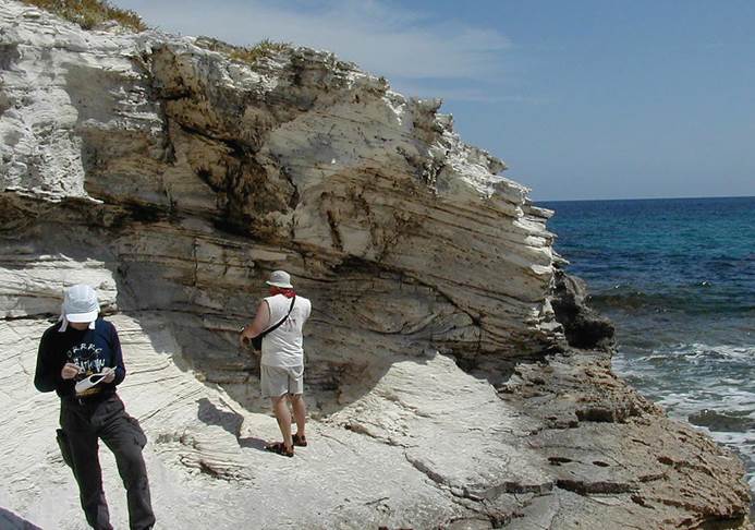
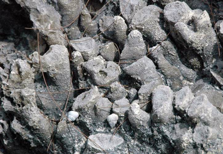
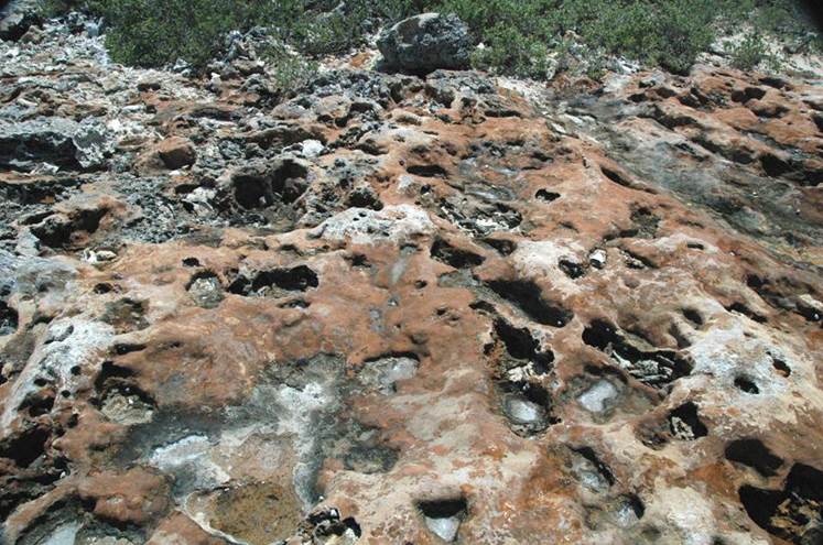
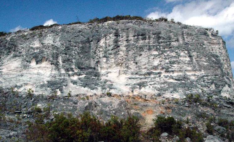
OWL’S HOLE FORMATION
Owl’s Hole Formation at Watling’s Quarry (southwestern San Salvador
Island) - this is the oldest surface-exposed stratigraphic unit on the
island. It outcrops in relatively few places (for example, Watling’s
Quarry, Owl’s Hole Cave, Grotto Beach, around Stouts Lake, on the southern side
of South Granny Lake, west of southern Storr’s Lake, and in the Reckley Hill
Settlement Pond-Crescent Pond-Pain Pond area, and in the Dixon Hill
area). Only subaerial/terrestrial facies of the Owl’s Hole Formation are
known to outcrop here. Beach facies, shallow subtidal facies, and reef
facies of the same age are presumably only now present in the subsurface.
The Owl’s Hole Formation is an upper to middle Middle Pleistocene unit.
Deposition occurred during the MIS 7, 9, 11, and perhaps 13 and 15 (see Kindler
et al., 2010), highstands (= warm interglacial intervals) of the Pleistocene
Ice Age. Deposits from each highstand are generally separated by calcrete
paleosols or otherwise recognizable hiatuses/truncation surfaces. The
orangish-brown areas in the upper left parts of the photo represent a weathered
calcrete paleosol.
The weathered outcrop shown above is a well-sorted,
aragonitic calcarenite interpreted as having formed in a dune facies (=
eolianite limestones). Sand grains in the Owl’s Hole Formation are
dominated by bioclasts, as in the Rice Bay Formation, but unlike the
Grotto Beach Formation (oolites are the dominant calcarenite grain type there).
SUBSURFACE STRATIGRAPHY OF SAN
SALVADOR ISLAND
The island’s stratigraphy below the Owl’s Hole
Formation was revealed by a core drilled down ~168 meters (~550-feet) below the
surface (for details, see Supko, 1977). The well site was at 3 meters
above sea level near Graham’s Harbour beach, between Line Hole Settlement and
Singer Bar Point (northern margin of San Salvador Island). The first 37
meters were limestones. Below that, dolostones dominate, alternating with
some mixed dolostone-limestone intervals. Reddish-brown calcretes
separate major units. Supko (1977) infers that the lowest rocks in the
core are Upper Miocene to Lower Pliocene, based on known Bahamas Platform
subsidence rates.
In light of the successful island-to-island
correlations of Middle Pleistocene, Upper Pleistocene, and Holocene units
throughout the Bahamas (see the Bahamas geologic literature), it seems
reasonable to conclude that San Salvador’s subsurface dolostones may correlate
with sub-Pleistocene dolostone units exposed in the far-southeastern portions
of the Bahamas Platform.
Recent field work on Mayaguana Island has resulted in
the identification of Miocene, Pliocene, and Lower Pleistocene surface outcrops
(see Pascal Kindler’s 2010 talk on the subject). On Mayaguana, the
worked-out stratigraphy is:
- Rice Bay Formation (Holocene)
- Grotto Beach Formation (Upper
Pleistocene)
- Owl’s Hole Formation (Middle
Pleistocene)
- Misery Point Formation (Lower
Pleistocene)
- Timber Bay Formation (Pliocene)
- Little Bay Formation (Upper Miocene)
- Mayaguana Formation (Lower Miocene)
The
Timber Bay Fm. and Little Bay Fm. are completely dolomitized. The
Mayaguana Fm. is ~5% dolomitized. The Misery Point Fm. is nondolomitized,
but the original aragonite mineralogy is absent.
I
wouldn’t be surprised if careful comparison of the San Salvador core (if it
still exists & is accessible) with Mayaguana outcrops results in some
definitive correlations (sounds like a good Ph.D. project for someone).
SAN SALVADOR PALEOSOLS
Paleosol
- the dominant paleosol type on San Salvador Island (& other Bahamian
islands) consists of hard, reddish-brown to orangish-brown colored,
irregularly-sculpted crusts. These are referred to as calcretes or
caliches or terra rosas.
Calcrete paleosols cap all of the Pleistocene-aged
stratigraphic units, except where removed by erosion. The Holocene-aged
units (Hanna Bay Member & North Point Member of the Rice Bay Formation)
haven’t been around long enough to develop calcrete paleosols atop their
outcrops.
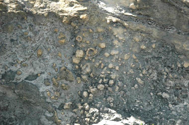
Calcrete paleosol (orangish-brown horizon) separating eolian
calcarenites of the Middle Pleistocene Owl’s Hole Formation (below) from eolian
calcarenites of the Upper Pleistocene Grotto Beach Formation (above) at
Watling’s Quarry, southwestern San Salvador Island.
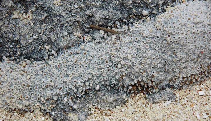
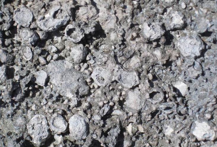
Pisolites (above & below) - pisolites are moderately large versions of
oolites - they’re >2 mm-sized, subspherical to ellipsoidal, concentrically
to irregularly concentrically laminated structures, commonly composed of
calcium carbonate (as these are). They are often perceived to be biogenic
in origin. Pisolites are not uncommon below calcrete/caliche paleosol
horizons.
Above:
carbonate soil pisolites in basket structure underneath a calcrete paleosol
capping eolian calcarenite limestones of the Grotto Beach Formation (lower
Upper Pleistocene, MIS 5e, 119-131 k.y.) at Watling’s Quarry, southwestern San
Salvador Island.
Below:
carbonate soil pisolites exposed by erosion of a calcrete paleosol
horizon. This paleosol caps the Cockburn Town Member of the Grotto Beach
Formation (lower Upper Pleistocene, MIS 5e, 119-131 k.y.) just east of “The
Notch”, eastern part of southern margin of San Salvador Island.
References cited
Supko,
P.R. 1977. Subsurface dolomites, San Salvador, Bahamas. Journal
of Sedimentary Petrology 47: 1063-1077.
Kindler,
P., J.E. Mylroie, H.A. Curran, J.L. Carew, D.W. Gamble, T.A. Rothfus, M.
Savarese & N.E. Sealey. 2010. Geology of Central Eleuthera,
Bahamas: a Field Trip Guide. Gerace Research Centre. San
Salvador, Bahamas. 74 pp.
Other
San Salvador geology literature