CAVES AND KARST
Several categories of karst (dissolutional features in
soluble rocks such as limestone) exist on islands in the Bahamas. Common
small-scale karst features include phytokarst and solution tubes.
Large-scale karst features include flank margin caves, pit caves, banana holes,
lake drains, and blue holes.
Info. on this page is mostly synthesized from Mylroie
& Carew (2008).
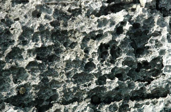
Phytokarst - irregular, sharp-edged, small-scale karst is developed on most
exposed limestone surfaces (this one is at North Point Peninsula, northeatern
corner of San Salvador Island). Synonyms for phytokarst include
“epikarst” and “biokarst” and “eogenetic karren”. Phytokarst is the
result of several inorganic and biologic processes. These include
preferential cementation of otherwise unlithified young limestones by sea
spray, differential dissolution by slightly acidic rainwater, cyanobacterial
& algal boring activities, and gastropod radular scraping. As an
example of the latter, note the Tectarius antonii false pricklywinkle
snail at lower left. The snail uses its mineralized radula to scrape away
and consume biofilms on the rocks. This is one type of bioerosion.
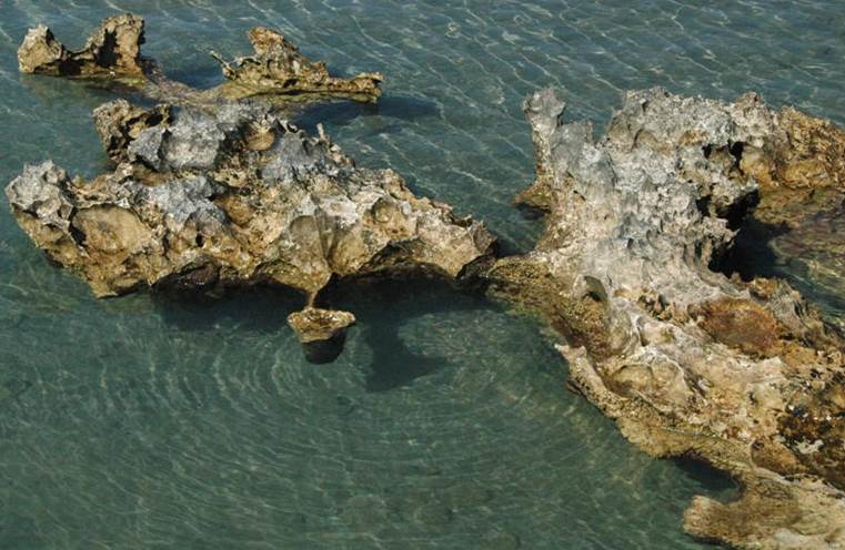
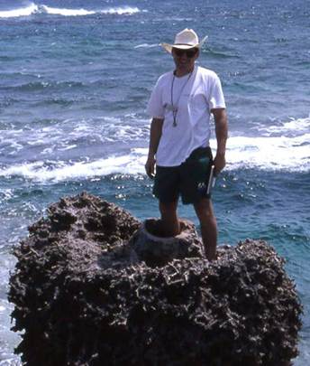
“Swiss Cheese Limestone” at Pain Pond, a small
inland lake near the northeastern corner of San Salvador Island. Bahamian
islands are often said to be composed of swiss cheese, in reference to the
significant degree of macroscale dissolutional porosity in the limestone
bedrock. This remarkable outcrop at Pain Pond has extremely
irregularly-karstified limestone.
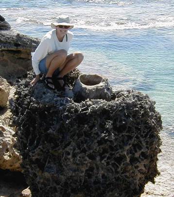
“Swiss Cheese Limestone” along western shore of
Pain Pond, northeastern San Salvador Island. Rainwater doesn’t run off into
rivers or streams on carbonate islands in the Bahamas. Rainwater moves
downward via small to large conduits that lead to the water table.
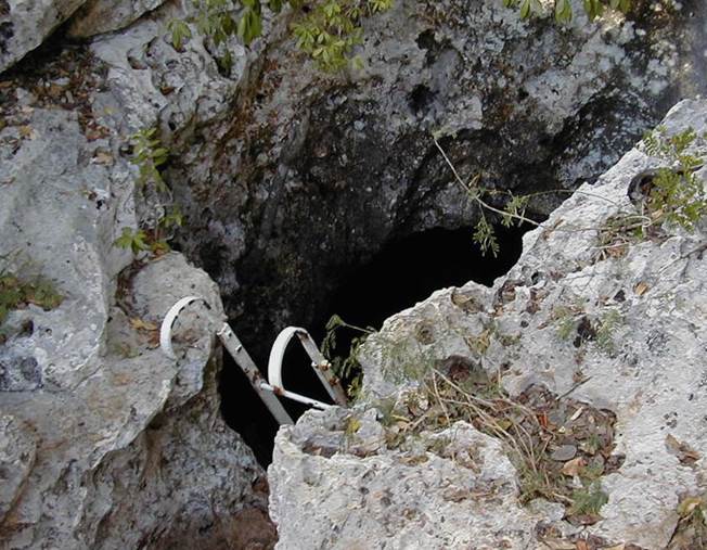
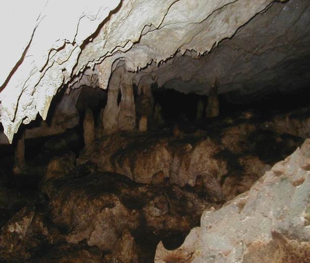
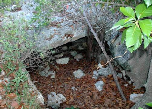
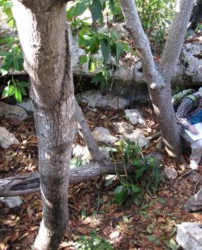
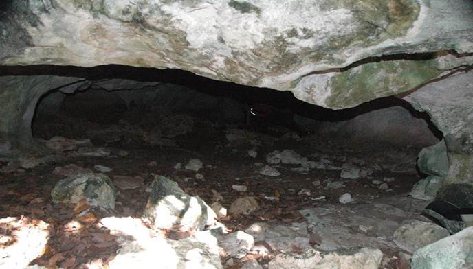
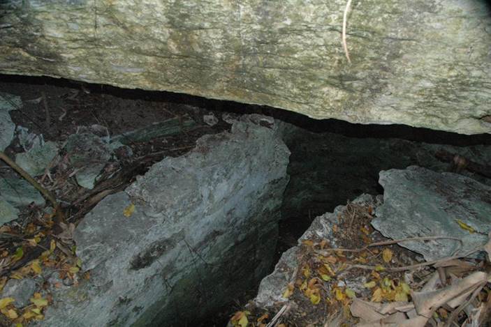
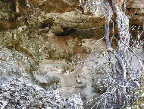
Lighthouse Cave (above & below) - flank margin cave near Dixon
Hill Lighthouse, northeastern San Salvador Island (above: Main Entrance
to Lighthouse Cave; below: speleothem in Lighthouse Cave’s main
chamber).
Lighthouse Cave is hosted in eolian, cross-bedded,
aragonitic calcarenite limestones of the Owl’s Hole Formation (Middle
Pleistocene). This cave is a classic example of a flank margin cave.
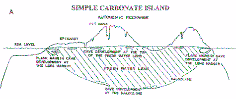
They form at the flanks of carbonate islands and at the margins of
fresh-groundwater lenses. As such, flank margin caves are phreatic
features. In the vinicity of the seawater-freshwater mixing zone
(halocline) of a groundwater lens (see diagram),
relatively rapid dissolution of limestone occurs. Limestone dissolution at Lighthouse Cave
occurred during the MIS 5e highstand (early Late Pleistocene 119-131 k.y.).
Flank margin caves have no surface entrances.
Access to flank margin caves occurs only after surficial erosion
intercepts chambers or passages.
Lighthouse Cave was drained of water during the
long-duration lowstand accompanying the Wisconsinan Glaciation (middle &
late Late Pleistocene). Today, the lowest levels of Lighthouse Cave are
partially flooded. Tidal fluctuations indicate connectivity with the
ocean.
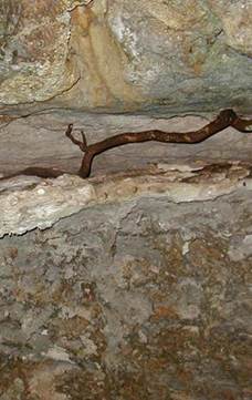
Dripstone speleothem (stalactites, stalagmites,
columns) composed of travertine is common at Lighthouse Cave. Published
information indicates that speleothem formation has occurred since about 71
k.y. Bell holes, bell pits, and sawteeth draperies are also
present.
Garden Cave (above & below) - this is an erosional remnant of a much larger
flank margin cave on a Pleistocene-aged, lithified sand dune ridge between
Reckley Hill Pond and Crescent Pond in northeastern San Salvador Island.
The original cave ceiling has mostly collapsed.
The cave is partially filled with fine-grained sediments, limestone
rubble, and soil.
Below:
phreatic cave passage in Garden Cave (looking NNW).
Watling’s Well Banana Hole (just south of Sandy Point Manor House, a.k.a.
“Watling’s Castle”) (above & below) - banana holes are relatively small,
relatively low caves having a subcircular shape in plan view. They are
phreatic dissolutional features that formed at the top of an ancient
groundwater lens (at the water table), away from the margins of a carbonate
island. Like flank margin caves, banana holes originally had no entrances
to the surface. With erosional denudation of limestone bedrock surfaces,
banana hole ceilings collapse, resulting in a cave entrance.
The banana hole shown above was modified during the
late 1700s to early 1800s by the placement of well for drinking water.
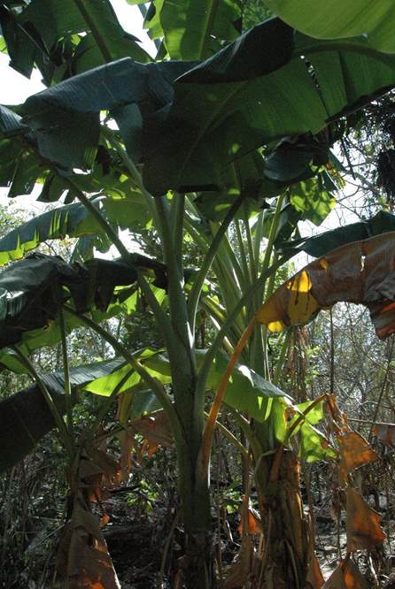
Musa acuminata Colla, 1820 - banana trees (Plantae,
Angiospermophyta, Zingiberales, Musaceae) in Watling’s Well Banana Hole,
southern San Salvador Island. These are left over from the 1800s
plantation era.
Once the ceiling of a banana hole collapses, the cave
becomes a local depocenter for sediment and organic debris. This results
in the development of a decent soil (decent for the Bahamas). In the
plantation era, the soils in banana holes were used to grow certain
agricultural crops such as banana trees (they are not true trees, however).
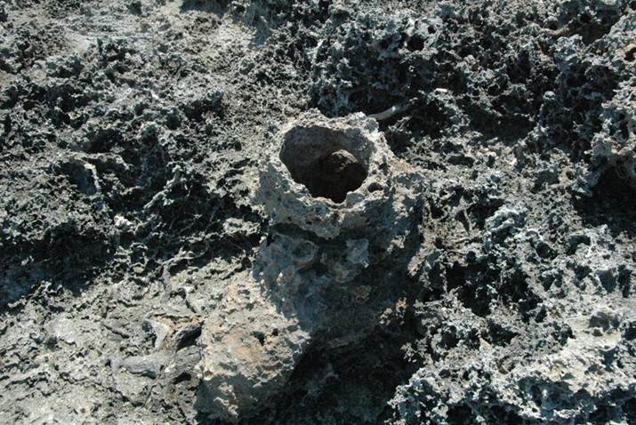
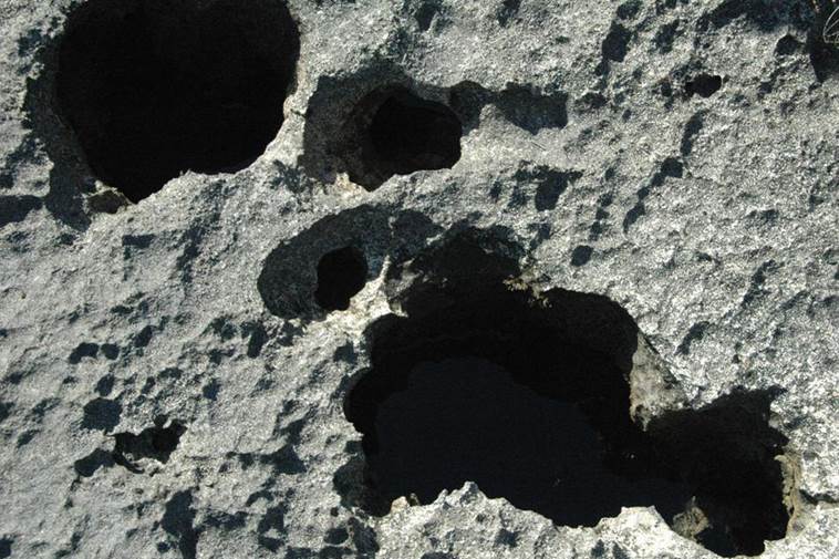
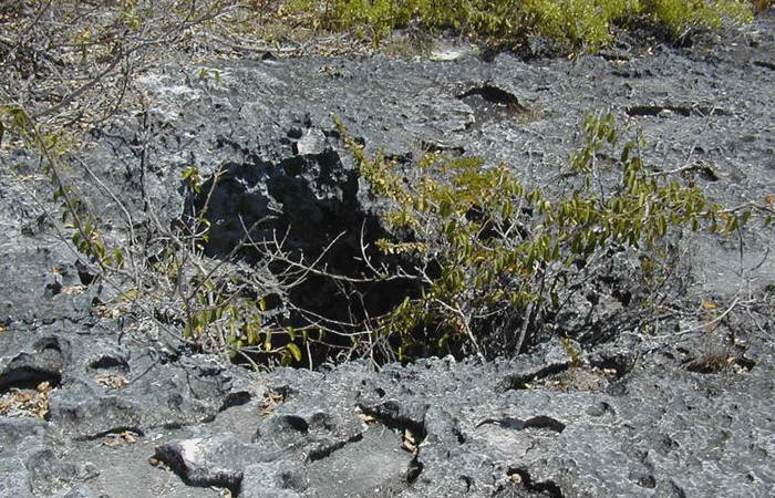
Solution tube - solution tubes and pit caves (see below) are vertically-oriented,
subcylindrical, vadose dissolutional features. These structures formed as
small scale pathways for conduit flow, likely vegemorphs (plant root traces),
were dissolutionally enlarged. The conduit linings were sites of calcium
carbonate precipitation. Differential weathering and erosion resulted in
this solution tube projecting above the surrounding rocky surface. Note
the abundant phytokarst.
Locality:
near Owl’s Hole Cave, southwestern San Salvador Island.
“Palmetto Structure” - calcium carbonate
cementation around this solution tube penetrated far into the surrounding
limestone bedrock, which is rich in vegemorphs. Differential weathering
and erosion resulted in a large, somewhat barrel-shaped structure locally
called the “Palmetto Structure”.
Locality:
The Bluff, northern Snow Bay, eastern margin of San Salvador Island.
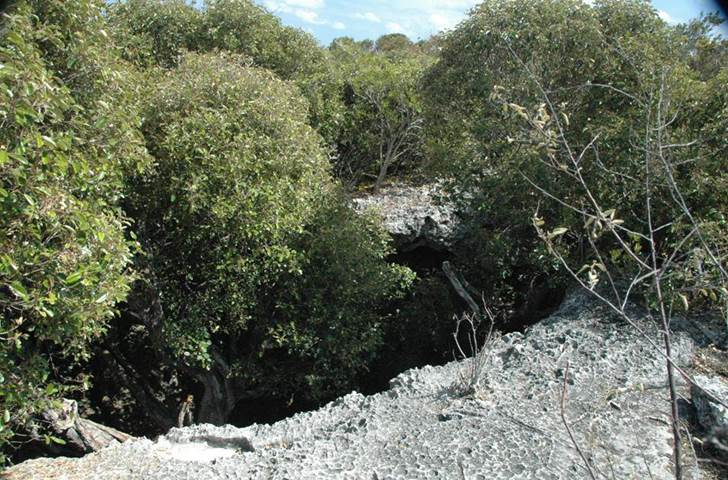
Pit Cave
- small pit cave near Owl's Hole Cave (southwestern San Salvador Island).
Pit caves are enlarged solution tubes. They descend vertically 5 to 10
meters (Mylroie & Carew, 2008) and have irregularly subcircular plan-view
shapes.
Owl’s Hole Cave (above & below) - this large pit cave in
southwestern San Salvador Island drops down ten meters into the Middle
Pleistocene. The cave originally penetrated further than that, but it is
filled with sediments. The limestones at the rim are Grotto Beach
Formation (lower Upper Pleistocene, 119-131 k.y.).
Owl’s Hole Cave (above & below)
Above left: the upper 8 meters of the Owl’s Hole Pit Cave consists of eolian
aragonitic oolitic calcarenites of the Grotto Beach Formation (lower Upper
Pleistocene, MIS 5e, 119-131 k.y.). This is a bench about 3 meters down
from the rim of the pit cave.
Above right: the lowest 2 meters consists of eolian aragonitic bioclastic
calcarenites of the Owl’s Hole Formation (Middle Pleistocene, MIS 7/9). A
calcrete paleosol separates the two units. The paleosol horizon (=
projecting ledge just below the brown root) is at about 2.5 meters above the
sediment floor of the pit cave.
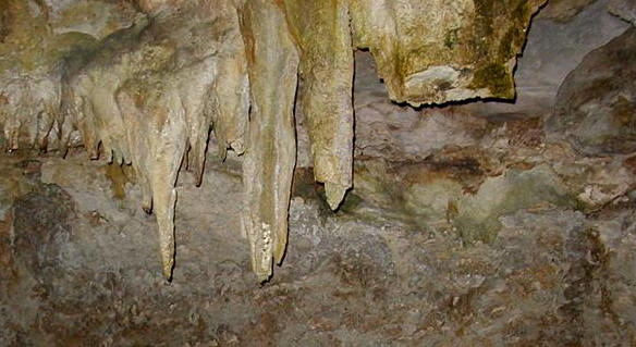
Below:
stalactites (dripstone speleothem), composed of travertine, near the bottom of
Owl’s Hole Cave. The surrounding rocks are Owl’s Hole Formation.
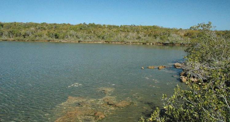
Pain Pond - San Salvador Island has numerous inland ponds and lakes that range
in salinity from normal marine to hypersaline to hyposaline to brackish.
Many of these lakes have obvious tidal fluctuations, indicating that there is
connectivity with the ocean. The nature of the plumbing system between
the ocean and the inland lakes is largely unknown. Lakes having tidal
fluctuations usually have an obvious lake drain (see below) through
which water enters and exits.
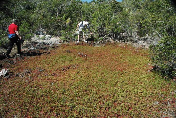
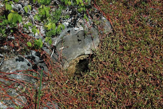
Purslane Pit (above & below) - this ephemeral inland pond is normally covered
in a greenish & reddish, low-growing succulent called the sea purslane, Sesuvium
portulacastrum (Plantae, Angiospermophyta, Caryophyllales,
Aizoaceae). A small opening in the limestone bedrock on the western side
of the depression is a lake drain. Most lake drains reported in
the San Salvador geology literature are small. Some are big enough for a
person to enter. Underwater exploration of larger lake drains has shown
they do not extend far before narrowing to inaccessability. See Godfrey
et al. (1994) for more info.
Above:
Purslane Pit, looking ~west. The lake drain is the small grayish area
where the person at center is pointing.
Below:
lake drain for Purslane Pit.
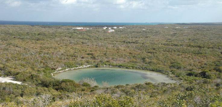
Blue Hole (Watling’s Blue Hole, southwestern San Salvador Island) - blue holes
are large, water-filled, subcylindrical voids that extend well below sea
level. Blue holes can be oceanic or inland (as is the
example shown above). Blue hole waters range in salinity from fresh to
marine. Multiple plausible mechanisms have been proposed for the origin
of blue holes (e.g., see Mylroie & Carew, 2008, p. 31).
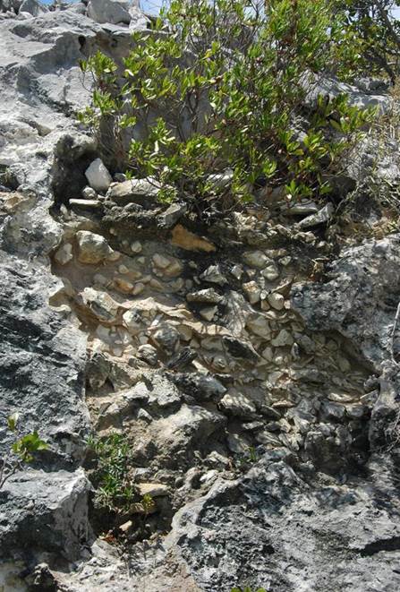
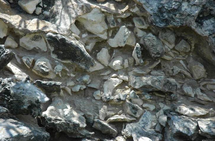
Breccia-filled solution pit (above & below) - this outcrop shows breccia
filling a former void that extended >2 meters below the preserved rim.
The rocks surrounding the filled solution pit are eolian aragonitic calcarenite
limestones of the Grotto Beach Formation (lower Upper Pleistocene, MIS 5e,
119-131 k.y.). The clasts are angular pebbles and cobbles of the same
calcarenite material. Calcrete paleosol material is present in the lowest
parts of the pit (just below the large green plant at lower left). Clasts
likely filled the pit episodically.
Locality:
first north-facing roadcut east & uphill from Sandy Point beach, near the
southwestern-most corner of San Salvador Island.
References cited:
Godfrey, P.J., D.C. Edwards, R.R. Smith & R.L.
Davis. 1994. Natural History of Northeastern San Salvador
Island: a “New World” Where the New World Began, Bahamian Field Station Trail
Guide. 28 pp.
Mylroie, J.E. & J.L. Carew. 2008. Field
Guide to the Geology and Karst Geomorphology of San Salvador Island.
88 pp.