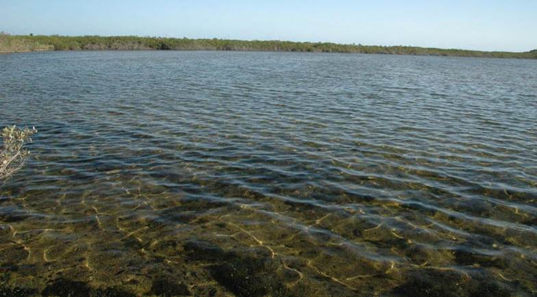
INLAND LAKES & PONDS
ON SAN SALVADOR ISLAND
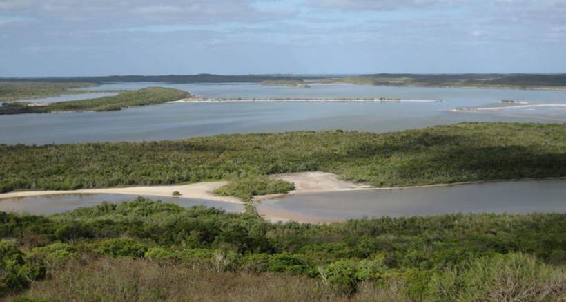
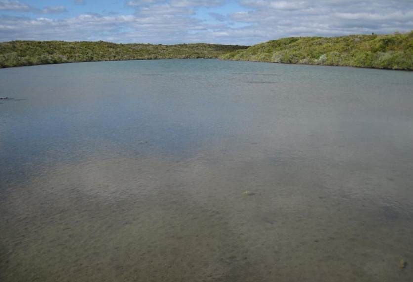
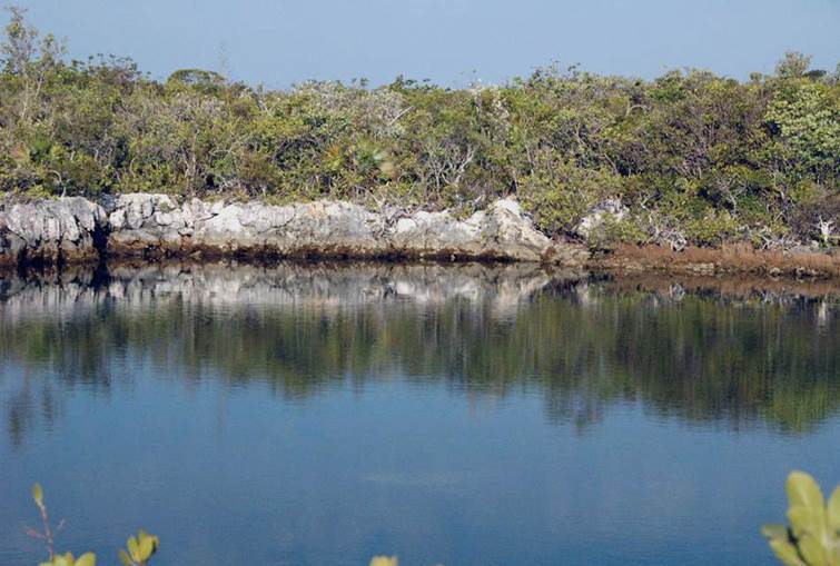
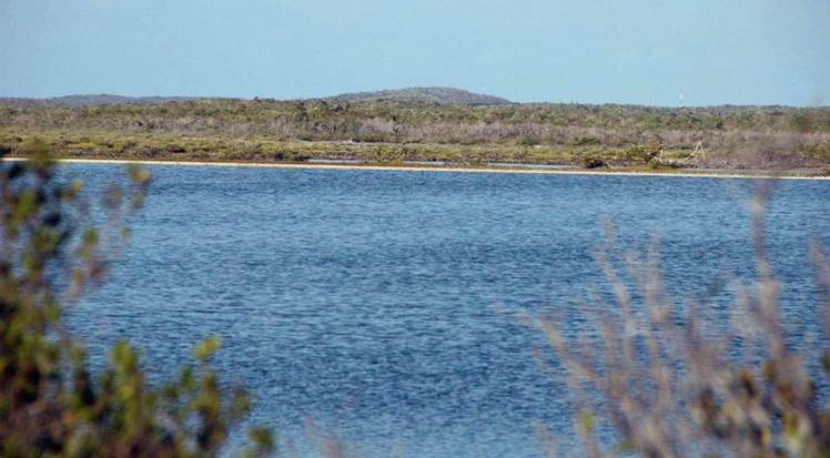
Inland lakes and ponds (view of Northeast Arm Lake from atop Dixon Hill
Lighthouse; looking W) - San Salvador Island has numerous inland bodies of
water. Christopher Columbus remarked upon them during his visit in October
1492. These ponds and lakes can have freshwater, brackish water,
hyposaline water, normal marine-salinity water, or hypersaline water.
Many of these lakes have aquatic biotas quite distinctive from adjacent lakes.
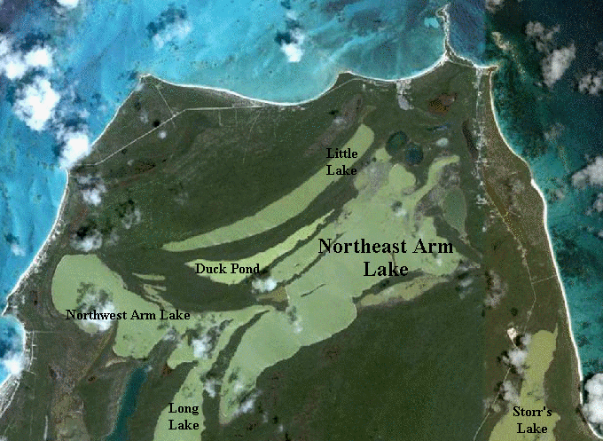
Much of the northeastern San Salvador lakes
information presented below is synthesized from Godfrey et al. (1994) and
Mylroie & Carew (2008) (see citations at bottom of page).
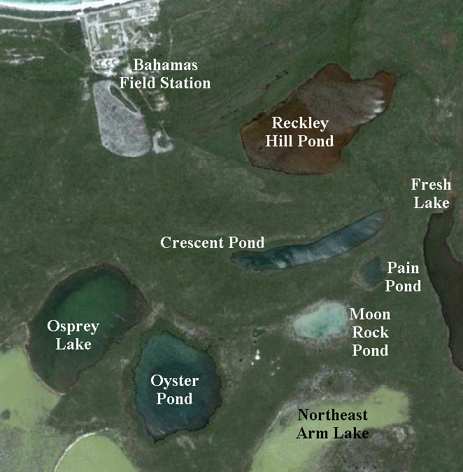
RECKLEY HILL POND
Reckley Hill Pond (looking ~NW) - this hyposaline to hypersaline lake
just southeast of the Bahamas Field Station is also known as Reckley Hill
Settlement Pond or Merrill’s Pond or Coast Guard Pond. Reported water
salinities range from 18 to 66 ppt, averaging around 47 ppt (cf. normal marine
water at about 35 ppt). I measured 45 ppt salinity here on 24 March 1999.
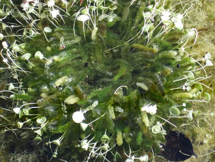
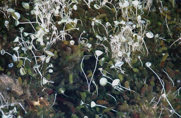
Batophora oerstedi Agardh, 1854 (= dark green fuzzy structures) & Acetabularia
crenulata Lamouroux, 1816 (= whitish to whitish-green cup structures on
thin stalks) (above & below). The most common algae seen along the
southern shoreline of Reckley Hill Pond are two green algae species - fuzzy
finger algae (Batophora oerstedi - Plantae, Chlorophyta, Dasycladales,
Dasycladaceae) and white mermaid’s wine glass algae (Acetabularia crenulata
- Plantae, Chlorophyta, Dasycladales, Polyphysaceae).
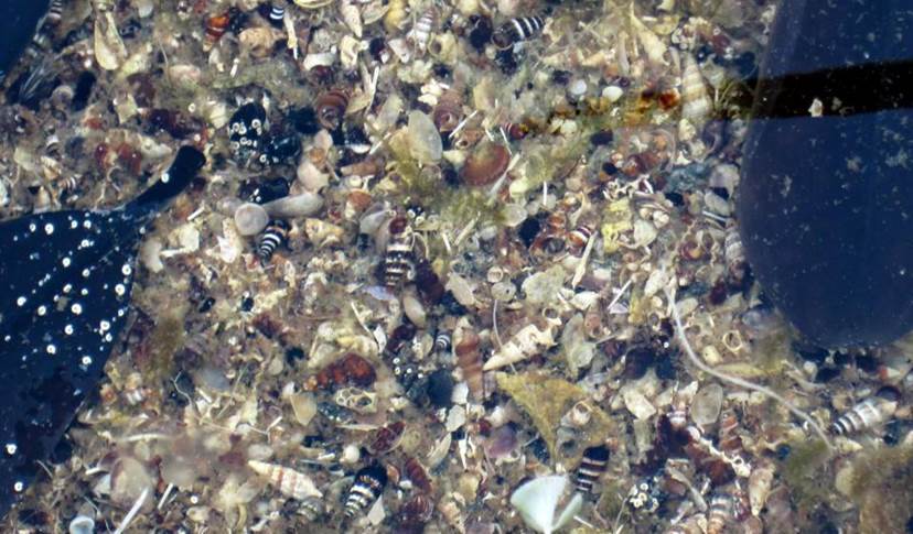
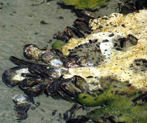
Molluscan lake sediments - Reckley Hill Pond lakefloor sediments are
overwhelmingly dominated by mollusc shells and broken mollusc shells.
Most of the shells seen above are batillariiid snails (black & white
stripes - Batillaria minima), cerithiid snails (Cerithium lutosum),
potamidid snails (brown - Cerithidea costata), and bivalves
(whitish-gray - Anomalocardia auberiana & Polymesoda maritima).
Note the small, white-colored, coiled structures
attached to the large, black leaf at left - those are Spirorbis worm
tubes (Annelida, Polychaeta, Sabellida, Spirorbidae).
Reckley Hill Pond Conduit - this lake drain occurs near the southeastern corner
of the lake. Reckley Hill Pond experiences tides. Because of the
pond’s elevation, tidal inflows occur only during and near times of spring high
tides (= extra high-high tides). Reported salinites of water entering the
lake from this conduit are 36 to 38 ppt - just above normal marine
values. The rocks around the conduit are limestones of the Cockburn Town
Member of the Grotto Beach Formation (lower Upper Pleistocene, Sangamonian, MIS
5e, 119-131 k.y.).
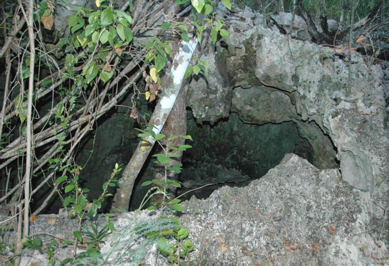
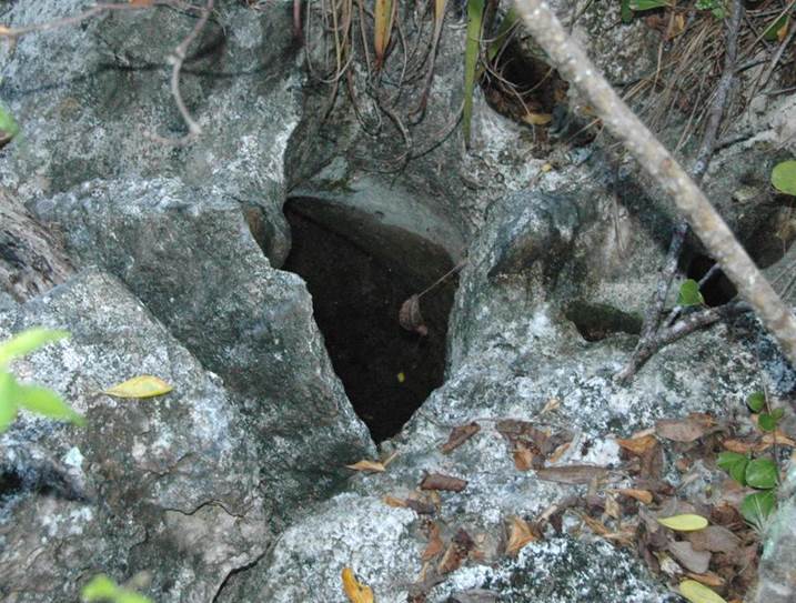
Reckley Hill Pond Water Cave - this is the entrance to one of three small caves
near the eastern shore of the lake, just northeast of Reckley Hill Pond Conduit
(see above). Published research has shown that a small stream flowing
through this particular cave leads to the Reckley Hill Pond Conduit. The
rocks here are limestones of the Cockburn Town Member of the Grotto Beach
Formation (lower Upper Pleistocene, Sangamonian, MIS 5e, 119-131 k.y.).
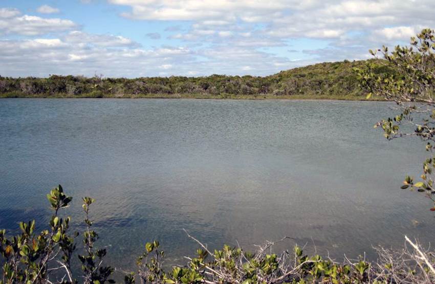
CRESCENT POND
Crescent Pond (a.k.a. No Name Pond) (looking ~WSW) - this gently curving, E-
to ENE-trending, inland lake in northeastern San Salvador Island occurs in a
depression between two Pleistocene-aged sand dune ridges (now lithified to
aragonitic calcarenite limestones).
Crescent Pond has slightly higher-than-normal marine
salinities at 36 to 38 ppt. I measured 38 ppt here on 22 March
2009. The pond has three significant lake drains (conduits) on the
southern side, near its western end. Water flow from these conduits into
the lake is moderately energetic during flood tides, resulting in visible boils
at the lake surface.
Isognomon alatus (Gmelin, 1791) - the thin, black-colored shells
encrusting Crescent Pond’s shoreline rocks here are mangrove oysters (Animalia,
Mollusca, Bivalvia, Pteroida, Isognomonidae). The greenish algae are Cladophoropsis
macromeres Taylor, 1928 (Plantae, Chlorophyta, Siphonocladales,
Boodleaceae).
Arenicola cristata Stimpson, 1856 - egg mass of the Atlantic lugworm
(Animalia, Annelida, Polychaeta, Capitellida, Arenicolidae) in eastern Crescent
Pond.
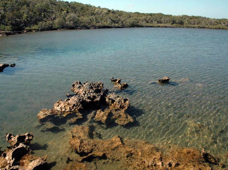
PAIN POND
Pain Pond (above & below) (looking ~WNW above & looking ~SW below) -
Pain Pond is a small lake having a lake drain/conduit on the eastern side, along
a “swiss-cheese limestone” rocky shoreline. The water’s salinity is
near-normal marine, around 36 ppt. I measured 36 to 37 ppt salinity on 24
March 1999.
Easily observed organisms include Cerithium
snails, Arenicola cristata (Atlantic lugworm) egg masses, and Cyprinodon
variegatus sheepshead minnows.
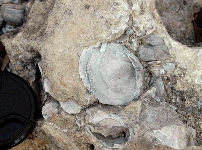
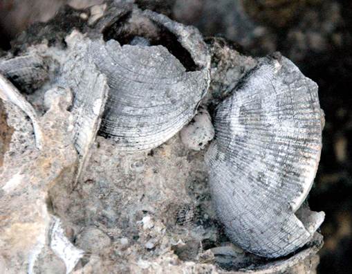
Codakia
limestone just west of Pain Pond (camera lens for scale). The large
fossil shells are the tiger lucine clam, Codakia orbiculata (Linnaeus,
1758). This is part of the Cockburn Town Member of the Grotto Beach
Limestone (lower Upper Pleistocene, Sangamonian, MIS 5e, 119-131 k.y.).
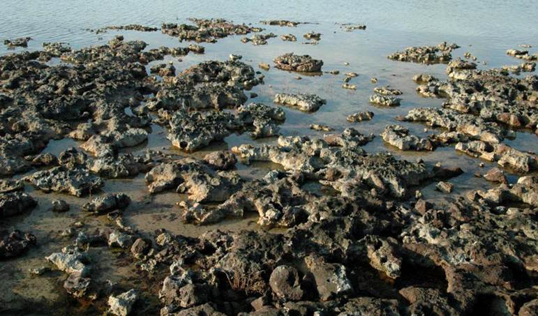
MOON ROCK POND
Moon Rock Pond (looking ~SE) - the name of this lake is in reference
to the extensive “swiss cheese limestone” outcrops along much of its shoreline,
especially on the northern side (see below). The large-scale limestone
macroporosity somewhat resembles craters on the Moon. I measured 39 ppt
salinity here on 22 March 2009.
Whitish, fine-grained aragonite lakefloor sediments
are common in this pond. The sediments appear to originate from CaCO3
precipitation events in the lake following rainstorms. During such
events, Moon Rock Pond’s waters turn milky white (for the full story, see Davis
in Godfrey et al., 1994, p. 26).
Codakia
limestone at the northeastern corner of Moon Rock Pond. The large fossil
shells are the tiger lucine clam, Codakia orbiculata (Linnaeus,
1758). This is part of the Cockburn Town Member of the Grotto Beach
Limestone (lower Upper Pleistocene, Sangamonian, MIS 5e, 119-131 k.y.).
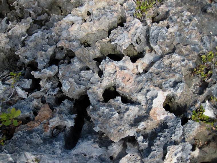
Moon rock (above & below) along the northern shoreline of Moon Rock
Pond. The limestone’s secondary macroporosity has been attributed to
groundwater aggresivity at the mixing zone of lake water and meteoric-derived
groundwater descending toward the lake from the hill to the north. A
lithified dune ridge of Pleistocene-aged aragonitic calcarenite limestones
occurs on the northern side of this pond, separating it from Crescent Pond (see
above).
Mixing zone groundwater aggresivity is the same causal
factor behind development of flank margin caves in the Bahamas.
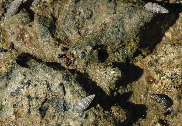
Batillaria snails (Animalia, Mollusca, Gastropoda, Batillariidae) on rocky
western shoreline of Moon Rock Pond.
WILD DILLY POND
Wild Dilly Pond (above & below) (looking ~SW) - this small,
~flat-bottomed lake between Moon Rock Pond and Oyster Pond is lined by
subvertical limestone walls. The rocks are Cockburn Town Member of the
Grotto Beach Formation (lower Upper Pleistocene, Sangamonian, MIS 5e, 119-131
k.y.). The lake drain/conduit is along the limestone wall near the southwestern
corner of the pond. Water salinities are ~normal marine.
The subvertical grooves on the upper part of the
sloping limestone walls are rills, formed by dissolution by slightly
acidic rainwater draining into the pond.

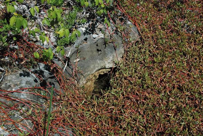
PURSLANE PIT
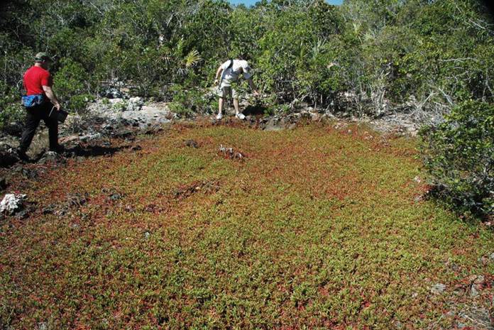
Purslane Pit (above & below) - this very small, ephemeral pond just west of
Wild Dilly Pond is normally covered in a greenish & reddish, low-growing
succulent called the sea purslane, Sesuvium portulacastrum (Plantae,
Angiospermophyta, Caryophyllales, Aizoaceae). The lake drain/conduit is a
small opening in the limestone on the western edge of the depression.
Above:
Purslane Pit, looking ~west. The lake drain is the small grayish area
where the person at center is pointing.
Below:
lake drain for Purslane Pit. The water is reported to be ~normal marine
salinity.
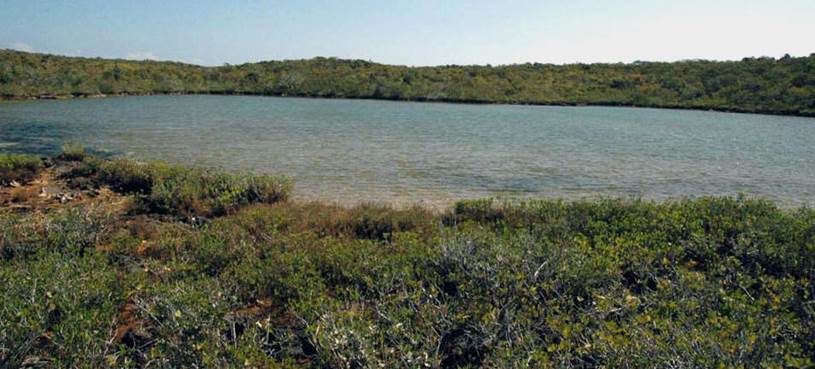
OSPREY LAKE
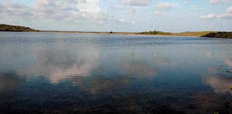
Osprey Lake (a.k.a. Osprey Pond) (above & below) (looking ~SW) - this
medium-sized lake is separated from Northeast Arm Lake (= part of San Salvador
Island’s Great Lake System) by a narrow barrier (see below). Osprey Lake
water salinites are ~normal marine to hypersaline. Water enters and exits
via a lake drain/conduit and a tidal channel in the barrier beach.
References cited:
Godfrey, P.J., D.C. Edwards, R.R. Smith & R.L.
Davis. 1994. Natural History of Northeastern San Salvador
Island: a “New World” Where the New World Began, Bahamian Field Station Trail
Guide. 28 pp.
Mylroie, J.E. & J.L. Carew. 2008. Field
Guide to the Geology and Karst Geomorphology of San Salvador Island.
88 pp.