SHORELINE FEATURES & LIFE
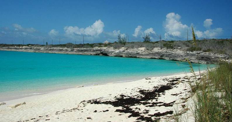
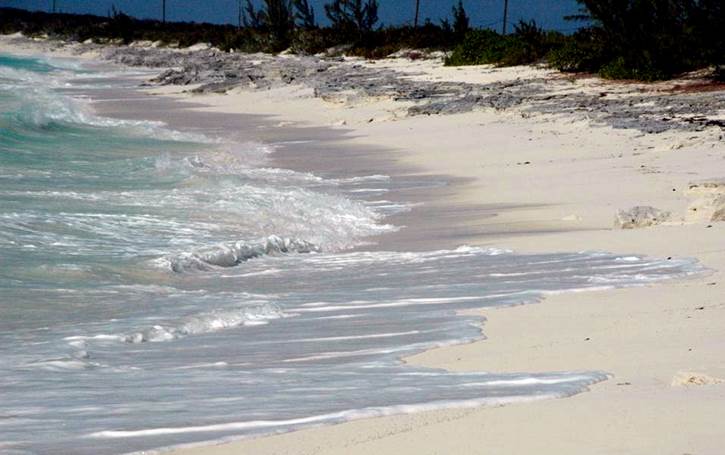
Grotto Beach & Grotto Bay (southwestern San Salvador Island) - all non-rocky
marine shorelines of San Salvador Island are beaches having whitish- to
cream-colored aragonite sand (CaCO3).
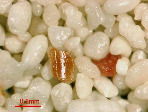
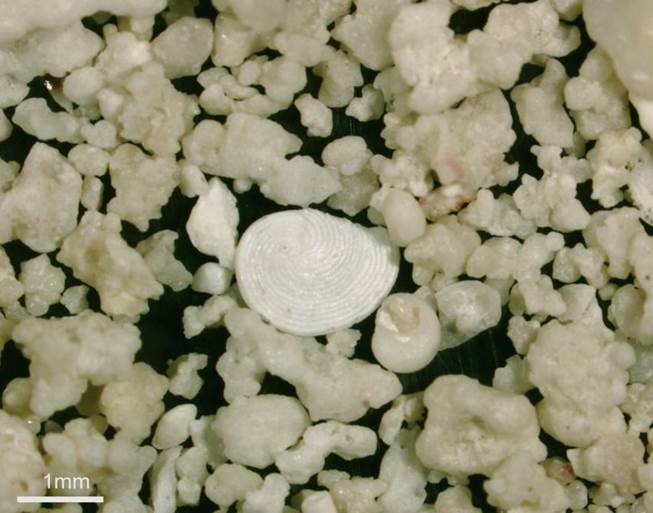
Swash zone aragonite sand from Grotto Beach (locality shown above), which
consists of bioclastic fragments + coated grains (incipient oolites). The
reddish-colored grain at right, in the background, is a skeletal fragment from
an encrusting rotalliid foraminiferan, Homotrema rubrum. Microphotograph
by Sara Beth Kopczynski (Lehigh University, Bethlehem, Pennsylvania, USA).
Barker’s Point (northwestern corner of San Salvador Island) -
aragonite-sand beach abutting a rocky shoreline consisting of epikarstified
aragonitic limestones (“aragonitites”) (Hanna Bay Member, Rice Bay Formation,
upper Holocene).
Swash zone aragonite sand from Barker’s Point (locality shown above), which
consists of an abundance of irregularly-shaped, cemented aggregates of smaller
grains + apparent micromollusc shells + foraminiferan tests (see the large Archaias
angulatus milioline benthic foram at center). Microphotograph by Sara
Beth Kopczynski (Lehigh University, Bethlehem, Pennsylvania, USA).
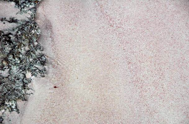
Pink aragonite sand along the western shoreline of North Point Peninsula,
eastern Graham’s Harbour, northeastern San Salvador Island. The pink
coloration is the result of whitish aragonite sand sediments being mixed with
reddish-colored test fragments of the rotaliine foraminiferan Homotrema
rubrum (see the 2nd photo at the top of this page). Homotrema
rubrum is ubiquitous in this area - it encrusts shells, dead coral,
limestone clasts, or any other available hard substrate (see below).
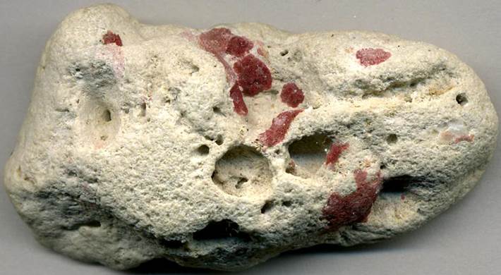
Homotrema rubrum (Lamarck, 1816) (reddish) (Protista, Foraminiferida,
Rotaliina, Homotrematidae) encrusting a modern aragonitic limestone pebble (5.2
cm across at its widest).
Locality:
eastern shore of North Point Peninsula, northeastern San Salvador Island.
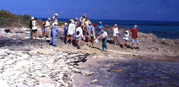
Other San Salvador Island aragonite beach sand samples
under the microscope
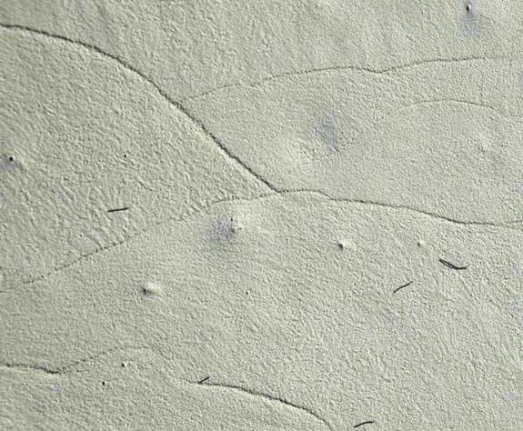
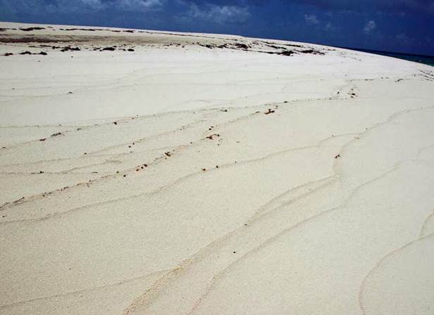
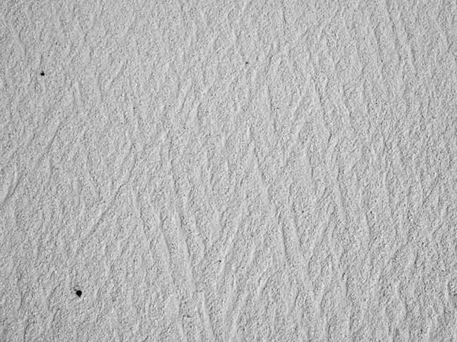
Swash lines on aragonite sand beach, San Salvador Island, eastern Bahamas.
These lines consist of thin ridges of sediment (sometimes mixed with organic
debris), often slightly coarser-grained than surrounding sediments, that mark
the maximum landward extent of water from individual waves washing ashore.
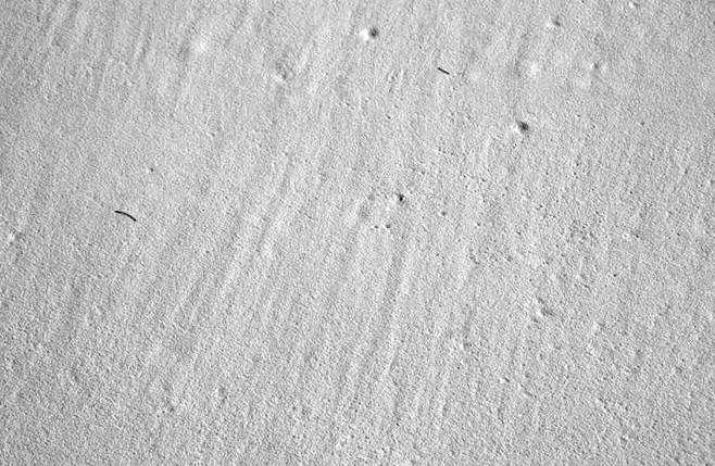
Swash lines on aragonite sand beach at Sandy Point, southwestern corner of San
Salvador Island, eastern Bahamas.
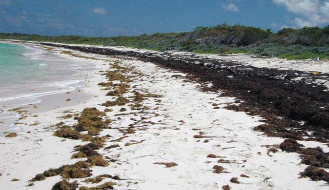
Strand lines on aragonite sand beach (looking ~S), Hanna Bay, northeastern San
Salvador Island. These particular strand lines are dominated by dead and
desiccated “seaweed”, overwhelmingly consisting of Sargassum (brown
algae), with some Thalassia (turtle grass) and Syringodium
(manatee grass) as well. The brownish-colored clumps in the strand line
on the left, near the water, were left “high and dry” by the most recent high
tide. The blackish-colored strand lines on the right, higher up on the
beach, were left by the last high high tide (spring tide).
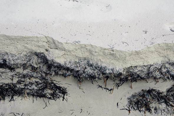
Sargassum-Syringodium-Thalassia seagrass deposit interbedded with
aragonite beach sand. The seaweed-seagrass layer was probably a strand
line similar to those seen in the above photo. Eroded modern beach
deposits at the southwestern corner of North Point Peninsula, northeastern San
Salvador Island.
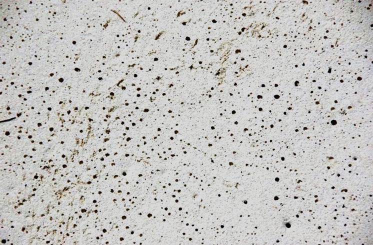
Bubble porosity on aragonite sand beach, San Salvador Island.
These structures occur in the swash zone.
Waves crashing onto beaches results in water moving landward and
elevationally upward before gravity slows the velocity and water returns to the
ocean (see next photo below). Some wave water percolates downward, into
the sediments, displacing air that normally occupies the spaces between
the sand grains. This air moves upward and emerges at the sediment-water
interface in the form of bubbles. After wave water washes back into the
ocean, the sandy surface has an abundance of variably-sized holes, representing
individual bubble emergence sites. This is bubble porosity.
In the carbonate rock record, bubble porosity is thought to be the origin of fenestral
fabric.
Waves
of normal marine water crashing onto aragonite sand beach (shoreline of
Fernandez Bay at Columbus Monument, western margin of San Salvador Island).
Rhomboid ripples on aragonite sand beach (shoreline of Fernandez Bay
at Columbus Monument, western margin of San Salvador Island). Rhomboid
ripples are slender, diamond-shaped structures defined by criss-crossing ridges
of sediment formed in the swash zone during a wave’s backwash phase.
Current lineations on aragonite sandy beach. These shallow grooves
and ridges are essentially perpendicular to shoreline and parallel to the
back-and-forth swash movement of waves. Current lineations form during a
wave’s backwash phase, as are rhomboid ripples (see above). The seaward
direction is “up” on this photo & the landward direction is “down”.
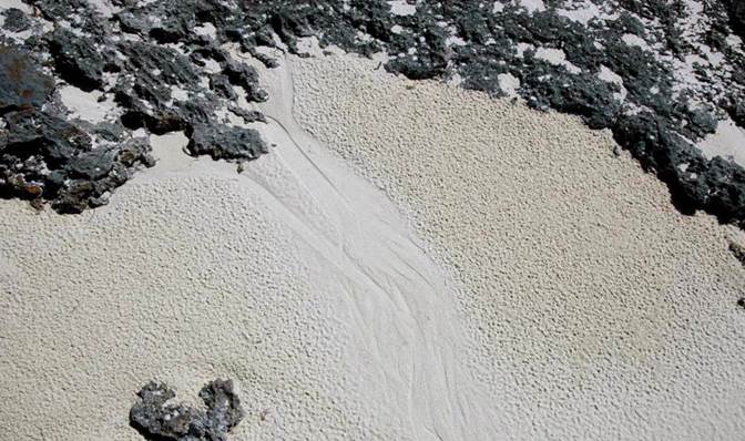
Rill channel and raindrop imprints on aragonite sand beach.
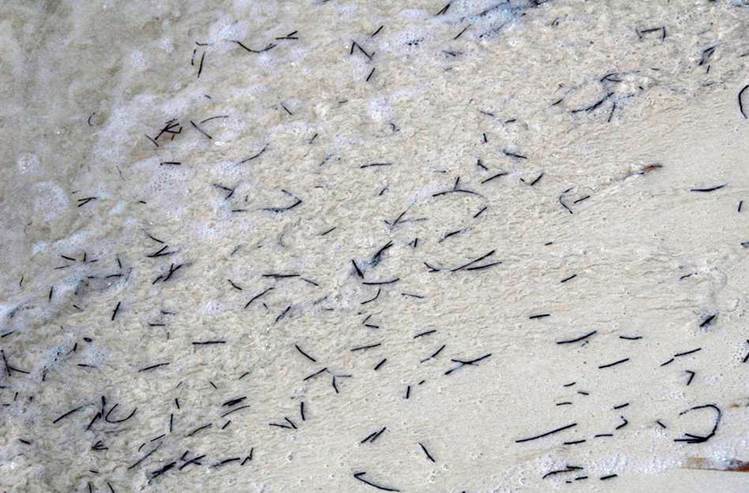
Syringodium and Thalassia seagrass washing ashore on an aragonite sand beach
along the western side of North Point Peninsula, northeastern San Salvador
Island.
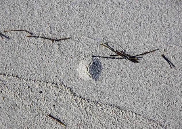
Gas blister (apparently) + strand lines + Syringodium (manatee grass) +
bubble porosity on aragonite sand beach (southern shore of Graham’s Harbour,
northern margin of San Salvador Island).
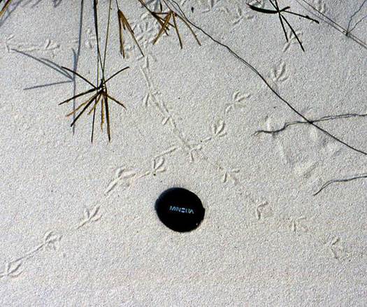
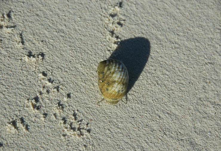
Bird tracks on aragonite sand beach (southern shoreline of Graham’s Harbour,
northern margin of San Salvador Island).
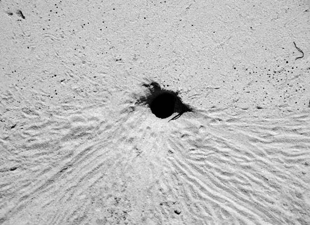
Ghost crab burrow - habitation burrow constructed by Ocypode quadrata
(Fabricius, 1787) (Animalia, Arthropoda, Crustacea, Decapoda, Brachyura,
Ocypodidae).
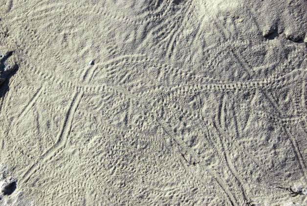
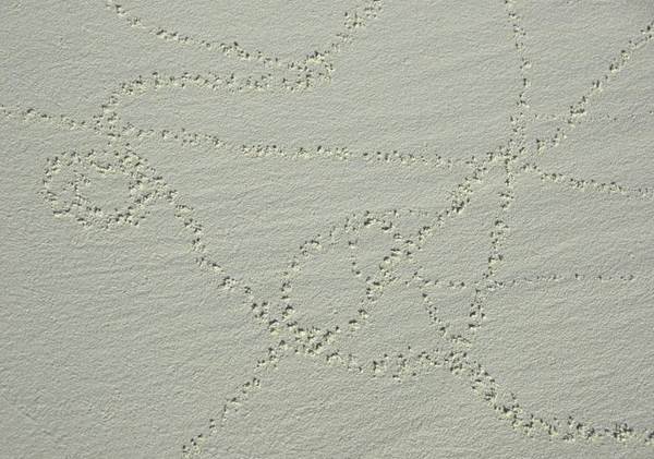
Crab tracks on aragonite sand beach. Many of these are hermit crab tracks.
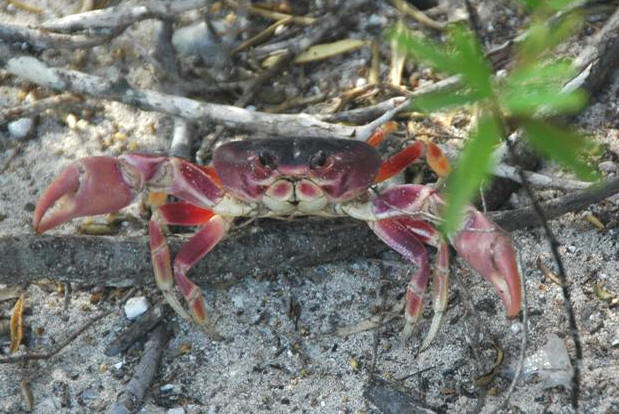
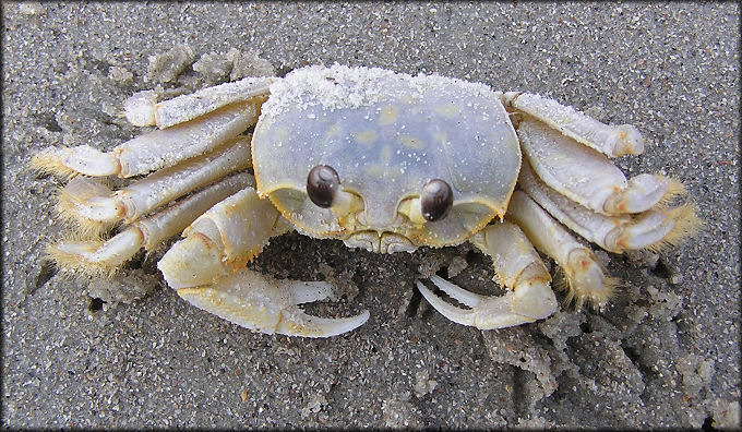
Gecarcinus lateralis (Freminville, 1835) - black-backed land crab
(Arthropoda, Crustacea, Decapoda, Brachyura) in vegetated back-beach facies,
northern margin of San Salvador Island.
Nerita versicolor gastropod feeding trace on aragonite sand beach
(southern shore of Graham’s Harbour, northern margin of San Salvador Island).
Nerita versicolor Gmelin, 1791 (Animalia, Mollusca, Gastropoda, Neritidae)
processing aragonite sand sediment and leaving behind a track of pellet-like
clumps.
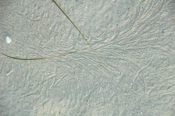
Scratch lines (pseudotraces) on aragonite sand (backbeach, southern shoreline of
Graham’s Harbour, northern margin of San Salvador Island). These marks
are produced by moving, wind-blown vegetative structures.
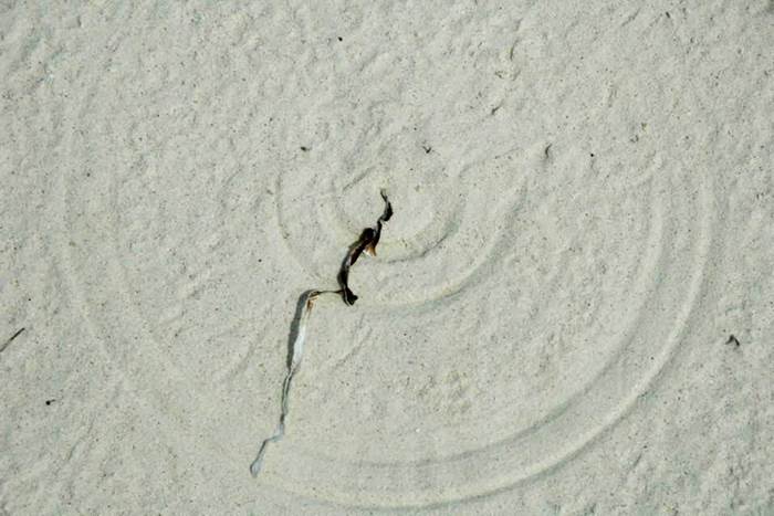
Scratch circle (pseudotrace) on aragonite sand (backbeach, southern
shoreline of Graham’s Harbour, northern margin of San Salvador Island).
This scratch circle was produced by wind moving the anchored piece of dead
marine vegetation. Scratch circles are known in the rock record and have
sometimes been misidentified as body fossils of jellyfish, jellyfish-like
organisms, or holdfasts of organisms.
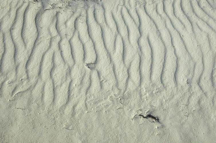
Backbeach asymmetrical wind ripples in aragonite sand (southern shoreline of Graham’s Harbour,
northern margin of San Salvador Island). Landward is “up” on the
photograph & seaward is “below”. At this site, winds blow from left
to right, resulting in ripple marks having ridges perpendicular to shoreline
and subparallel to wave movement directions.
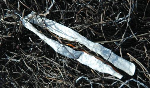
Thalassia testudinum turtle grass (whitish blades) and Syringodium
filiforme manatee grass (blackish twigs) stranded on aragonite sand beach
(southern shoreline of Graham’s Harbour, northern margin of San Salvador
Island).
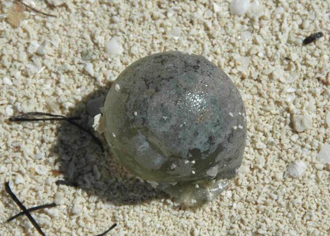
Ventricaria ventricosa (Agardh, 1887) (sea pearl/bubble algae) stranded on
aragonite sand beach (southern shoreline of Graham’s Harbour, northern margin
of San Salvador Island). The very pale pink-colored films on the sea
pearl are encrusting calcareous red algae.
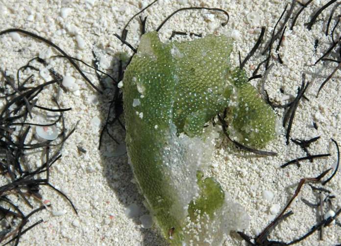
Dictyosphaera cavernosa (green bubble weed) on aragonite sand beach
(southern shoreline of Graham’s Harbour, northern
margin of San Salvador Island). Dictyosphaera is a common green
alga in reefs surrounding San Salvador.
It is essentially a living version of green bubble wrap. The
blackish-colored twigs are dead manatee grass, Syringodium filiforme.
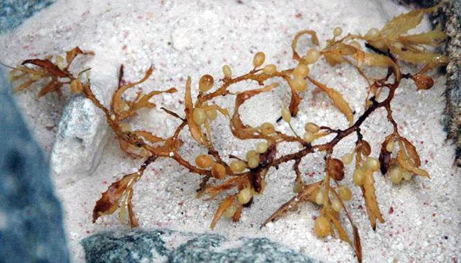
Sargassum fluitans Børgesen, 1914 (Plantae, Phaeophyta, Fucales,
Sargassaceae) on rubbly aragonite sand beach on the western side of North Point
Peninsula. This megaplanktonic brown alga stays suspended in the water
column using small, subspherical, gas-filled floats.
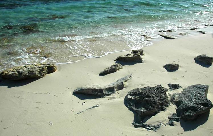
Beach rock on aragonite sand beach (southern shoreline of Graham’s Harbour,
northern margin of San Salvador Island). Sand-embedded slabs or apparent
outcrops of rock on carbonate sand beaches are generally called beach rock.
It has more than one possible origin:
1) very young calcarenite rock cemented by marine
phreatic carbonate cement after shallow burial of modern beach sands and
exhumation by normal shoreline and/or storm wave processes.
2) erosion of outcrops of young to old limestone
bedrock.
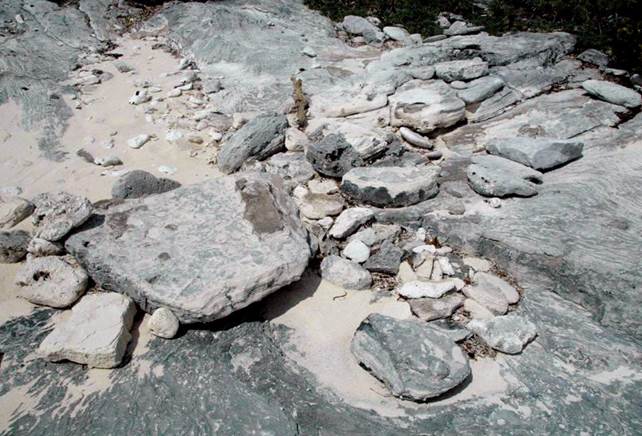
Mobile hardgrounds - beach rubble consisting of pebbles, cobbles, and
slabby boulders of aragonitic limestone are common in the supratidal,
intertidal, and subtidal zones of many of the rocky shorelines of San Salvador
Island. Many have been bored or are encrusted by various
invertebrates. These loose calcarenite rocks are mostly (all?) derived from
erosion of the surrounding outcrops of North Point Member eolian calcarenite
limestones (Rice Bay Formation, middle Holocene).
Locality:
North Point Peninsula, northeastern San Salvador Island.
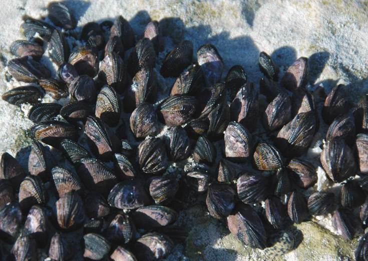
Brachidontes domingensis (Lamarck, 1819) (above & below) - Domingo mussels
(Mollusca, Bivalvia, Mytilidae) encrusting intertidal-zone aragonitic limestone
beachrock along shoreline of southeastern Graham’s Harbour, northern margin of
San Salvador Island. These mussels are in the intertidal zone, resulting
in regularly episodic marine submergence and subaerial exposure. Mussels
are sessile, benthic, filter feeders. They attach to hard substrates
using byssal threads exuded from near the beak area of their shells.
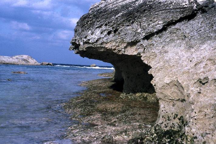
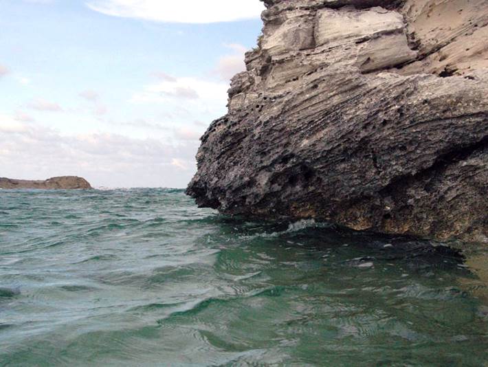
Intertidal notch (bioerosion notch) (above & below) along rocky
shoreline, northern end of North Point Peninsula at channel adjacent to Cut
Cay, eastern Graham’s Harbour, northeastern San Salvador Island. Research
on intertidal notches has indicated that the apex of the notch is at mean high
tide level. The top of the notch corresponds to high high tide (=
spring tide).
Above:
intertidal notch at low tide, March 1992.
Below:
intertidal notch at a fairly high high tide, June 2008.
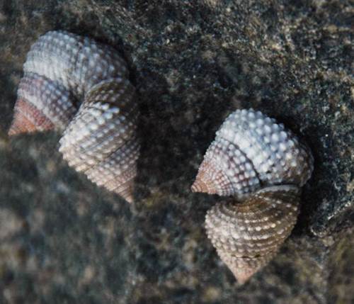
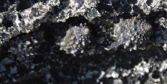
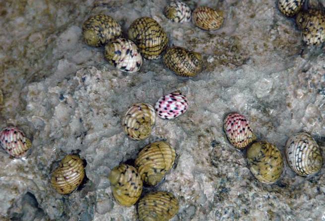
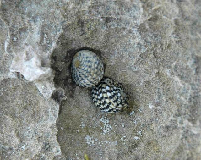
Tectarius muricatus (Linnaeus, 1758) (above) & Tectarius antonii
(Philippi, 1846) (below) - beaded periwinkles & false pricklywinkles
(Mollusca, Gastropoda, Littorinidae) on aragonitic calcarenite limestones of
the Hanna Bay Member (upper Rice Bay Formation, middle to upper Holocene) along
the southern shoreline of Graham’s Harbour, northern margin of San Salvador
Island. These littorinid snails are supratidal rocky shore
bacterial/algal grazers. Notice that the Tectarius antonii snails
below have coloration and shell ornament that well camouflages them against the
mottled dark gray to light gray, epikarstified limestone surfaces.
Nerita versicolor Gmelin, 1791 - living four-tooth nerite snails
(Mollusca, Gastropoda, Neritidae) on epikarstified aragonitic limestone in the
intertidal zone along the western shoreline of North Point Peninsula,
northeastern corner of San Salvador Island. The neritid snails here are
grazing on algal/bacterial films by scraping rocks with their radulae.
Nerita tessellata Gmelin, 1791 - living checkered nerite snails
(Mollusca, Gastropoda, Neritidae) on epikarstified aragonitic limestone in the
high intertidal zone on the southern side of Rocky Point (= northern end of
Sand Dollar Beach), northwestern San Salvador Island. Checkered nerite snails have the same
lifestyle as the four-tooth nerite snails shown above.
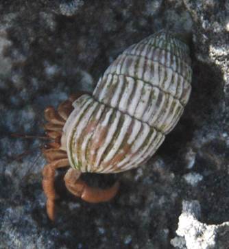
Unidentified terrestrial hermit crab (Arthropoda, Crustacea, Decapoda) in Cerion
watlingense snail shell (Mollusca, Gastropoda, Cerionidae) on aragonitic
calcarenite limestones of the Hanna Bay Member (upper Rice Bay Formation,
middle to upper Holocene) along the southern shoreline of Graham’s Harbour,
northern margin of San Salvador Island.
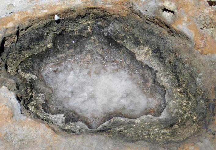
Halite
in depression in ~9200 year-old calcrete (terra rosa paleosol). This
depression occasionally accumulates ocean water from sea spray, typically
during storms. Evaporation of the seawater results in the precipitation
of halite (NaCl) crystals. So, the depression starts off having
seawater. After some evaporation, the water becomes a brine (very high
salinity water), followed by a halite slush (crystals + briny water), and
finally a halite crust (no water left).
Locality:
near the rocky shoreline of Green Cay, western Graham’s Harbour, offshore from
the northwestern corner of San Salvador Island.
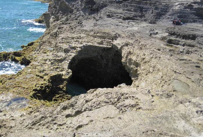
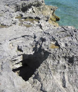
Blowhole
- openings to the land surface above sea caves along rocky shores are called
blowholes. As waves crash in, air and/or water is forced upward. See video.
Locality:
immediately east of “The Notch”, eastern part of southern margin of San
Salvador Island.
Stratigraphy: the rocks are eolian aragonitic calcarenite limestones of the
Cockburn Town Member, Grotto Beach Formation (lower Upper Pleistocene, MIS 5e,
119-131 k.y.)
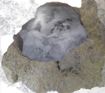
Blowhole
- small blowhole east of “The Notch”, eastern part of southern margin of San
Salvador Island. See
video.
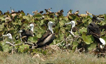
Shorebirds (above & below) - some birds prefer shoreline and surficial marine
environments.
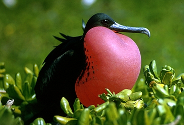
Above left: Fregata magnificens Mathews, 1914 - magnificent
frigatebirds at a nesting colony on Catto Cay, northeastern Grahams
Harbour, offshore from San Salvador Island. Black-headed individuals are
adults; white-headed individuals are juveniles. The magnificent
frigatebird (Family Fregatidae) is a moderately large, tropical to subtropical
seabird with a long, bifurcated tail and an unusually long wingspan. They
seldom land at the ocean surface, but inhabit islands and marine
coastlines. Adult plumage is mostly blackish. Adult male
frigatebirds have a red throat pouch, which they enlarge
while engaged in courtship display.
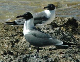
Above right: Larus atricilla Linnaeus, 1758 - the laughing gull at
Singer Bar Point, northern margin of San Salvador Island. The laughing
gull (Family Laridae) has a black head, blackish bill, and blackish legs (the
bill & legs can also be dark reddish).
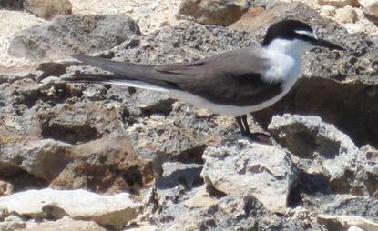
Below:
Onychoprion anaethetus (Scopoli, 1786) - bridled tern (Family Laridae,
Subfamily Sterninae) at Green Cay, western Graham’s Harbour, offshore from San
Salvador Island. This female’s nest is below the rock upon which she
stands. It consists of one egg sitting in the shade under the rock.
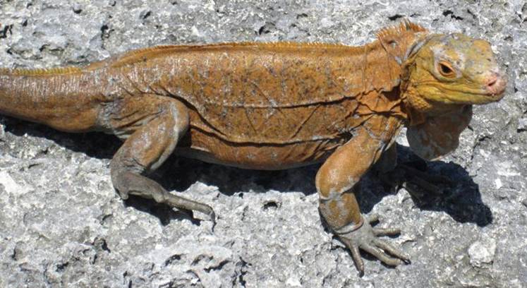
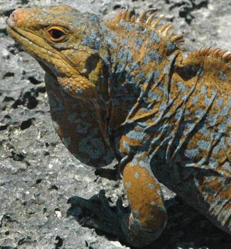
Cyclura rileyi rileyi (Stejneger, 1903) (above & below) - San Salvador
rock iguanas (Animalia, Vertebrata, Reptilia, Squamata, Iguanidae) on Green
Cay, western Graham’s Harbour, offshore from northwestern San Salvador
Island. This lizard is one of the rarest reptile species on Earth.
The species is sexually dimorphic; females have smaller body size and small
dorsal crests (see above), while males are larger and have more prominent
dorsal crests (see below). Population estimates indicate that only
several hundred individuals exist on Earth today. San Salvador rock iguanas
are principally herbivores.