St. Louisville Gravel Pit
(northern Licking County,
Ohio, USA)


Active and inactive gravel
(aggregate) mines occur along the Licking River's North Fork. The
floodplain of the North Fork is floored by an extensive outwash terrace
consisting of water-deposited sand & gravel deposits of Late Pleistocene
age (late Wisconsinan, 15,000-18,000 years) (Pavey et al., 1999, Quaternary
geology of Ohio. Ohio Division of Geological Survey Map 2).
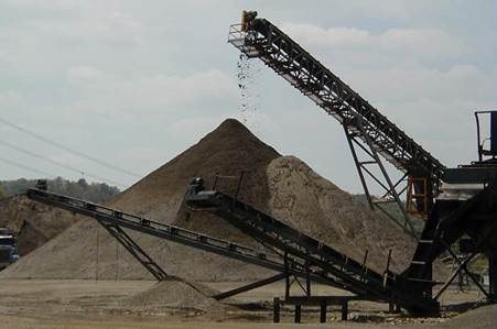
The pictures above are from
Shelly Materials' St. Louisville Plant. The top picture shows the active
pit (as of May 2005). The water level in the active pit marks the level
of the water table. The other pictures show gravel piles with gravel
sorted into specific sizes. Much of what is mined & sold here is
subrounded "pea gravel".
Location: gravel pit on the eastern
side of the North Fork of the Licking River, south of St. Louisville, northern
Newton Township, northern Licking County, central Ohio, USA. GPS of
active pit: 40˚ 9.572’ North, 82˚ 24.766’
West.
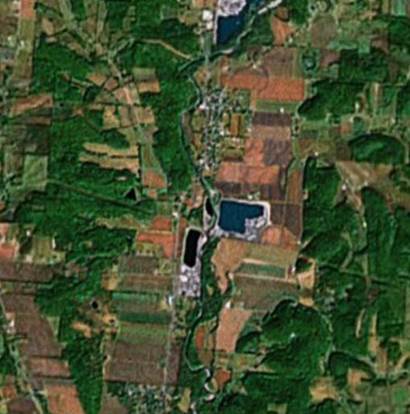
The St. Louisville Gravel
Pit shown in the pics above is the bluish body of water at center right in this
satellite photo. (Satellite photo provided by TerraMetrics & Google Earth)