ZION CANYON Area
Zion National Park is
located at the western edge of the Colorado Plateau, in eastern Washington
County, southwestern Utah, USA. Three areas of the park are readily
accessible:
1) the far-northwestern
corner (Kolob Canyons area)
2) the northwest-central
area (along Kolob Terrace Road/Kolob Reservoir Road)
3) the southern area
(vicinity of Zion Canyon)
The Zion area is dominated
by relatively undisturbed, ~flat-lying sedimentary rocks of Mesozoic age
(Triassic-Jurassic-Cretaceous). Erosion has carved deep canyons,
resulting in spectacularly tall cliffs of stunning colors.
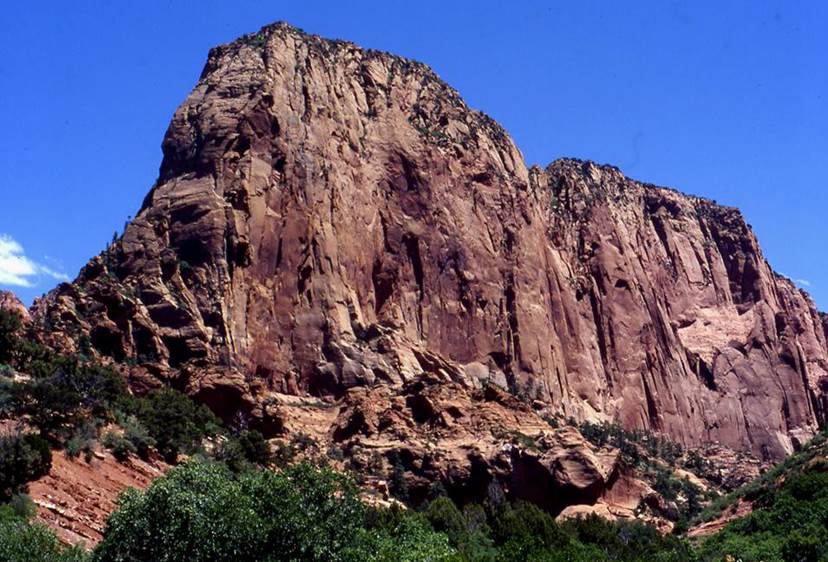
Looking ~ENE.
The photo above shows the view of Paria Point
from along Kolob Canyons Road, in the northwestern corner of Zion Park (see
map). Paria Point is part of the Hurricane Cliffs, which occur at the
boundary between the Colorado Plateau and the Basin & Range Province.
The tall, sheer cliffs are
composed of red-stained quartzose sandstones of the Navajo Sandstone
(~Upper Triassic to ~Lower Jurassic). Its maximum thickness in the Zion
area is reported to be about 2000'. The red coloration is from hematite
staining (Fe2O3). The Navajo Sandstone is an
ancient wind-blown (eolian) sand deposit. Occasional dinosaur footprints
are found in the Navajo.
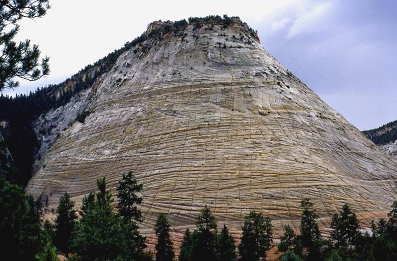
Looking ~SSW.
Here we have Checkerboard
Mesa, named in reference to the squarish structures formed by the
intersection of ~horizontal sandstone bedding planes and ~vertical scour
channels. The slopes of Checkerboard Mesa are cross-bedded quartzose
sandstones of the Navajo Sandstone (~Upper Triassic to ~Lower Jurassic).
Cross-bedding is quite apparent in the cliff here.
Checkerboard Mesa is part of
the White Cliffs, located in the southeastern portions of Zion Park, along
Zion-Mt. Carmel Highway (see
map).